
In April 2019 I began writing a monthly column for our local weekly newspaper, The Bourne Enterprise. They gave me free rein on content, asking only that each piece be about the Town of Bourne, non-political, and exclusive to The Enterprise. In August 2022 a new editor asked me to submit two columns per month. They actually paid me to do this. After six years of writing these columns, I decided in April 2025 to cut back to one column per month, and in January 2026 submitted my final column, deciding to finally retire as I approach age 85.
TIME TO RETIRE
(Published on the editorial page of The Bourne Enterprise January 16, 2026)
With mixed feelings, I offer this column as the final installment of my Bourne Musings. Over the last six years the Enterprise has published 112 of these columns. The editors and publishers have been wonderful people to work for, rarely changing anything more than a misplaced comma and granting me total freedom to write anything that comes to mind as long as it is related to Bourne. But the time has come to let go of this assignment. I am no longer involved with town government and there is a limit on how many times I can complain about our state highway department or stress the value of replacing an obsolete rail line with a recreational path that would benefit our town in so many ways.
Bourne has changed a lot since I was a kid enjoying summers on Hen Cove. Back then Pocasset Heights was a seasonal neighborhood of simple family cottages that were passed down from generation to generation. My grandparents had only one neighbor living there through the winter. The area is now dominated by year-round retirement homes and seldom-used second homes. The cove is ecologically barren now, damaged by toxic runoff and aircraft fuel that has leached from the military facilities. Fortunately, the source of those contaminants is being controlled and the eelgrass, quahogs, and crabs may someday return for our great-grandchildren to enjoy.
Main Street in Buzzards Bay has finally recovered and become a thriving downtown, with new apartments, year-round restaurants, a real hotel and interesting shops. We are still waiting for commuter rail service, but that may eventually happen now that the Southcoast extension to New Bedford and Fall River has been finished. The revitalization of our downtown was the result of a 30-year effort by dedicated volunteers working with the town planning department, department of public works, and elected officials. The goal of creating an active community where people can live, work, shop, and play has been reached and will continue to expand.
Bourne has also fundamentally changed over the last two decades since I retired from full-time work and became involved with town affairs as a planning consultant and as a volunteer on half a dozen committees. Our town is no longer dominated by the military base, which has become an empty shell of its former glory. I expect its eventual closing and redevelopment to become the biggest issue facing Bourne after the canal bridges are replaced. The base’s potential as a regional airport, surrounded by workforce housing and business development, holds great promise if done right. Bourne is also far less dependent on the seasonal economy than it has ever been. Our town now has a solid year-round economic base of locally owned businesses, clean manufacturing, and community services.
I intend to continue to write occasional guest columns for the Enterprise, as I did for years before becoming a regular columnist. I am about to turn 85 and writing is one of the few things I have been able to do in recent years. It has kept me thinking clearly, and the positive feedback from loyal readers has been rewarding. I especially want to thank everyone at the Enterprise for their enthusiastic support and encouragement. It’s been a fun ride.
MEMORIES OF BUZZARDS BAY IN THE 1940s
(Published on the editorial page of The Bourne Enterprise December 12, 2025)
Our neighbor, Nancy Fougere, moved to Bourne when she was in middle school more than 80 years ago. Her family knew the town from visits to her aunt’s house overlooking Buttermilk Bay. Nancy’s father John Stephenson had been appointed rector of Saint Peter’s Episcopal church. At that time, the congregation met in the Red Men’s hall and had not yet qualified as a parish. But that changed in 1947 when they acquired a sanctuary building from the town of Hull and moved it on a barge to Buzzards Bay. That was the only practical way to move such a large structure over such a long distance. It might not have succeeded but for the skill of the tugboat crew who towed the barge across Cape Cod Bay at night through a ferocious northeaster.
The barge was then moored along the banks of the canal near where the post office is now. It must have been a treacherous task to get the building off the barge and onto the land while dealing with the strong currents and rapid tidal changes in the canal. The building then sat in a field until a foundation could be installed on the new site. That move may have been the most exciting event in Bourne that year. Nancy said that when the building was finally moved across Main Street to its new foundation, the town’s schools closed for the day so the students could watch the move. She also told me that Vox Pop Radio, a popular national program, featured the move, resulting in contributions that covered part of the cost.
Father Steve, as he was called, not only led the church but also hosted Teen Town at the community center, where he played records for teenagers every Friday night. Nancy told me the kids from Gray Gables would walk across the railroad bridge, with the tacit approval of the bridge tender, to get to the dances. I asked Nancy what it was like living year-round in Buzzards Bay in the 1940s. She said it was a small community where everyone knew everyone else and watched out for their neighbors. Buzzards Bay had a First National supermarket and a drugstore, but not much else. If they needed to shop for clothes or major items they went to New Bedford. Nancy said the town employed a nurse who, when she saw a family struggling to put food on the table, would tell Tiny Tim, a giant of a man who owned a local restaurant, and he would deliver a healthy meal to them.
Nancy went on to become a registered nurse, married her high school sweetheart Lou Fougere and raised nine children, including one they adopted from China. Lou was a graduate of Carnegie Mellon University and owned Fern Engineering, which specialized in repairing General Electric turbine generators. Lou passed on four years ago, but several of their children live nearby and visit their mother regularly. Nancy turned 96 last week and still lives independently, tends a small garden, runs errands by herself, and attends the early mass at Saint John’s in Pocasset most Sundays. She now has 32 grandchildren and 44 great grands, with another due to arrive soon. And she is a delightful neighbor.
THE FIRST THANKSGIVING
(Published on the editorial page of The Bourne Enterprise November 28, 2025)
As those of us who enjoyed a traditional Thanksgiving feast yesterday groggily recover today, this might be a good time to take another look at the first thanksgiving in 1621. Three years ago, I wrote in a Bourne Musings of a presentation made by historian Kevin Doyle at the Bourne Historical Society’s annual harvest dinner. Kevin dug into the meager records and later accounts of that first thanksgiving celebration. His research led him to believe that both the pilgrims and the Wampanoags came together warily out of common need, and that it would have taken only a nod from the warrior Sachem for the Plymouth colony to be wiped out, as apparently happened in Roanoke a generation earlier.
While there are abundant legends and fanciful lore of that first harvest dinner, the only written documentation we have is William Bradford’s journal and a later recollection by Edward Winslow. The event is often depicted in elementary school history books as a lovefest between the Pilgrims and their indigenous neighbors. But a careful reading of Bradford’s writing reveals that the Wampanoag may have crashed the party when they heard celebratory musket fire coming from the settlement and thought they were under attack. This theory seems plausible when you consider that the group that showed up consisted of 90 armed men led by King Massasoit. There were no women or children. Only 53 of the 102 Pilgrims had survived a year after they landed in Plymouth, and nearly half of them were children or teenagers. Three were apparently not well enough to attend the feast. Not a likely group to start an uprising.
Fortunately, the Wampanoag leaders understood the English language from earlier encounters with English explorers and a year of working with the Pilgrims, teaching them how to grow local crops and harvest the local seafood. One of them, a young man named Squanto, learned the language after he was captured by English explorers before the Pilgrims arrived and spent time in Europe as a slave. When Massasoit realized that his people were not under attack, he had his men go out and kill five deer, which they brought back to add to the feast. Bradford wrote that their hunting party had gathered enough fowl in one day to feed their group for a week. Combined with an abundant harvest, they had more than enough food for the feast.
That first harvest feast lasted three days. Some historic accounts describe it as a raucous party that led to a peace treaty. According to the Encyclopedia Britannica “The men fired guns, ran races, and drank liquor, struggling to communicate in broken English and Wampanoag. Although a rather disorderly affair, it sealed a treaty between the two groups that lasted until King Philip’s War.” While some of that description may be true, the treaty was not likely sealed during that encounter. I also suspect the other parts of that description may have stretched the truth, as most of the Pilgrims were Puritans who did not drink alcohol or dance, and believed nobody else should either. Nonetheless, that first thanksgiving feast established a tradition that has lasted more than four centuries.
CLOSING DOWN THE SUMMER COTTAGE
(Published on the editorial page of The Bourne Enterprise October 10, 2025)
Before building codes required that all new houses be insulated, heated, and have foundations and septic systems, many seasonal homes in Bourne were little more than simple shelters that were used only during the summer months. In other areas of New England they are called camps; here they are cottages. My family sold our old cottage on Circuit Avenue after the hurricane in 1956 and built a new one outside of the flood zone. That house was set on century-old locust posts and had a cesspool out back that worked fine for the four months each summer that it was used. That simple dwelling served us and a subsequent owner well for 60 years before being replaced by a year-round retirement home that complies with all the modern regulations.
Those old cottages required a seasonal ritual of opening in the spring and closing in the fall, and this was the weekend that most of them were cleaned out and prepared for their winter rest. In my family we each had our assignments for the closing. Mom would take down the curtains and strip the beds, bringing them back home to be laundered and stored for the winter. Dad would drain the water pipes in sometimes futile expectation that they would not freeze and burst. Just before leaving, he would pour anti-freeze into the toilet and the sink and shower drains. My brother and I would clean up the yard and store the outdoor furniture. We would also help Grandpa Bert haul his old cedar catboat out of Hen Cove on log rollers and store it on the beach. We set his rowboat upside down and covered it with seaweed to keep it from drying out too much over the winter.
The change in the building code did more than create business for the contractors and building tradespeople. It fundamentally changed the character of many Bourne neighborhoods. Second homes built to the new codes could be used on weekends and holidays all year. But it became more difficult for middle income families to afford to build or maintain a seasonal cottage, and those who kept a place that had been passed down through the family for generations often chose to sell rather than endure the cost of installing septic systems or tight tanks. Others have rebuilt or refurbished their cottages into year-round retirement homes. The neighborhood has become quieter in the summer but more active through the off seasons.
Bourne, along with the other upper and middle Cape towns, has changed over the years from a seasonal to a year-round economy. The population is now older on average and more wealthy. Tradespeople and health care workers are more likely to commute from less expensive places off-Cape. This is neither a bad thing nor a good thing. It simply is the way our life on this sandbar has evolved. For those of us who are fortunate enough to live here, we may enjoy our nostalgic memories of a simpler childhood, while living in a community with far more services, excellent health care, unlimited recreational opportunities, and more year-round neighbors.
TIME TO TABLE THE RAIL TRAIL
(Published on the editorial page of The Bourne Enterprise September 26, 2025)
Long-time followers of this column know that I have been a vocal advocate of removing the railroad that once moved troops and tanks for the military and carried passengers to and from Woods Hole and extending the Shining Sea recreational trail to the canal. As I wrote in Bourne’s Local Comprehensive Plan 20 years ago, and reiterated in its revision 13 years later, “This project would benefit the town in more ways than any other single action it might take. It would provide a significant boost to the local economy. It would provide off-road bicycle and pedestrian connections among all of Bourne’s villages. It would increase public safety by giving cyclists an alternative to pedaling on Shore and County Roads. And it would open some of the most scenic portions of the town’s coastline to public access.”
While I believe the town should continue to pursue this project, I think that the wisest thing we could do now is to table it until a time of more favorable political and economic conditions. And most critically, we should reject the rail with trail alternative. The engineering analysis published last year showed that this plan would be extraordinarily expensive and would adversely affect many abutting properties. It would also move the trail off the most scenic sections of the coastal route, which is one of the biggest benefits of replacing the rails with a trail. Shore Road remains a designated bike route by the state and offers a scenic way for bicycle tourists heading to and from Falmouth and Martha’s Vineyard.
When Tom Cahir scored a federal grant to fund the trail, it looked like it might get built. The state has not responded to requests to abandon the railroad, however, and it’s likely that the current Pentagon brass would oppose such a move. And that funding may also be in jeopardy. The non-profit Rails to Trails Conservancy reported earlier this month that the federal government has begun rescinding awarded grants for recreational trails in favor of highway improvements. The conservancy also reported that the government is planning to remove protections that have kept abandoned rail corridors from being sold off to abutters. Keeping the rails in use, if only for the trash train, would protect the corridor until it can be repurposed as a key section of a regional recreational trail.
It is also apparent that the canal bridge replacement project is likely to block full use of the canal service roads, delaying the planned trail connection between Woods Hole and Provincetown. Funding for the bridge project may also be in jeopardy under the current administration, which is trying to shift responsibility for everything other than national defense to the states. Even after current federal leadership is ousted, it could take many years and trillions of dollars to rebuild a functional national government that is able to assure basic human needs and fund recreational projects. And while our state might be willing to invest in a trail, it too will be stretched to fund more crucial responsibilities once covered by federal grants. It took 50 years to extend the Shining Sea Trail to North Falmouth; we can wait a few more to extend it to the canal.
BRACING FOR TWO KINDS OF STORMS
(Published on the editorial page of The Bourne Enterprise August 22, 2025)
As the summer winds down, we are about to move into the best time of year to live in Bourne. September and October are the prime months to enjoy our beaches, hike our trails, and bike the canal path. The weather is usually pleasant, the nights cool, and we can get into our favorite restaurants without waiting for hours. It hasn’t always been this way, though. When I was a youngster, during the middle of the last century, August, September and October were the months for destructive hurricanes. In 1954 we had two blow through only two weeks apart. That was the year my family decided to sell our cottage on Hen Cove and build a new one on higher ground. But it has been a while since we have been hit by a hurricane; the last big one was Bob in 1991. I was living at Sea Watch when that storm hit. I don’t remember much of it, though, as I fell asleep when it got close and woke up after it passed to find a pine tree had been uprooted just outside my bedroom window.
As I write this column, Hurricane Erin shows signs of weakening and spreading out, and is predicted to veer east and remain out to sea. The storm’s behavior has been somewhat erratic, though, and could suddenly change direction and intensity. As you are reading this, you now know whether that happened and we got hit with more than high surf and rip currents. The National Weather Service is forecasting that this year will have a more active hurricane season than usual, so Erin may be followed by other threats. And tropical storms are not the only perils we face this fall. The turmoil in our federal government has not yet hit home, but Bourne could feel the effects of cuts to government services, including storm prediction and recovery, as both the National Weather Service and FEMA funds have been diverted from storm tracking and disaster relief to support the misguided effort to rid our country of hard-working farm hands, construction workers, restaurant help and hotel staff.
Bourne’s hospitality businesses and shops have enjoyed another booming season, as the price of gas has remained low and the negative effects of ill-conceived tariffs, inflationary policies, and a tightened employment market have not begun to hurt. We didn’t see as many visitors as usual from Canada, Europe, and the Pacific Rim, but there were plenty of tourists coming here from our own country who might have traveled to those places in more normal times. The economic storm is gaining strength, though, and likely to hit our local businesses as the year wears on. The threats from both the weather and the economy are real, and there is not much we can do about either. But whatever happens, one thing is certain: we will eventually recover from the effects of these storms and rebuild our property, our economy and our government in ways that leave us better prepared and more resistant to future damage.
RECONSIDERING CANAL BRIDGE PLANS
(Published on the editorial page of The Bourne Enterprise July 18, 2025)
The horrendous traffic over the July fourth weekend prompted me to take one more swipe at the state’s canal bridge replacement project. At their last public meeting, we learned that the first Sagamore bridge span is scheduled for completion in eight to ten years. That assumes that the federal government continues to fund the project, which is not assured. This might be a good time to review some of the basic assumptions that are driving the design and engineering. While thinking about how this project might proceed, I came up with some surprising statistics.
It was six years ago that I first suggested in a Bourne Musing that the state should consider building a direct three-mile long highway connecting Route 25 at the Wareham town line with the Mid-Cape Highway at the Sandwich town line, crossing a high-level bridge near Bournedale. I still think that idea makes sense. In that column I noted that on a typical summer weekend 59 percent of the traffic crossing the Bourne Bridge travelled between those two highways. That’s in addition to the vehicles crossing the Sagamore Bridge between them.
Current plans provide uninterrupted movement between Route 3 and the Mid-Cape Highway across two new bridges in Sagamore, and two more bridges providing uninterrupted movement between Route 25 and MacArthur Boulevard. The proposed design not only perpetuates the current circuitous route along the canal connecting Route 25 with the Mid-Cape but shifts traffic now using Sandwich Road onto Scenic Highway. With a mid-canal bridge carrying more than half of the traffic, the Bourne bridge could be replaced by a single span instead of two and traffic on Scenic Highway and Sandwich Road would be dramatically reduced.
It currently takes about 12 minutes to travel in either direction between the Wareham and Sandwich town lines. That assumes encountering no traffic backups and hitting green lights at every traffic signal. The proposed design will reduce that travel time to about 10 minutes, except during peak summer travel days. Crossing a central bridge would take only three minutes between those two points, with no peak time delays. That seven minute time saving and four mile distance reduction per vehicle crossing may not seem like much, but when multiplied by 60,000 vehicle crossings a day, the cumulative savings in time, miles travelled, fuel use, and air pollution are staggering.
Shortening the travel time by seven minutes would save more than two million vehicle hours per year. Reducing the distance by four miles would cut the total distance travelled by nearly 88 million vehicle miles per year. Assuming an average fuel use of 25 miles per gallon, vehicles crossing the canal would save about 3.6 million gallons per year. There would be proportional reductions in air pollution and vehicle wear, as well as fewer collisions. I doubt that any of these potential savings were considered when choosing the current plan, and I am sure they will not appear in the environmental and economic impact reports. Factoring them in would certainly upend the engineers’ current plans. And don’t get me started on roundabouts or the engineers’ decision to design connecting roads based on October 15 average traffic counts instead of designing them to handle peak summer weekend traffic.
DOWNTOWN’S HIDDEN GEM
(Published on the editorial page of The Bourne Enterprise June 20, 2025)
The National Marine Life Center is in the news this week, and the news is disturbing. For Bourne, the center is more than a hospital for injured sea creatures; it was the catalyst that led to the revitalization of Main Street in Buzzards Bay. It now appears that the center is facing serious challenges that go deeper than staff communications and that threaten its existence. Four years ago, I wrote in this column how the center emerged from humble beginnings in an abandoned lumber yard to become a nationally respected institution, and of the two strong women who were instrumental in creating the center and bringing people back into Bourne’s downtown.
In that column, I described how the center was originally conceived by Sallie Riggs while she was working at the Woods Hole Oceanographic Institution. After two earlier attempts to establish a marine hospital on Cape Cod, Sallie brought together veterinarian Joseph Geraci of Tufts University, retired investment banker Townsend Horner, and others, who incorporated the National Marine Life Center in 1995 as an independent, non-profit corporation. Although she lived in North Falmouth, Sallie became deeply involved with the local business community and town government to build support for the new center. That involvement soon grew into a passion for revitalizing all of Main Street. Once she got the center established, Sallie turned over the leadership to others so that she could devote her time and effort to Bourne’s downtown.
For several years after Sallie stepped down, the marine life center struggled to develop plans and programs, while focusing on fund-raising. In 2005, Kathy Zagzebski was brought in as the president and executive director. Kathy arrived with stellar academic credentials and broad experience in marine rescue operations in California, Hawaii, Georgia, and North Carolina. Under Kathy’s leadership, the center evolved into a nationally known and respected marine education, research and rescue operation. She assembled a strong support staff of experienced professionals, supplemented with ardent volunteers and enthusiastic student interns during the summer season. The center partnered with related organizations all over the country to advance the science and coordinate rescue and release of stranded or injured marine animals.
Like Sallie, Kathy also became involved in the process of putting Buzzards Bay back on the map as a vital town center. She served on several town committees and regional non-profit boards, including the advisory committee of the Environmental Technology Program at Upper Cape Cod Regional Technical High School. After 16 years in the job, Kathy moved on, leaving not only a strong institution but also an active downtown. Today the marine life center is apparently facing some serious challenges. As I write this, the specifics have not been made public, but I suspect the potential loss of essential federal grants tops the list, as the current administration slashes its support of arts and sciences. Main Street will continue to thrive regardless of the outcome, but it would be a shame to lose the key piece of our downtown that got it all started a generation ago.
HONORING THOSE WHO NEVER RETURN
(Published on the editorial page of The Bourne Enterprise May 23, 2025)
This is the weekend we honor the military heroes who never came home. There were almost 117,000 killed in the first world war, more than 400,000 in the second world war, 36,500 in the Korean conflict, and more than 58,000 in Viet Nam. For as long as I can remember, though, Memorial Day has been a demonstration of military dominance and veterans marching in celebratory parades. I marched in eight as a drummer in high school and college bands but, although I am a veteran, I never marched as one. Memorial Day is often conflated with Veterans Day, Patriots Day, and Independence Day as a celebration of war. We have seen fewer of those parades and celebrations in recent decades but our president is planning a grand one in the ancient tradition of emperors and kings on his birthday next month.
When I was a youngster there were VFW posts in every town where those who survived the wars would gather to tell tales of their experiences and relive their military adventures. Everyone I knew seemed to have uncles and grandparents who did the same at family gatherings. Even then, though, I was aware that some veterans never spoke of their service. Many years later I realized that those were the vets who experienced the horror of actual combat. Some were the walking wounded who could be seen wandering the grounds of veterans’ hospitals. Before post-traumatic stress was defined as a psychological syndrome, those vets were said to be “shell-shocked.” And even those who successfully reintegrated into civilian life rarely shared their military experiences with friends or family members.
My uncle Buddy was one of them. He enlisted in the army as a teenager in 1942, learned baking while on active duty, and after the war ran a large commercial bakery his entire working life. He frequently sent letters home during the war but was not allowed to say where he was stationed or what he was doing. Buddy was a man of few words who never spoke of his army experience. The most I ever heard him say were three catch phrases: “Well, I’ll Be,” “Whatever,” and “Oh, Happy Day.” After he died, one of his sons was sorting through his papers and found a citation signed by French President Charles de Gaulle, thanking him for his participation in the D-Day invasion at Omaha Beach in Normandy.
There are fewer veterans now but many of us still live on the cape. Bourne was dominated by the military base for most of the 20th century and still has a larger percentage of vets, about one in thirteen residents, than any other cape town. The average for Barnstable County is about one in eight residents. Until just a few months ago the cape had one of the best veteran’s medical clinics in the country, but it has now been closed by an administration determined to reduce government services. My hope is that my grandchildren might see the day when there are no more veterans and our world becomes enlightened enough to stop celebrating war and having to set aside a day to honor those who died so needlessly.
BOATBUILDING IN CATAUMET

(Published on the editorial page of The Bourne Enterprise April 18, 2025)
On a spring day in 1953, I was visiting my grandparents at their retirement home overlooking Hen Cove when I heard a roar coming across the bay and saw a speedboat racing up the channel between Bassett’s Island and Patuisset. Grandpa explained that what I heard and saw was a P.T. boat built at Kingman’s boatyard in Cataumet. Thinking this might make an interesting subject for this column, I did some digging online.
I found the information I needed on the blog site of Scott Zeien, the current owner of Kingman Yacht Center. There I learned that those boats were not Navy P.T. boats but were smaller harbor rescue boats for the Army. In Scott’s words “In 1952, T. Barry Kingman Construction Company won the contract to build 33, 37-foot wooden “J” patrol boats for the U.S. Army Transportation Corps. At the height of construction, Kingman employed 65 yard personnel, and 10 office personnel and draftsmen. A boat was built and launched every 3.5 days, sea trialed in the harbor, then loaded onto trucks for transport to the Pocasset train station and off to the Army.”
These boats, like the Navy P.T. boats, were built of plywood over oak or southern pine frames. This method allowed for quick and inexpensive construction by small boatyards like Kingman’s Cataumet Marine. They were designed for speed in order to quickly reach ditched aircraft or troubled boats and rescue their pilots and sailors. The boats that Kingman built had blunt punt bows with walkways and handrails on the foredecks to enable rescues in rough seas. There is no mention in Scott’s blog of how these boats were powered, but the racket they produced leads me to think they might have had Merlin V-12 aircraft engines, designed by Rolls Royce and build under license in the U.S. by Packard during the Second World War. These engines were widely available as surplus after the war and often used in racing boats and cars.
Scott’s blog also explained that Kingman got his start at Captain Butts’ Boat Shop in Patuisset. He wrote that Kingman’s crew constructed four 36-foot aircraft rescue boats in Captain Butts’ shed in the early 1940’s while he was also operating at a second site in Cataumet where Parker’s Boatyard stands today. Scott wrote, “At some time during the mid-1940’s, Kingman moved most of his operation across the mouth of Red Brook and established Cataumet Marina on land where William Handy had built ships during the War of 1812. Here, Kingman worked with Philip Rhodes’ design to build 42 beautiful, 21-foot Arrowhead sloops.”
I have written before in this column about Bourne’s industrial history. Iron foundries in Pocasset and Bournedale shipped products all over the world. The Keith and Ryder wagon company in the part of Sandwich that would later become Sagamore built farm wagons and prairie schooners for pioneering families that were moving west to open new frontiers. That company became Keith Car Works and built railroad freight cars until it was wiped out by construction of the canal. But I somehow missed the rich boatbuilding history on the other side of town.
BOURNE IS RICH IN HIKING TRAILS
(Published on the editorial page of The Bourne Enterprise March 14, 2025)
With the scent of spring in the air, our thoughts are once again turning to getting outdoors and enjoying the many walking and hiking trails that our town has to offer. It’s still a little early to get out on the canal service roads—the chill wind tends to funnel into that area until late May—but there are plenty of more sheltered areas to hike in Bourne. Between the town-owned conservation areas and the Bourne Conservation Trust properties, there are enough trails to try a new one every week for the season. Here is a brief description of the best trails.
Our favorite warm-up trail for the early season is the Leary property located on the S-curve at 214 County Road. This town-owned promontory offers panoramic views of the upper reaches of Back River that are not publicly visible from anywhere else. The trail is only about a quarter mile long, not including several small side trails, and has only one steep slope. There is a loop driveway for parking at the entrance. Across the street from the Leary property, at 221 County Road, you can find more than a mile and a half of scenic trails across both town and Trust lands at the Bourne Sisters Woodland and Perry Woods conservation areas. The sole public entry is easy to miss, with only a few parking spaces. There is also a private bridge connecting this parcel with Brookside.
Another popular hiking spot over both town and Trust lands can be found at Monk’s Park, off of Shore Road in Monument Beach. These trails are quite steep, so a walking stick is suggested. Park next to the railroad bridge on Valley Bars Road, or at the east entrance to the Little Bay Trails on Shore Road. Plan to rest your feet at the benches and chairs overlooking Little Bay and Monk’s Cove. The largest single town-owned area for hiking is the Four Ponds Conservation Area, which borders the town forest and offers several miles of trails. Some of these trails are steep, and a compass is advisable if you’re not familiar with the area. Access is off Barlow’s Landing Road opposite the mobile home park.
Most of the Bourne Conservation Trust properties and trails are in the Cataumet area. Maps of all of the trust’s properties and trails are available to view and download on its website, http://www.bourneconservationtrust.org. The Cataumet Greenway trails cover much of the land between Depot Street and Redbrook Harbor Road. Although there are several access points, the easiest are from the Cataumet Post Office parking lot and the Dimmick Waterfront Park on Redbrook Harbor Road. Just north of Redbrook Pond, at the top of the hill on Shore Road, you will find the Redbrook Pond trails, another Trust property. Park at the entrance to Thaxter Road. The main loop is about a mile, but there are intermediate trails to shorten the walk. As with all Trust properties, the trails are well marked and maintained. This one offers grand views of Redbrook Pond and several cranberry bogs.
THE BRIDGE TO PATUISSET
(Published on the editorial page of The Bourne Enterprise February 21, 2025)
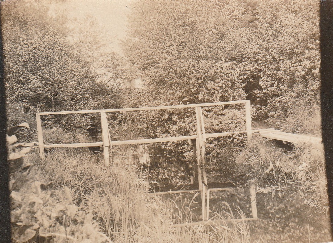
While sorting through a box of old family photos, I came across this one, labeled on the back “Footbridge to Patuissett 1901” in neat handwriting. And yes, Patuisset is misspelled. The photo shows a crude plank bridge with a handrail crossing a small stream. This bridge was likely used by local clammers, as the area was rich in quahogs until the middle of the twentieth century. It might have been located farther north than the current location of Circuit Avenue, possibly at the end of what is now Wabash Avenue, as the vegetation appears to not extend far beyond the bridge. The stream separating the island from the mainland existed until the town created the Hen Cove beach in the 1950s.
This photo was taken by my grandmother, Bertha Dunbar, when she was 21 years old. Bertha was an interesting woman, a strong-willed six-foot tall redhead of Scottish ancestry. In 1901 her father built a cottage on what would later become Saco Avenue in Pocasset Heights, and she enjoyed exploring the neighborhood. She would ride around on her bicycle with a big wooden box camera on her back, looking for scenes to photograph or to paint with watercolors. She sometimes painted her black and white photos with watercolors long before the days of colored photography. It was in that neighborhood where she met her future husband Bert Ewell, who had built a clamming shack across the street from the Dunbar cottage.
At the time of the photo Patuisset was an island comprised of a sand bar encompassing a salt marsh. An 1858 map of the area shows no buildings on the island and no roads leading to it. Another map, from 1880, shows four buildings on the island linked by a path off Barlow’s Landing Road in the general location of what is now Salt Marsh Lane. It wasn’t until 1913 that Circuit Avenue was extended to the island and the land subdivided into tiny lots as part of Pocasset Heights. It is apparent from those early maps that either they were not very accurate or that the land shifted around a lot. Maybe it was a bit of both.
Patuisset has certainly changed since this photo was taken. The modest family summer cottages of the early twentieth century have largely been upgraded or replaced by multi-million dollar second homes that are seldom occupied even during the summer. The quahogs are gone, along with most of the sandy beaches. But it remains a wonderful place for a scenic walk, regardless of the time of year. Paula and I frequently park at the town beach and stroll the 1.2-mile circuit around the island, where we often encounter others doing the same thing. We no longer have to cross a plank bridge to get there, but we still find great photo opportunities and even places to break out a folding chair and our watercolor paints.
GOOD NEWS FOR THE CANAL BRIDGES PROJECT
(Published on the editorial page of The Bourne Enterprise February 7, 2025)
The Massachusetts Department of Transportation (MassDOT) recently established a new Office of Megaproject Delivery, which will be responsible for successful completion of the Cape Cod bridges replacement project and the Allston Multimodal Project. This is good news. As I have written many times in this column, the bridge replacement project desperately needs to have a highly qualified and experienced person overseeing the work of the design and development teams that I believe have been heading in the wrong direction.
It is especially good news that they have brought in Luisa Paiewonski to head this office. Luisa began working at the state highway department 35 years ago. With a degree from Mount Holyoke and a master’s in city planning from Boston University, she quickly rose through the ranks to eventually become Commissioner of the Massachusetts Highway Department and MassDOT Highway Administrator, positions she held longer than anyone else before or after. Since leaving that office, Luisa has served as a Senior Policy Advisor on the White House Infrastructure Implementation Team and Director of Infrastructure Systems and Technology at the U.S. Department of Transportation Volpe Center, focusing on infrastructure modernization, transportation technologies and project delivery.
I first met Luisa in 1995 when I was managing reconstruction of the Steamship Authority’s Hyannis ferry terminal. At that time, she was in charge of public transportation at the state agency, and I was looking to connect the intercity bus services with the ferries. I remember being impressed by her intelligence, her quiet aura of competence, and her manner of actively listening before commenting. I cannot think of another person I would rather see in this new position.
The timing is perfect, as each iteration of the bridge replacement plans seem to get worse as they are refined. The latest plans show the Bourne Bridge rotary replaced by two roundabouts, with two more roundabouts on the Cape-side ramps of the Sagamore Bridge. Roundabouts have been promoted by environmentalists as “traffic calming devices” designed to slow down drivers in suburban areas. They have been widely used to replace traffic lights at intersections, saving electricity and maintenance costs. Roundabouts generally work well when traffic volumes are under 4,000 vehicles a day. On average, about 100,000 vehicles cross the canal every day.
With the new administration in Washington threatening to cancel federal grants, the bridge replacement project might be delayed. That would give state officials an opportunity to reevaluate the direction they are heading and to adjust their program to better address the way traffic actually moves across and around the canal. If they did that, they would see that a direct three-mile connection between Route 25 and the Mid-Cape Highway across a high-level bridge near Bournedale would carry more than half the traffic crossing the canal. That would reduce volumes on Scenic Highway and Sandwich Road and would require only one span replacing each of the existing bridges instead of two. They might even revise their intersection designs to handle peak summer traffic, instead of average daily traffic on October 15th.
DO WE NEED A NEW LIBRARY?
(Published on the editorial page of The Bourne Enterprise January 17, 2025)
Paula and I love books. She reads two or three new books every month and I have an extensive library of reference books, with a few classic works of fiction by my favorite authors. We rarely visit our town library, though. At our age, reading printed pages leads to eye strain and nodding off. Paula keeps electronic tablets handy and is an active user of the multi-town CLAMS library service. With a tablet, she can adjust font size, background and typeface color, and learn the meaning or etymology of an unfamiliar word with the press of a key.
I work on a desktop computer with a large monitor that can display multiple windows. And although I love writing while sitting next to a wall of books, I now do most of my research online. When it comes to reading history or fiction, I prefer listening to audio books. In the 1980s my work required driving alone more than 40,000 miles a year. To stay alert and avoid boredom, I rented books on tape and listened to many of the lengthy novels by Leon Uris and others that I never seemed to have time to read. I found my retention of what I heard was much higher than when I read words from a page.
While there will always be people who want to borrow printed books, libraries have evolved to meet changing cultural needs. Most of us now get our information more efficiently from electronic media. We see the effect of this trend when we visit the new or recently expanded libraries in surrounding towns. While those buildings still have book stacks, they are more oriented to computer stations, listening carrels and meeting rooms. Bourne’s library is similar but on a smaller scale. The Bourne library is doing everything right but needs more meeting space and a building that is not about to collapse from age and overuse.
When I received the questionnaire the library board sent out a few weeks ago, I asked my friend and neighbor Amy Sharpe to send me the building inspection reports. As someone who has managed or been involved in the conversion into new uses of a dozen obsolete school and factory buildings, I was appalled at what I read. The building was very lightly built to begin with and has been further weakened by subsequent modifications. In my opinion there is nothing worth saving in the old structure, other than the classic design and appearance of the façade.
I suggest the town raze the old building and construct a new one on the same site. The façade could be a replica of the old one, or a more modern interpretation that incorporates key elements of the old design such as the brick walls, multi-pane windows, sloped roof, and the bell tower. I would also like to see the new building become a regular meeting place like the Veterans Memorial Community Center, with similar programs for residents living east of the canal who do not like to drive across the bridge to Buzzards Bay.
WHAT TO EXPECT IN 2025
(Published on the editorial page of The Bourne Enterprise January 3, 2025)
My first column of the year for the last five years has always presented my predictions for events and actions that might affect our town and its people in coming months. This year, the only thing I can predict with any confidence is that it will be a year of political and economic chaos and confusion. Many Bourne voters chose to put Donald Trump back in the White House, expecting him to lower the cost of groceries and control immigration. Statements now being made by the former president and his nominees for top government positions, however, indicate that they are determined to reduce or eliminate social support programs, impose tariffs on imported goods and deport all undocumented immigrants, policies that could adversely affect Bourne’s many military veterans and retirees.
As a veteran who relies on VA medical services, I am concerned when I hear potential members of the incoming administration openly declare that those services should be ended. While I doubt that will actually happen, it is a disturbing sign of how little respect some of the people who will soon be in charge have for those of us who stepped up to protect our freedoms. And, as a retiree who depends on a monthly social security payment as my primary source of income, I am deeply concerned about talk of reducing or eliminating a program that I paid into for more than 60 years. For retirees who rely on Medicare, eliminating or privatizing that program would most certainly increase costs and reduce availability of their health care.
The second most important element of Bourne’s economy, behind health care, is hospitality. Our hotels and restaurants depend on workers who have work visas or may be legal immigrants awaiting documentation. The incoming administration’s apparent determination to deport undocumented immigrants, even those living here legally, could leave our most crucial local businesses severely short-handed during their busiest season. And that is not the only threat facing Bourne’s restaurants. Our country’s farms and food processing plants also rely heavily on immigrant labor, and nearly half of our fresh fruits and vegetables come from Mexico. Deporting immigrants and imposing tariffs on Mexican products would dramatically increase the cost and availability of food, not just for restaurants but for all of us.
When tariffs were imposed on lumber and construction materials imported from Canada and other countries by the first Trump administration, the cost of those materials more than doubled. The price of the white cedar shingles that give Cape Cod homes their distinctive grey look quadrupled. And the construction industry, like the hotels and restaurants, relies heavily on immigrant labor. Finally, funding for replacement of our canal bridges appropriated by the Biden administration could be reduced, delayed, or even cancelled by the next administration. Despite strong support for Donald Trump from Bourne voters, we live in one of the most heavily Democratic states in the country and cannot expect to be treated kindly by the incoming administration. We can only hope that much of the news that seems to threaten our local economy and way of life is only bluster and does not actually hit home.
MY FAVORITE CHRISTMAS GIFT
(Published on the editorial page of The Bourne Enterprise on December 20, 2024)
My family will be celebrating Christmas tomorrow, on the winter solstice. Like many modern families, we find it difficult to bring everyone together on Christmas day, as we all have other family groups to work around. All but two of us are now adults and, with the exception of a Yankee swap, only the youngest grandchild and the sole great-grandchild receive gifts. Our celebration will be as festive as always but focused more on enjoying being together than with opening presents. It wasn’t always like that of course.
When my daughters were young, Christmas was all about the gifts. After weeks of shopping and a few frantic evenings assembling toys and wrapping packages, we would fill the area around the Christmas tree with gifts, pack the red and white felt stockings that my mother made for the girls with little gifts, candies and fresh fruit, all to be joyfully ripped apart and happily enjoyed in a matter of minutes. We always attended the Christmas eve service at our church, so our daughters understood the spiritual meaning of the holiday, but Christmas day was all about the presents.
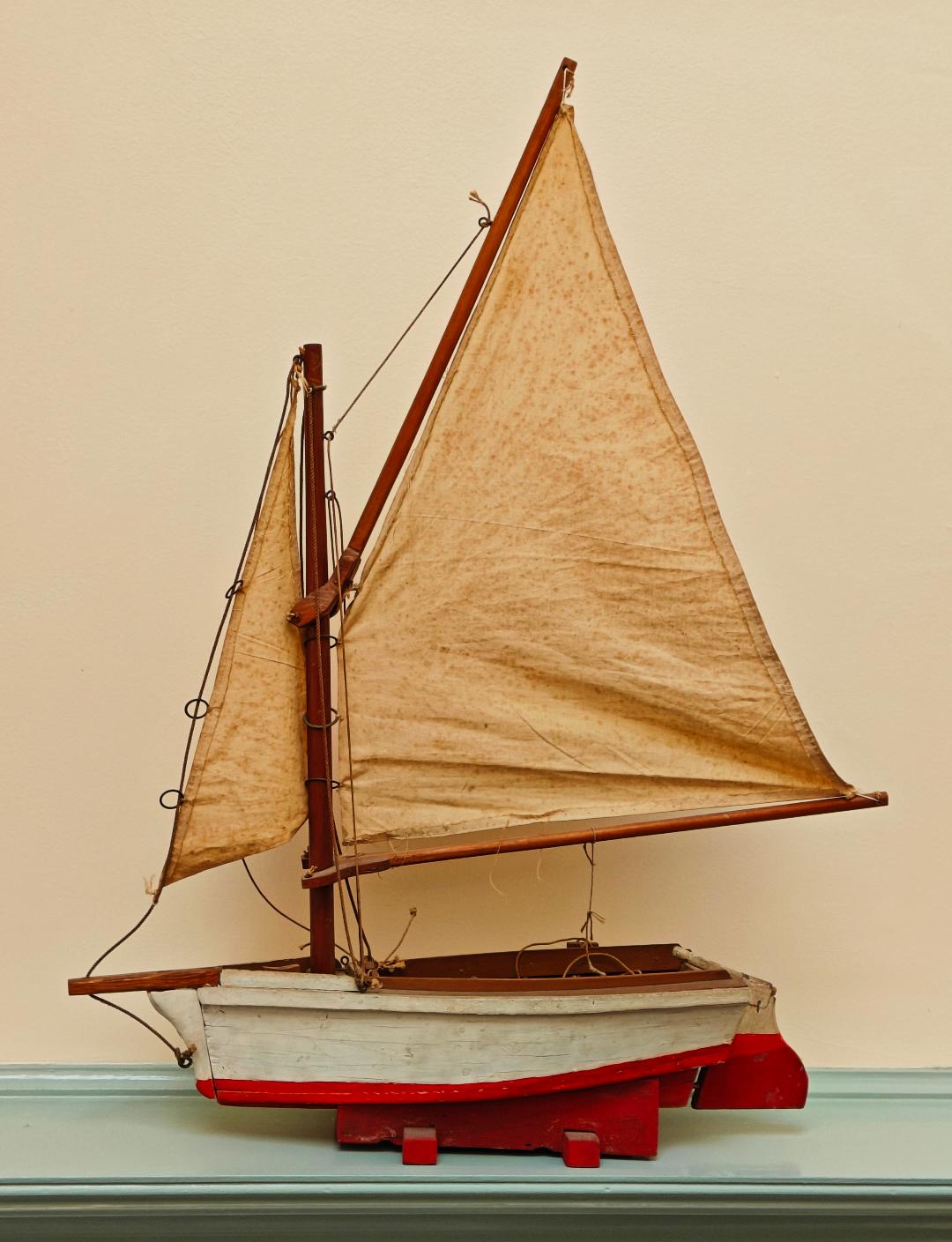
As I look back at the gifts my children and grandchildren have received for Christmas over the years, the ones they have kept and often still use are those that I made for them. My youngest grandchild still plays with the crude plywood dollhouse I made for my daughter when she was nine. My adult granddaughter treasures the cedar chest I made for her when she was a teenager. Her daughter still plays with the pink dollhouse I made for her when she was only two. And on the top of a bookshelf in my study is my own all-time favorite Christmas gift, a toy sailboat my grandfather made and gave me when I was seven.
This boat is no ordinary toy; it is a reasonably close to scale model of my grandfather’s sailboat, with working rigging and an operable centerboard. Grandpa called his boat Old Squaw, not in reference to an indigenous woman, but after a deep-diving sea bird that has since been more properly renamed a long-tailed duck. It is the boat in which I learned to sail, and the source of many happy childhood memories puttering around Hen Cove and Bassett’s Island. Old Squaw was a hard-chine cedar catboat, sixteen feet long and eight feet wide, with a barn door rudder and an equally big centerboard. Grandpa added a bowsprit and jib to make it easier to handle.
Like my daughter’s dollhouse, my toy sailboat is rather crudely made. Grandpa was a skilled carpenter, but better at building houses than toys. My grandmother, a talented artist, made the sails from an old bed sheet, all sewn by hand. The paint has faded, the sails have turned brown with age, and the rigging needs work. But I can still feel the love that went into creating this gift so many years ago, and hope that one of my grandchildren will keep this treasure in the family after I’m gone. It might even inspire them to try making their own gifts for children yet to come.
TIME TO MOVE ON THE RAIIL TRAIL
(Published on the editorial page of The Bourne Enterprise on December 6, 2024)
Project managers from the state department of transportation (MassDOT) and their engineers recently presented detailed plans showing alternatives to replacing the old rail line along Bourne’s coastline with a recreational trail between Gray Gables and Monks Cove. The three alternatives that they studied were building a trail on the east side of the tracks, building it on the west side of the tracks, and a hybrid of building a new trail partly within the railroad right of way and partly on or alongside town roads.
It was probably not their intent to demonstrate the absurdity of keeping a railroad that has not been used by the public or the military for 65 years, but that is what they accomplished. The alternatives to removing the rails would cost many times the price of replacing them with a trail. All three proposals would adversely impact many abutting properties and require many land takings. One would destroy the bucolic nature of Shore Road. All would take years to design and permit. And they still would not connect the Shining Sea Trail to the canal service road.
If we are to have any prospect of getting the proposed trail built, it has to be done now. The money to build it has been appropriated and allocated by the federal government and is ready to be spent. Any delay would likely result in loss of these funds, as the incoming administration has made it clear that this sort of funding is not on its agenda, especially for a state like Massachusetts that is not aligned with its political platform. The Shining Sea Trail took 50 years to get built from Woods Hole to North Falmouth. The section through Bourne could be done in five years. If it isn’t built now, we might have to wait another generation before it is done.
As I have written before, in this column and in Bourne’s Local Comprehensive Plan, there is no single action the town could take that would have such huge economic, transportation, and social benefits at so little expense and with so few adverse effects, as replacing the underused railroad with a recreational trail. Estimates of the value of rail trails to local businesses provided by the Rails to Trails Conservancy show that extending the Shining Sea Trail through Bourne could generate six million dollars a year in local economic activity, while costing the town almost nothing in additional services.
The only alternatives that the MassDOT project managers and engineers should be studying are how to bring a new rail line into the military base from the line that runs along the canal, and how to relocate the trash transfer station to a site along that line. Both could be done at a fraction of the cost of any plan to build a trail while keeping the old rail line. The proposed trail replacing the railroad will provide a key link in the planned cape-wide trail between Woods Hole and Provincetown. It will also be the most scenic section of all. And it will get many of those dangerous summer cyclists off of County and Shore Roads.
BOURNE NEEDS YOU
(Published on the editorial page of The Bourne Enterprise November 15, 2024)
Bourne is looking for a few good men and women to serve on town committees. While we have professional administrators with experienced staff running every town department, much of the work of our local government is done by volunteers working on 67 boards and committees who meet once or twice a month to study issues and propose solutions and policies to elected officials or town meeting. Many of these volunteers bring decades of experience and specialized knowledge to the table that the town could not otherwise afford. At this time there are 30 openings on town boards and committees that need to be filled.
Our town government is the purest form of democracy that exists. The Select Board sets policy and oversees administrative functions, while the town meeting acts as the legislative branch that sets the budget and adopts bylaws. All of the board and committee members are unpaid except for the Select Board members, who get token salaries and limited benefits. As someone who has served on half a dozen town committees, I would encourage anyone who would like to contribute a few hours a month to public service to volunteer for one of the vacant seats. While some of the committees want a multi-year commitment, others only last a few months or until a particular project is completed.
I have to admit that serving on some committees can be frustrating. One of my earliest volunteer experiences was as a member of the first local comprehensive plan committee 20 years ago. That project, which was anticipated to take a year, stretched into five years because of one member, who no longer lives in Bourne, who adamantly insisted that not one more person be able to move into town. We eventually came up with a unique plan that was unanimously adopted by town meeting, approved by the Cape Cod Commission, and later became the model that the commission staff recommended other towns follow. I also served on three charter review committees, including chairing one. Those committees only last a few months but often have to balance a lot of political pressure.
You don’t need specialized training or experience to serve on any committee but should have an interest in the subject you choose. Most committees have at least one member with professional experience in their subject that you can rely on for advice and guidance. It is also not uncommon to develop lasting friendships with other committee members. Most importantly, though, you are likely to experience a deep feeling of satisfaction. This feeling is hard to describe, and varies from person to person, but once you feel it you will understand why so many of your neighbors serve on some committees for years. For more information on what each committee does, who is on the committees now, and where the vacancies are, go online to townofbourne.com and click on the boards and committees tab. If one or more appeal to you, attend a few meetings as an observer to see if they might be a good fit before making a commitment.
FIXING DANGEROUS INTERSECTIONS
(Published on the editorial page of The Bourne Enterprise November 1, 2024)
Paula and I took a trip down Cape earlier this month to celebrate her birthday. It was a glorious fall day, sunny and warm with little wind. We had lunch at a quaint inn, bought gifts at two of our favorite stores, and walked the trails at Fort Hill in the National Seashore. Heading home tired but happy, we drove the length of Route 6A and hit Sandwich Road at the peak of the rush hour. About halfway between the bridges traffic stopped. For nearly an hour, we moved only when someone ahead of us gave up and turned around. When we finally got to move, we saw that traffic in all directions around the canal was backed up for miles.
The cause of that wasted hour for thousands of weary commuters was a collision at the entrance to Upper Cape Tech. Both vehicles had to be towed but nobody was seriously injured. There are many such collisions at this location. It is not the worst intersection in Bourne for the number of accidents, but it may be the one that inconveniences the greatest number people when they occur. When the school opened 58 years ago, seasonal traffic was mostly confined to the summer when school was not in session. Now traffic is heavy at that location and the school is busy year-round. As someone who spent a long career in transportation planning, I started thinking about how to reduce collisions not only at this intersection, but also at the nearby intersection where Sandwich Road splits off from the connector road to the Bourne bridge rotary and ducks under the bridge.
A quick search of traffic studies published over the last decade found that nearly all of them recommended a traffic signal at the Sandwich Road split but none addressed the school driveway. Preliminary plans for road improvements in the canal bridges replacement project also call for a traffic light at the Sandwich Road split. After seeing how quickly traffic backed up into the bridge rotary when police have controlled traffic leaving the school, however, I think that both intersections are too close to the rotary for signalized control. And a light on the curve at the school driveway might not be visible soon enough for traffic coming from the north.
The problem might be solved though by a signalized intersection in front of the skating rink that combines all of the driveways in that area. Extending the school driveway parallel to Sandwich Road to the new light would be physically easy but legally tough. It would involve the town, the state, three landowners, and taking of land. The large commercial garage in its path would have to be removed and its owner compensated. Extending the portion of Sandwich Road that goes under the Bourne bridge would be similarly difficult and twice as long. A much better and easier solution for Sandwich Road would be to reconfigure the traffic island at the rotary connector and add signage prohibiting left turns at that location. I hold scant hope that any of these changes will be made soon but hope they will be considered as part of the canal bridges project.
THE WINTER MIGRATION HAS BEGUN
(Published on the editorial page of The Bourne Enterprise October 18, 2024)
As I sit at my computer writing this, I look out at the feeder hanging from the deck railing and watch the birds enjoying their feast. We get visited by a lot of birds because our feeder is in an ideal location: about twenty feet away from dense woods where the smaller birds can safely enjoy a morsel picked quickly from the feeder, which is on an upper level away from predatory animals on the ground. This month many of the birds are coming through in flocks on their way to warmer climates. The chickadees, wrens, and finches hang around all winter, but the grackles and other bullying birds fortunately move on.
Like the birds at our feeder, a few of our neighbors are also heading south for the winter. This year may be different for some of them because of the storms that have devastated parts of Florida and the Carolinas. Some may have lost their winter retreats and others may have already headed south to clean up the mess. Just this morning I read an article that reported that many of the snowbirds who have been wintering in Florida for years now have second thoughts. As tropical storms have increased in both frequency and intensity, property insurance has become extremely expensive and increasingly hard to get. Several of our friends have already given up on Florida and bought or rented winter homes in the Carolinas or moved back to Cape Cod.
Paula and I stay here year-round, although we would not be averse to a midwinter trip to visit her son in Sedona or to revisit our favorite tropical isle of Kauai. We find plenty to do all winter, whether bundling up for a walk in the woods or along the canal or helping prepare and serve meals at the Salvation Army kitchen in Hyannis. Most of our favorite restaurants remain open all winter, and we take advantage of the exercise and yoga classes at the community center. Paula spends a lot of time with three of her grandchildren who live nearby, and I keep busy with my writing and fixing things around the house.
Maybe I get my love of winters in Bourne from my grandparents, who retired to their summer home on Hen Cove in 1942. Grandpa Bert would sit for hours in his overstuffed chair, with a low fire crackling in the massive fireplace at the center of the house, smoking his pipe and watching the weather constantly change over the harbor. Grandma would keep busy in the kitchen or painting her lovely watercolors and tending her pet canary. By February, though, Grandma would get bored and visit her daughter in Hingham for a few weeks. Bert didn’t seem to mind. He had a neighbor who also stayed here all winter and would stop by with his pet Cocker Spaniel to chat during his morning walks. Our winter routines in retirement are certainly different now, much more active than my grandparents’ but no less rewarding or enjoyable.
A BIG STEP TOWARD BRIDGE REPLACEMENT
(Published on the editorial page of The Bourne Enterprise October 4, 2024)
The Enterprise reported last week that the U.S. Army Corps of Engineers will transfer to the Federal Highway Administration $350 million of previously appropriated funds for the first phase of the Sagamore Bridge replacement. This is good news, but it is not likely to move the project along any sooner. And the new memorandum of understanding between the two federal agencies and the state does not address any of the serious problems that have arisen during conceptual design of the canal bridges replacement project. As regular readers know, I have been critical of the way the Massachusetts Department of Transportation (MassDOT) has been managing this project, and of the expensive and antiquated bridge design they have chosen.
This is a major project, bigger than anything the state has done since the Big Dig that replaced the elevated Central Artery across Boston with tunnels under the city and linking the highway to Logan Airport. That project took many years longer to complete than originally estimated, and cost five times its original budget. The canal bridges replacement project may be headed in the same direction. The project managers at MassDOT lack the experience and expertise to run such a massive project. And the engineer in charge of bridge design seems to know only how to design the steel truss bridges that they have been building since the middle of the last century. Those bridges cost more than twice the price of more modern designs and require the same frequent painting and pavement maintenance as the old bridges.
I have been critical of this project from the start based upon my years of experience working on major construction projects with both the Army Corps of Engineers and MassDOT. I was astonished when the federal government agreed to relinquish responsibility for replacing the bridges to the state agency, knowing that this project was way beyond the state’s ability to manage effectively. I was horrified when I saw the engineers’ first public concept presentation, with its childish drawings, skewed reasoning behind its design choices, and apparent ignorance of the way traffic actually moves across and around the canal.
Their second public presentation was more polished and refined, but the estimated project cost quadrupled while still in the conceptual phase. It is past time for people higher up in both the state and federal governments to realize that this project is not going well, and that it is time for a reboot. A new management team at the federal level is needed to take a hard look at the proposed bridge design and realize that we don’t need two four-lane bridges connecting two four-lane highways that are not likely to ever be brought to interstate highway standards. We might also hope that they will see that those two four-lane all-steel bridges will cost much more than a single six-lane cable-stayed reinforced concrete bridge. Given the history of the state agency’s past performance, though, I hold little hope that there will be any change in management or in bridge design.
MORE CHANGING WEATHER PATTERNS
(Published on the editorial page of The Bourne Enterprise September 20, 2024)
Now that the official part of summer is over, the traffic has eased, and the weather is perfect. So far this month we have not needed either the furnace or the air conditioner. We are still wearing shorts and tees, and have been sleeping under just a sheet, even with the windows open. If only we could somehow lock this weather in year-round, it would make living here even more perfect. This is the month to get outdoors and enjoy all the blessings of our town. The water is still warm at our beaches, blues are running in the canal, and our hiking trails are in peak condition. The town park by the train bridge in Buzzards Bay has been buzzing with activity all summer, winding up this weekend with the Canal Day festival.
It was not always like this. Until about 30 years ago, September on Cape Cod was associated more with hurricanes then with pleasant weather. Between 1938 and 1992 Bourne was hit by eight damaging storms, six of them during September. Since Bob blew through, though, we have only been hit tangentially. I am old enough to have experienced all but one of those storms and was fascinated as a child by the enormous power of wind that did not gust but just blew steadily. I recall the 1954 hurricane passing directly overhead when I lived in Wakefield, and sensing the eerie stillness of being under the eye of the storm before the wind roared furiously back in the opposite direction.
Ironically, the fine September weather and the recent paucity of hurricanes are both apparently results of climate change. As our summers have become more steamy, the shoulder seasons have become more pleasant. The connection between global warming and fewer hurricanes is less certain, though. Theoretically, as the Atlantic ocean has grown warmer, we should be seeing more storms come up the coast, but they seem to be more often continuing into the Gulf of Mexico or heading out to sea than coming our way. The past few years, weather models have predicted active hurricane seasons while the actual number of storms coming north decreased. These patterns could change in a day, of course. The official hurricane season runs through November. Wisdom tells us to remain prepared for coastal flooding, damaging storm surges, extended power outages, and widespread wind damage. Yet how many of us do that? It may be too easy to become complacent if you have not experienced a hurricane firsthand. At least now, satellite tracking gives us a few days’ warning of a storm’s approach. That system was not available in the mid twentieth century. My mother told the story of riding home from work on a bus in 1938, when their path was suddenly blocked by a large tree that had fallen across the road. She said everyone was confused because they had heard no warning of an impending storm. Let’s just hope
BOURNE’S HISTORIC GEMS
(Published on the editorial page of The Bourne Enterprise August 26, 2024)
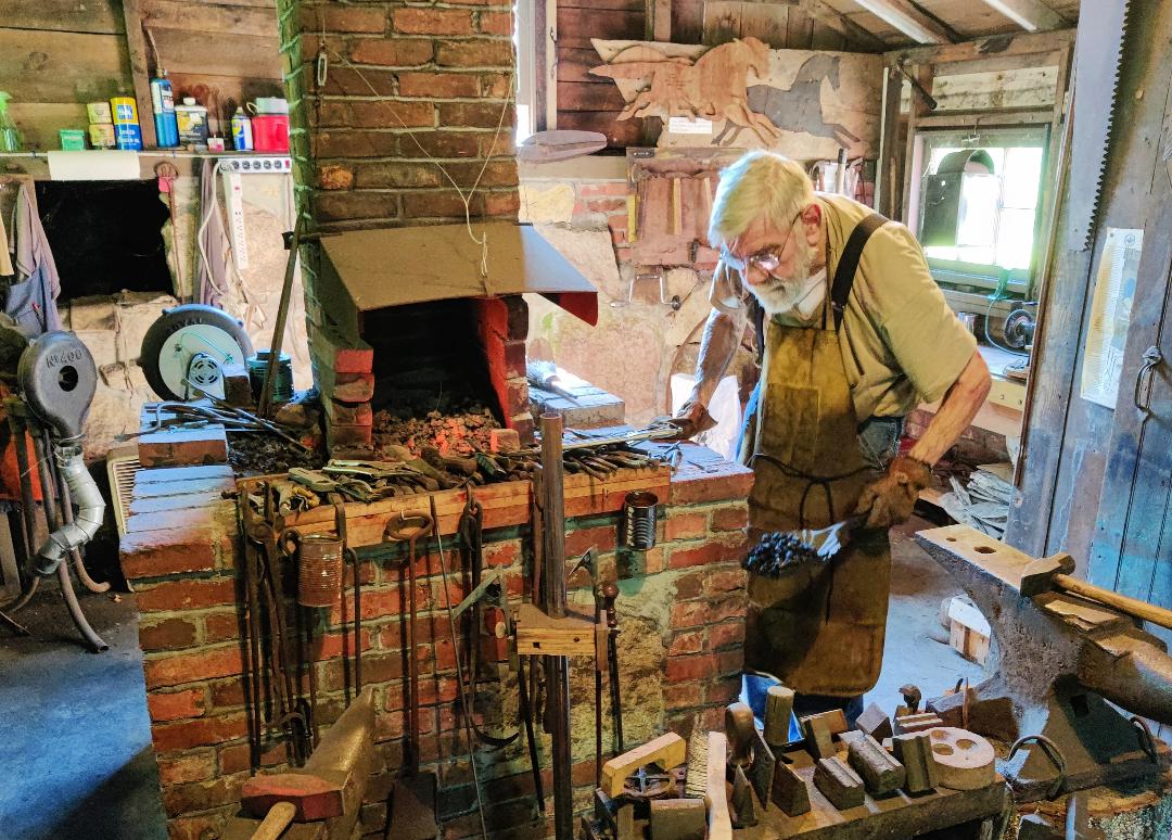
The Bourne Society for Historic Preservation held its Everything Blueberry event August 10th. It was a perfect beach day with an early afternoon high tide, so attendance was lower than it should have been. Those of us who did attend got to see blacksmith Mike Kelley working the antique Alonzo Booth forge, listened to Jim Dineen describe the society’s collection of horse-drawn wagons and sleighs, and toured the beautifully restored Briggs-McDermott house. Jim serves as the society’s long-time property manager and is one of its artifact restorers. Toni Dering, Margot Jenkins, Deborah Burgess, and society president Louise Innis worked as docents in the house. We also enjoyed what must be the world’s best blueberry cobbler, made by society member Emilie Martin.
The Society for Historic Preservation is often confused with the Bourne Historical Society and the Bourne Historical Commission, but they are separate organizations with related goals. The Historical Society manages the Jonathan Bourne Historical Center on Keene Street, where it keeps historic town archives and artifacts. It also owns and manages the collection of historic buildings and property at Aptucxet and is currently working to move and restore the Keene house on Sandwich Road. The Historical Commission is a town agency that was established for the preservation and protection of the historical and archeological assets of the town. It administers the town’s historic protection bylaws.
The Society for Historic Preservation was formed when the Briggs-McDermott House, opposite the library on Sandwich Road, was scheduled for demolition in 1979. The society acquired the house, built in 1800, and restored it to reflect how it appeared in the 1840-1910 period. The house has since been placed on the National Register of Historic Places. The society later acquired and restored to operating condition the Alonzo Booth blacksmith shop, which was moved to the society’s Sandwich Road property from its original location on Shore Road. The third building on the society’s site is a reproduction of the Alan Greene carriage house, built by students from Upper Cape Technical School.
On display in the carriage house is a collection of eight horse-drawn wagons and sleighs, several of which have been lovingly restored by society volunteers. Additional collections on display in the Briggs-McDermott house include mid-19th century furniture and household items, as well as a special display this year of bridal gowns and other clothing that would have been worn by Bourne residents of the time. The display changes each year. More information about the Bourne Society for Historic Preservation, including membership levels and upcoming events, can be found on its website http://www.bournepreservation.org. Their next scheduled event is Christmas in Old Bourne Village on December 6th. And if you have not visited the society’s properties at 22 Sandwich Road, you have just four more chances this year. They are open Fridays and Saturdays from one to four until August 31st.
MESSING ABOUT IN BOATS
(Published on the editorial page of The Bourne Enterprise August 9, 2024)
Author Kenneth Grahame penned a line that is well known to those of us who enjoy small boats. In his classic children’s book, The Wind in the Willows, the Water Rat said to the Mole: “Believe me, my young friend, there is nothing–absolutely nothing–half so much worth doing as simply messing about in boats.” There are few places more conducive to messing about in boats than Bourne, with our many protected coves, inlets and estuaries. Whether you prefer sailing, fishing, paddling or waterskiing, there are great spots nearby to pursue your passion.
As my regular readers know, I spent my childhood summers on Hen Cove in Pocasset, where I learned to sail in an old gaff-rigged Cape Cod catboat, a hard-chined tub half as wide as it was long. The best things about that boat were that it was impossible to capsize and, if run aground, no harm would be done. As an adult, I found it was easier and less expensive to sail other people’s boats than to own one. Whether I was racing a fast daysailer or crewing on a 45-foot ketch, there were always friends eager to have an experienced sailor on their crew. But I still kept a small sloop on a trailer, and often enjoyed a sailboard my brother built when he was in high school from plans published in Boy’s Life magazine.
It was later in life that I discovered the most fun with small boats. A friend invited me to join a paddling party and rent kayaks to paddle around Phinney’s Harbor in Monument Beach. I ended up in a short, wide, and mostly open boat that could be paddled as fast backward as forward. But messing about in that boat was more unmitigated fun than I had experienced since I was a kid. I immediately bought an Old Town sea kayak, which was so heavy and slow that I soon traded it for a lighter and faster boat. Then I got into building kayaks, and for a decade I led kayak trips with the Appalachian Mountain Club. I’m too old to do that now, but it was the perfect way to keep messing about in boats long after I had lost interest in sailing anything bigger.
If you haven’t tried kayaking or paddleboarding but think you might enjoy it, I suggest taking some basic lessons, then joining a guided tour with an experienced leader. We are fortunate in Bourne to have outstanding local businesses that offer those services along with rental boats. The town maintains launching ramps or water access points at just about any place you would want to paddle. My favorite is Monks Cove, which provides a protected launching area accessible to the entire coast between Wing’s Neck and the canal, including Back River and the Pocasset River. South of Wing’s Neck, there are safe launching spots on Hen Cove and Redbrook Harbor. A warning, though, do not attempt to paddle, row, or sail a small craft anywhere near the canal; the tidal currents there will overwhelm even the strongest paddler.
CHANGING WEATHER MEANS A LONGER VISITOR SEASON
(Published on the editorial page of The Bourne Enterprise July 26, 2024)
Since my column a few weeks ago praising the delightful June weather, we have endured three solid weeks of blistering heat, suffocating humidity, fog and rain. You would think that kind of weather would put a real damper on our tourist season. And yet, our roads have been packed with traffic, local businesses are thriving, and we are seeing record numbers of visitors crossing the canal. How do we explain that? As bad as the weather has been here, it’s been worse off cape. At least here we have ocean breezes to temper the heat. With my background in community planning, I think a lot about how the changing climate has affected the way we live in Bourne, and its influence on our seasonal economy. I’ve been concerned that the increasingly hot summers might discourage visitors from coming here.
When I was a youngster enjoying summers in Pocasset in the 1950s, we would open up the cottage on Patriot’s day weekend, then not return until school ended in June. After Labor Day, we seldom came back before we drained the plumbing and closed up the house for the winter on Columbus Day weekend. Back then summer weather was more like what we now experience in June or September. It usually got hot toward the end of August, but few houses had or needed air conditioning. As late as 1997, when I built a new house high on a hill in Pocasset Woods. I didn’t consider central air because there was always a cool breeze that moderated the occasional heat and humidity. It wasn’t long, though, before I had window units in every room.
Ironically, the climate changes that are making the summer months less comfortable have had a positive effect on our local economy by extending the visitor season into the shoulder months. Just last week I read a national travel column online promoting Cape Cod that suggested visitors come in the spring or fall, not only because of the summer traffic but also because of the changing weather patterns. It seems that June is the new July and September the new August. As the tourist season has expanded, our restaurants and lodgings are opening sooner in the year and closing later, or even staying open for business all year.
Families with second homes here now come for weekends earlier and later in the year. And the visiting tourists during the shoulder seasons tend to be older travelers whose children are no longer in school. They have money to spend and are more likely to eat out and stay at luxury resorts than younger visitors. Bourne, and the rest of the cape, has also become more of a year-round home to retirees and remote workers who are less likely to head south for the winter, partly because of the changing weather. But we should not let this benefit of climate change blind us to the fact that the ocean is also getting warmer and rising faster than even climate scientists expected. At this rate, my house on the hill might someday be waterfront property.
PADDLING THE POCASSET RIVER
(Published on the editorial page of The Bourne Enterprise July 6, 2024)
One of the most isolated and serene places in Bourne is the upper reaches of the Pocasset River, east of the railroad tracks. Unless you live along its banks, though, or know someone who does, this estuary has not been easy to get to. I have many times launched my kayak from Monk’s Cove or Monument Beach, paddled over to the river, and worked my way through the shoals and marsh passages to the concrete floodgate at Mill Pond, where the river originates.
Until recently, the only other public access point with parking has been the town’s pier at the Shore Road bridge, which can be difficult for an inexperienced paddler to use. Now, with the new stairway to the river installed across the street, it is much easier for casual canoe or kayak paddlers to launch their boats. I would like to offer a few helpful observations and suggestions before you try it, though. The river, north of the singing bridge, is very shallow, and the bottom is too soft to walk on safely, so I recommend launching an hour or so before high tide and getting out within an hour after the tide turns.
This area is not dredged, so the natural channel is also shallow and not very wide. Try to stay in the channel until you get to the railroad trestle. There are eight openings between the bents of the trestle. You will want to go through the third opening from the southern end of the trestle, because there are barnacle-covered boulders lurking close to the surface in the other passages whenever the tide is close to full. The meanest of them lies immediately to your left as you emerge from under the trestle. Once you clear the trestle, there are few hazards to impede your enjoyment of a sunny day on the water. The area is shallow, however, and there are remnants of boats that were destroyed by hurricanes still lurking in the mud here.
You might notice that the water is exceptionally clean and clear, making it easy to see the river bottom. Don’t be surprised to see fish swimming alongside you, blue crabs, and lots of eels. The Pocasset River is fed from the Four Ponds conservation area, and the water is so clean that wild watercress thrives there. If you are a birder, bring your binoculars. This area is so protected that it seems like an aviary, with plenty of shore birds to identify. It wasn’t always like that, though. When you get to the head of the river, look up to the bluff on your left. A century ago, there was a huge factory here that produced iron stoves and cooking tools that were sold around the world.
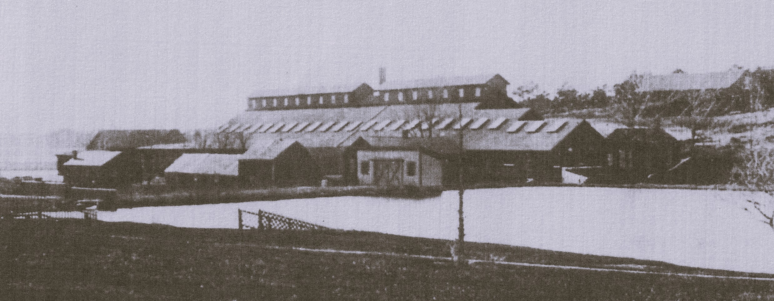
(Photo of the Pocasset Iron Works cropped from an image in the Bourne Archives)
Try to avoid the passage under the trestle at mid-tide, as the water rushes through pretty fast and can push your boat into the rocks if you get caught off-guard. And for a similar adventure on a much larger scale, with similar perils at mid-tide, be sure to paddle the Back River in Monument Beach. Just don’t get too close to the swans, as they can be mean and are very territorial.
IS THERE ANYTHING NICER THAN A DAY IN JUNE?
(Published on the editorial page of The Bourne Enterprise June 21, 2024)
June might be the best month of the year to live in Bourne. And this year it is a stunner. Warm dry days and cool nights, with no need for either heat or air conditioning until a few days ago. Gorgeous sunsets and long evenings for after-dinner walks along the canal. Restaurants that are still accessible without long waits. Beaches that are not yet crowded and with plenty of parking. And this year, thanks to the super-wet spring, gloriously lush foliage on all the trees and flowering shrubs. The hydrangeas are loaded with buds, unlike their disappointing blossoms last year. Traffic is picking up, but we can still make left turns most of the time.
By now, we have our yards raked and fertilized, and our gardens planted. We’ve swept the patio or deck, cleaned up the outdoor furniture, and dusted off the grill. Some of us have put our bird feeders away for the summer, having tired of the Grackles and Ravens cleaning them out in minutes. Fishermen, sailors, and kayakers have uncovered their boats and begun to enjoy the fantastic feeling of freedom they experience on the water in summer.
Our blankets and sweaters have been cleaned and stowed until fall. We are now fully into shorts and T-shirts. The spirit of seasonal renewal has encouraged us to clean out our closets and overwhelm our favorite thrift shops with donations. The snow blower that saw so little use last winter had its oil changed and is stowed away in the shed, while the lawn mower has been tuned up and sharpened for its turn to noisily annoy the neighbors. The outdoor shower is now in daily use, and we have enjoyed a hearty crop of asparagus from the bed we planted years ago.
We are done with the graduation ceremonies, and our children and grandchildren are getting ready for camp or summer jobs. It’s an exciting month, full of hope and expectations. We made one last trip down-cape to see the Lupins at Fort Hill and to stroll along Commercial Street in Provincetown and Main Street in Chatham while there was still room to park. Soon we will limit our travel and be grateful that we now have an active downtown in Buzzards Bay, with concerts and festivals at the town park, and a hometown Fourth of July parade.
Next week we will be flooded with seasonal visitors, who support our local businesses and keep our property taxes low while their aggressive driving annoys us. The days will inevitably get hotter and more humid, but that makes evenings on the beach watching the sunset even more enjoyable. With any kind of luck, the summer storms will blow past us without damage. And in a flash, the busy season will pass, just in time to enjoy our second and third favorite months in Bourne, when the kids are back in school, and we can once again make left turns with ease. June may be almost over, but we still feel blessed to live every month in such a wonderful place.
THE NEW FACE OF SUMMER TRAFFIC
(Published on the editorial page of The Bourne Enterprise June 7, 2024)
This should be a terrific summer for tourism on Cape Cod. Despite what you might hear from certain news sources, our national and regional economies are booming. Food and housing prices, along with interest rates, remain high, but the rate of inflation has held below four percent for two years now, and wages have risen faster than inflation. Unemployment is at a 60-year low. The stock market indices are at record highs. The price of gas is back down to where it was three years ago, and more people are now travelling than ever before. And since all traffic to any location on the Cape and islands goes through Bourne, we could see more of it this year.
There has also been a significant change in the source of traffic moving through Bourne over the last four years. When the COVID pandemic hit, a lot of service workers on the Cape lost their jobs. Some of them moved inland for better work opportunities. At the same time, many professionals and office workers were forced to work remotely. Mortgage interest rates dropped to all-time lows. That created a perfect economic storm in Bourne and the rest of the Cape. Many older workers retired early and moved here full-time. As remote work became more widespread, those who could work from home also gave up the daily commute and moved here.
As the economy has recovered, demand for service workers has not only returned, but has increased. Our newer residents tend to be older and wealthier, and more likely to hire others to do yard work and home repairs. Tradespeople and service workers who moved away are now commuting across the canal every day. Much of the increased traffic we now see at peak hours has been building year-round; it’s just more noticeable now that the seasonal traffic has picked up. We are also seeing a flattening of the seasonal traffic peaks that once concentrated on Friday afternoons through Sunday nights. With flexible work hours becoming more common, visitors and seasonal residents are able to avoid those peak travel times.
It also seems to me that drivers have become more aggressive this year. Those of us who live here year-round are so used to having roads that are not crowded off-season that we tend to drive more cooperatively and less competitively. If you have driven through any of the metropolitan Boston area lately, though, you know that the kind of traffic we see now on the Cape is common all the time in the urban areas. Drivers in those areas need to be aggressive to get anywhere and simply bring that way of driving with them. And no, we cannot blame the peak hour backups on the reconfiguration of the Bourne bridge rotary. Drivers from other states are already familiar with that kind of rotary traffic pattern, and locals have quickly adapted. The new pattern is working well. There is just a lot more traffic moving through that circle every day.
ONE LAST WORD (FOR NOW) ON THE BRIDGES
(Published on the editorial page of The Bourne Enterprise May 24, 2024)
The Massachusetts Department of Transportation (MassDOT) and its engineers held a well-attended open house last week to show their latest plans for replacing the canal highway bridges and reconfiguring the approach roads. Here are some of my observations on their progress.
First, the quality of presentation graphics has improved by orders of magnitude. Large photo-quality prints of computer-generated images that look like aerial photographs made it easy to visualize how traffic would move and how reconfigured access roads would affect each neighborhood. I was especially pleased to see a scale drawing of a canal cross-section, showing the proposed bridge design overlain on the existing bridge for comparison of how the new bridges will look from the canal service roads.
Second, the project managers and engineers have apparently heard our criticisms that their designs did not consider that traffic levels double in the summer and did not recognize that the bulk of traffic crossing the canal connects Route 25 with the Mid-Cape Highway. The latest designs show two-lane exit and entrance ramps instead of single lanes at the busiest turns. They also show clear travel lanes between the bridges on the mainland side, unimpeded by sharp turns or traffic signals, except for two of the existing signals on Scenic Highway. And one of the representatives told me they are now using mid-August traffic numbers at key points.
Third, that same representative confirmed my long-held suspicion that the engineers are deliberately trying to discourage vehicles travelling between Route 25 and the Mid-Cape from using the Bourne Bridge and Sandwich Road. That tactic will substantially increase traffic on Scenic Highway but will obviate the need to widen and upgrade Sandwich Road. It may also reduce traffic on the Bourne bridge enough to require only a single five-lane bridge instead of two at that crossing. MassDOT has already announced a multi-million-dollar project to upgrade and improve traffic safety on Scenic Highway.
Fourth, I was pleased to see people tracing their travel routes with their fingers on the maps and asking about the differences in traffic volumes during the summer, as I had suggested in my last column. It was also encouraging to see several town officials at the open house and to see so many local residents of all ages actively involved and interested in this project.
Finally, I still don’t understand how building four bridges can be more economical than building two, or why they need ten bridge lanes connecting four-lane highways that are not likely to ever be brought to interstate standards. I also don’t understand why they insist on using a 60-year-old bridge design instead of the more advanced, more attractive, and far less expensive cable-stayed designs that have been built almost universally for spans this size in recent decades. And I was appalled to see a proposal to replace the Bourne bridge rotary with not one but two roundabouts. Those mini rotaries work fine when daily traffic is less than 4,000 vehicles but not when volumes are ten times that number. But then, I’m a planner, not an engineer, so what do I know.
LATEST BRIDGE PLANS – NOTHING CHANGED
(Published on the editorial page of The Bourne Enterprise May 10, 2024)
Monday afternoon and evening the engineers charged with designing the Cape Cod Canal bridge replacements will once again hold a public viewing of their plans at the Bourne Veteran’s Memorial Community Center on Main Street in Buzzards Bay. I urge all of my readers to attend. Pay close attention to the proposed entrance and exit ramp configurations. Imagine you are driving the ramps you regularly use. Will the new plans improve your experience or make it worse? Some of the ramps in the new plans will further slow and back up peak time traffic.
The biggest changes to the plans since we last saw them involve the timing of construction and the quality of the illustrations. After the estimated construction cost quadrupled during the concept design phase, focus shifted to replacing only the Sagamore bridge, leaving the Bourne bridge and its approaches for later. The new concept drawings are a bit more sophisticated, no longer looking like they were created by a child with crayons. Two major flaws remain: the plans do not consider the massive increase in peak day and peak hour traffic that crosses the canal during the tourist season, and they do not respond to the way traffic actually moves.
When I reviewed the earlier Environmental Impact Report, I saw that the design of the bridges and access roads was based on average daily traffic counts on October 15. Thinking that this must be either a typographical error or that I misunderstood the report, I questioned the engineers by email. They responded that it is standard practice when designing highways and interchanges to use October 15 traffic as the norm. Clearly, these engineers have never tried to cross the canal on a July fourth weekend or any of the turnover weekends. That standard may work well in Tulsa or Scranton but not in Bourne.
Even more egregious is the engineers’ failure to consider how traffic crossing the canal actually moves. They have provided unimpeded four-lane connections between Route 3 and the Mid-Cape Highway, although half of the traffic crossing the Sagamore bridge connects the Mid-Cape with Route 25. Similarly, they have provided unimpeded four-lane connections between Route 25 and MacArthur Boulevard, although only about one-quarter of the traffic using Route 25 connects with the highway to Falmouth. A substantial majority of the traffic crossing the canal travels between Route 25 and the Mid-Cape Highway. Yet the engineers limit access to Scenic Highway and Sandwich Road, which connect those two highways, to single-lane ramps, some of which end at traffic signals.
It is essential that Bourne officials, the Cape Cod Commission, and every person who crosses the canal regularly pay close attention to the latest design proposals and question the engineers when you see something that does not appear to make sense or is likely to make peak time traffic worse. Do not assume that the state engineers and their consultants know better than you, and don’t let them brush off your concerns. Once the designs are finalized, that is what will get built, and we will be stuck with their bad decisions for the rest of our lifetimes on the cape.
A FEW RANDOM THOUGHTS
(Published on the editorial page of The Bourne Enterprise April 26, 2024)
The Southside Fire Station is back in the news. My first reaction when hearing that the Bourne South Side Fire Station Building Committee recommended locating a new station on Shore Road was “What were they thinking?” Granted, the proposed location is midway along the Buzzards Bay shoreline, which is good for reaching the waterfront neighborhoods of mostly seasonal houses. But siting it on a winding two-lane road that limits the speed that equipment can safely travel, and that frequently suffers downed trees during storms, does not seem wise. Most of our year-round residents, who tend to be older and often need ambulance services, live farther inland.
The proposed station will cover a broad territory in the six-mile stretch between Bourne Village and Cataumet and equipment has to get to any location in the fastest way. I think the town should pay the price to buy the site on MacArthur Boulevard, from where equipment can move quickly to one of the main town roads leading to nearby neighborhoods as well as the shorefront villages. I was relieved to read that the Selectboard pulled the article to proceed with this site from the town meeting warrant. Not only is this a poor location, but the permitting process to use land set aside for conservation could delay the station by another five years.
On a lighter note, the archival photo of the Eustis mansion on Scraggy Neck published on the editorial page two weeks ago brought back a memory for me. When that house burned in the winter of 1947, my grandmother excitedly related how she could see the flames above the trees and houses on Patuisset from her home on Hen Cove. The photo commentary noted that the fire began from a fireplace malfunction. It was common at that time for local teenagers to break into summer mansions off-season, build a roaring fire, and party on. The style at the time it was built was to finish the walls and ceilings with varnished wood instead of plaster, so once a fire got out of control, it spread quickly.
This was not the only nineteenth century Victorian mansion lost that way in Bourne. The Paine mansion overlooking Red Brook harbor burned a few years later. At the beginning of the twentieth century, Bourne’s waterfront was largely undeveloped, but on the bluffs that overlook every harbor and inlet massive elaborate edifices to wealth were constructed, the summer homes of Boston tycoons and the summer White House of President Grover Cleveland. Nearly all of them were destroyed by fire.
And lastly, with sadness, I note the passing of a friend who contributed his time and expertise to our town for many years after he retired. John Johnson died earlier this month after suffering a massive stroke in December, only a few months after losing his lovely wife Mary. John and I worked together on several town committees, beginning with the first Local Comprehensive Plan Committee more than 20 years ago. His sharp wit and positive attitude guided our work through many contentious debates. John also presided over the Pocasset Village Association and was well known and respected in his Barlow’s Landing neighborhood. He will be missed.
A BOURNE MUSINGS MILESTONE
(Published on the editorial page of The Bourne Enterprise April 5, 2024)
Today marks five years since I became a paid columnist for The Bourne Enterprise, with this 79th column of Bourne Musings. The assignment they gave me is a writer’s dream, in that I decide what to write and how to present it, and they publish it exactly as I write it. The only limitation is that it has to be about Bourne. I especially like writing for The Enterprise, as the editors appreciate complex sentences and grown-up words. Most of all, I’m surprised at how well this column has been received, and how much it has influenced public policies and attitudes.
While strangers sometimes recognize me from the masthead photo and comment on my columns, I have had detractors. Several have unfriended me from social media. One anonymous reader a few years ago sent me a thick envelope of vicious hate mail about a person I had praised. This being a small town, it took only a single phone call to confirm who sent it. That letter upset Paula, my in-house copy editor who frequently asks: “Do you really think you should say that?” It didn’t bother me, though. I treasure instead the beautifully hand-written thank-you note I once received from another reader.
This month also marks the 50th anniversary of my first ever op-ed column published by a local weekly newspaper. That series ran for several years in the Dartmouth Chronicle. At that time, I was the first town planner for the town of Dartmouth and used the column to introduce readers to the benefits and limitations of community planning. I still have a binder of carbon copies of those columns, which I wrote out long-hand on yellow legal pads and my secretary typed up on her IBM Selectric typewriter.
I love this town and enjoy writing these columns. Bourne is a fascinating place populated with interesting people of diverse backgrounds, educational levels, and opinions. Each of its many villages has its own character and stories to tell. The area that became Bourne 140 years ago has a rich history. It was an international trading center in the 1600s, a major industrial center in the 1800s, and a crucial military center in the 1900s. Bourne is unique on the cape for its deep ties to the military, its canal, and its many secluded beaches. Every vehicle traveling between the mainland and any point on Cape Cod and the islands passes through Bourne on its journey, creating unusual problems as well as opportunities for a town the size of ours.
When my editor asked me in 2022 to submit columns bi-weekly instead of monthly, we were both concerned that I would not find enough material to write about. We needn’t have worried. There is usually a current discussion in the news or on social media that begs commentary. And on slow news weeks, I can always dig into my stash of family photos or pull something out of my time as a volunteer member of several town boards and consultant to the town. When all else fails, I never run out of rants about the incompetent management of our state department of transportation.
DO WE STILL NEED MEMORIAL CIRCLE?
(Published on the editorial page of The Bourne Enterprise March 22, 2024)
Memorial Circle, sometimes known as the west rotary, is the smallest of Bourne’s traffic circles and that’s a problem. This egg-shaped rotary sits at the west end of Main Street and the bypass in Buzzards Bay. It was originally built to manage traffic going to and from Taylor Point at a time when all traffic between the mainland and Falmouth, Martha’s Vineyard and Nantucket travelled through Main Street to and from the Bourne bridge. You can still see the curb cut where the old road to Taylor Point intersected the rotary via a bridge over the railroad tracks. At that time, the bypass did not exist, and traffic volume and speed were both much lower than they are today.
For many years there were war memorial stones on the center island, hence the name Memorial Circle. It was dangerous, of course, for pedestrians to access the center island, so nobody ever visited the memorials, and they were a nuisance for the lawn mowing crew. About a decade ago the memorial stones were moved to the town hall were they are more accessible. Maybe that was when the police and others began calling the circle the west rotary.
The problem with Memorial Circle is that it is too small to work effectively as a rotary and too big to work as a roundabout. Rotaries have two or more lanes and need space for vehicles to safely change lanes between exits. Roundabouts have only a single travel lane and do not work well when traffic volumes exceed 4,000 vehicles per day. This site carries about three times that volume. The primary purpose of roundabouts is to “calm traffic” or replace traffic signals, not to move traffic more smoothly.
Partly because of its size, and also because the circle is set to the side of Main Street instead of the middle of the road, Memorial Circle is confusing to drivers and is the site of many collisions. With this strange configuration, drivers unfamiliar with the road coming from the west often continue straight onto Main Street when they would be better served by using the bypass. And drivers coming off the bypass, as well as those coming from Wareham, often fail to yield to drivers already in the circle. With our Main Street downtown once again an active place, town leaders are looking at ways to direct more of the through traffic onto the bypass.
In the 2007 transportation plan I prepared for the Buzzards Bay Revitalization Association, I suggested eliminating Memorial Circle and reorienting the west end of the bypass to directly connect with Cranberry Highway, as shown in this sketch.
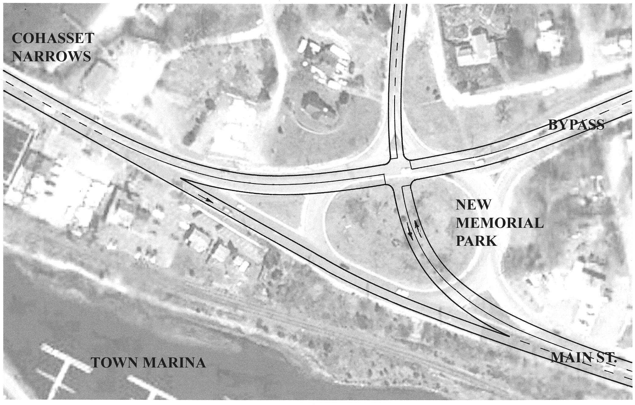
With this plan, Main Street would meet the state highway at a T-intersection with a traffic light. This configuration would send more of the through traffic to the bypass. It would also reduce the speed of vehicles entering downtown from the west, which might allow removal of the current traffic light at Academy Drive. I don’t hold a lot of hope that our state highway people would actually do this, however; it just makes too much sense.
RAILS AND TRAILS SHOULD NEVER MIX
(Published on the editorial page of The Bourne Enterprise February 23, 2024)
Mass Coastal Railroad and Carvossa Construction have been lobbying hard to keep the old rail line to Joint Base Cape Cod in place. Both businesses fear losing a business model that is heavily subsidized by the state and federal governments that maintain the rails and the lift bridge crossing the canal. The National Guard has asked that the rails remain or be moved to a different access to the base, even though it has not used the railroad more than a handful of times in the past 75 years. And Falmouth officials still cling to the hope that commuter rail service might someday be extended to their town, even though the fundamental nature of commuting has changed.
All of these entities have endorsed the concept of a recreational trail built alongside the railroad, as if that were a straightforward solution that would please everyone. The reality is that building a trail alongside the rail line is a non-starter. There are many reasons why the rails should be removed and replaced by an extension of the Shining Sea trail to the canal. To keep the railroad in place, the existing rails would have to be relocated over much of the route. The rails do not run neatly down one side of the right-of way but range from one side to the other.
Between Gray Gables and Pocasset, and south of Redbrook, the right-of -way is not wide enough to accommodate both the railroad and the trail and still comply with the state’s requirements for separation between the two. The existing bridges over roads and Back River are also too narrow for both the railroad and the trail. In addition, there are several wetland crossings where the rails are set on trestles or steep fills. In those places the trail would need to have its own trestles or be shunted onto Shore Road or County Road, both of which are unsafe for cyclists and walkers.
An analysis by the Cape Cod Commission found that the cost of building a trail alongside the railroad would be four times the cost of replacing the railroad with a trail. Land takings could cause that estimate to balloon. Additionally, studies by the non-profit Rails to Trails Collaborative have found that the value of properties abutting recreational trails is typically 15 to 25 percent higher than that of otherwise comparable properties that don’t abut trails. Much of that benefit would be lost if the railroad remains in place.
The most important reason for removing the railroad is the effect it has on enjoyment of the trail. As all of us who use the Shining Sea trail know, the section that abuts the rails, with its black chain link fence separator, does not feel the same as the rest of the trail as it winds through woods, past ponds, and along the shore. I have ridden trails next to rails in Maine, Rhode Island, and Connecticut, and found them far less used and less enjoyable than trails that do not share the right-of-way with railroads. That difference is especially important for the proposed Bourne trail connector because the rails are so seldom used, and the new trail would be so heavily used.
TAKING THE TRAIN TO POCASSET
(Published on the editorial page of The Bourne Enterprise February 9, 2024)
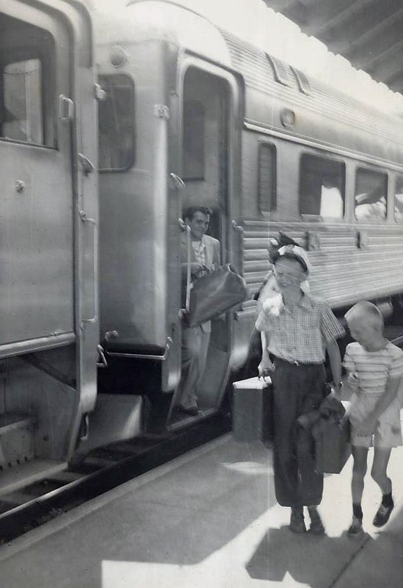
This photo, taken 70 years ago, is of me and my kid brother as I got off the train at the Pocasset station, returning from Parker Mountain Boy Scout camp. Even then, it wasn’t a traditional train; it was a pair of self-powered rail cars that ran on summer weekends. The Pocasset station was still there but had been boarded up for two decades. Occasionally, a mixed freight train would run to Woods Hole with a load of lumber, coal, or a tank car of fuel oil, but otherwise the Falmouth line rarely saw any service. It had been almost ten years since the last troop train pulled out of Camp Edwards.
Fast forward to 1991. I was assigned the task of leasing the old railroad yard in Falmouth from the state to expand the Steamship Authority’s Palmer Avenue parking lot. The Falmouth station had recently been rehabilitated as a bus station after being boarded up for years, and the tracks were not in active use. Nevertheless, state officials insisted that the rails were not to be removed or paved over, in expectation that railroad service might someday return to Falmouth. A few years later, the rails were torn up and the Shining Sea bike path extended to North Falmouth.
Today the rail yard on Joint Base Cape Cod has also been removed, with only a single track going onto the base. The tracks are now used solely by a private company to reach a trash transfer station located just south of the base. The taxpayers of Massachusetts recently spent more than $3 million upgrading the tracks, even though the military base is now used only by the Coast Guard air station, the Space Force radar facility, and limited National Guard training, none of which use the railroad. While many of us hold nostalgic memories of riding the train or hopes of seeing the military base return to its former use, our world is moving in a different direction.
Now let’s jump forward 30 years. Joint Base Cape Cod has been decommissioned. Most of the base over the groundwater aquifer has reverted to state forest. The Otis airfield is now the Cape Cod Airport; the Coast Guard has relocated to a portion of the Hyannis airport, much of which has been redeveloped into workforce housing. The Army Corps of Engineers has dismantled the century old railroad lift bridge crossing the canal after Congress refused to appropriate funds for its rehabilitation because it no longer served a strategic military purpose. All the rails on Cape Cod have been pulled up and the right of way converted to a cape-wide recreational trail.
None of this is fantasy; all of it is not only possible but likely. A rare opportunity for funding is available now to remove the rails to Falmouth and replace them with a recreational trail that will bring millions of dollars into Bourne’s economy. The railroad corridor between North Falmouth and the canal is one of the most scenic in the country, and the Falmouth branch line has not seen enough use to justify its existence for three generations. It’s time to relocate the transfer station and put this asset to better use.
THE END OF COMMUTER RAIL?
(Published on the editorial page of The Bourne Enterprise January 26, 2024)
When I was a member of Bourne’s first Local Comprehensive Plan committee 20 years ago, we decided that the best way to revitalize our Main Street downtown was to bring in commuter rail. The state had already upgraded the tracks and crossings into Wareham, so we figured it would not take long to extend the service into Bourne. A decade later, when I was chairing the selectmen’s Transportation Advisory Board, we were assured that commuter service to Buzzards Bay would begin within a year. The town meeting, with that assurance, voted to join the Massachusetts Bay Transportation Authority, better known as “The T.” Apparently the powers that be at the T didn’t get the memo, as we are still waiting for the train.
Unfortunately, the T – or MBTA – has suffered years of underfunding and bad management. Its personnel policies and pay scales have left it with hundreds of vacancies, resulting in forced overtime and low morale in its workforce. Its long-awaited Green Line extension into Medford ran years behind schedule and millions over budget. That line is still not operating as it should because the rails were set too close together. How’s that for incompetence?
Then along came the pandemic lockdown and ridership plummeted, as office workers found they could do the same work from home that they had done in their inner-city cubicles. A whole new way of working, enabled by reliable high-speed internet connections, was suddenly forced upon the business community. Workers loved it because it saved hours of commuting time and aggravation. Some bosses hated it until their accountants pointed out how much they could save by reducing their high-rent office space. Further analysis found that many employees were substantially more productive working from home. Now, four years later, ridership on the T has still not returned to anything close to pre-pandemic levels.
This is a fundamental change in the way we live that is never going to revert to the old pattern of gathering large groups of workers in a single place so that they can be managed effectively. The office vacancy rate in Boston is currently 20 percent, four times the normal rate. Developers are now converting office buildings into housing. The time has come for Bourne and its neighboring towns to let go of the idea that we need commuter rail service. Keep the Cape Flyer for the high season, but reconsider how commuter traffic moves. A fresh analysis is likely to show that the greatest number of commuters in Bourne and Falmouth are tradespeople and health care workers coming here from diverse off-cape locations.
It turns out we didn’t need the T to rebuild our downtown. Main Street is now thriving, with new businesses opening and more people than ever now living where they can also work, shop and play without having to drive or take a train anywhere. The T remains an essential service for the inner suburbs, but it is unlikely that it will be extended farther out. I would not be surprised to see the South Coast extension, currently under construction, never put into service, and expect that daily commuter rail service will never cross the canal.
WINTER IN POCASSET LONG AGO
(Published on the editorial page of The Bourne Enterprise January 12, 2024)
On this day in 1946 my mother was about to give birth to my brother. Back then even a routine pregnancy often meant a week-long hospital stay, so I was shipped off to my grandparents’ little retirement house on Hen Cove. I was not quite five at the time, and it was my first experience of Cape Cod in winter. Very few houses in Pocasset Heights were occupied, and there were no other children in the neighborhood. For me, though, it was a real treat. I adored my grandmother and became her shadow all week, helping her cook and care for her pet canary.
I’ve written before about my grandfather Bert’s house that started out as a crude beach shelter in 1904 and gradually evolved into a cozy year-round home. There were three rooms wrapped around a massive brick fireplace, plus a seasonal sunporch. I would be tucked into their bed at night and would somehow wake up on the living room couch in the morning. Grandpa Bert always kept a fire going, although he had installed an oil furnace in the dirt-floored cellar when he retired. Then, as now, snow was rare on the cape, but it got mighty cold and windy, so we stayed inside most of the time I was there.

This photo shows what the fireplace looked like at that time. The house is gone now, replaced by a larger modern interpretation of Grandpa Bert’s old place. The clock on the mantle was made in 1804. Each night, Grandpa would lift me up so I could wind it. I still have that clock with its original wooden mechanism. My brother has the flintlock rifle on display in his den. The 1942 Philco radio not only played the AM and FM stations but pulled in short-wave broadcasts from all over the world. It lasted almost 40 years before the wires rotted out. I eventually sold it to a collector in El Salvador who restored it to operating condition.
My grandmother was a bit of a renaissance woman. She was a six-foot tall redhead of Scottish descent, born in Maine, who could say “Ayah” the proper way: three times in a row on an inhale. Before marrying Bert, she would travel around on her bicycle with a big box camera on her back, taking pictures that she would process and then paint with watercolors. She was no longer doing that when I knew her, but she taught me the basics while I was with her that week. Grandpa Bert took us in his big black Packard sedan to the general store located where the Pocasset post office is now. There we bought a tin of watercolor paints and some paper, and my art classes began.
Paula and I try to give our own grandchildren the same sort of experiences, but their lives are not like ours were. Three of them live nearby so we see them often, but the others live in Maine and New York, so visits are less frequent. And the kids now seem more interested in their phones and tablets than learning how to cook or paint.
MY PREDICTIONS FOR BOURNE IN 2024
(Published on the editorial page of The Bourne Enterprise December 29, 2023)
The coming year promises to be a wild ride nationally and internationally. Many traditions will be upended, wild cards will appear, and surprise events might become almost normal. Anything anyone predicts today will be subject to change – possibly more than once. In Bourne, though, I expect another normal year. The national economy will continue to be strong; visitors will have money to spend, and that means another great summer on the cape. Local businesses will still struggle to find employees but will have no trouble finding customers. And while political uncertainty in the Middle East may drive gasoline prices higher, they will not go high enough to discourage travelers from coming here.
Our downtown, Main Street in Buzzards Bay, will continue to thrive, with more new businesses opening and plans announced for additional housing, both rental and condominium. Community events like the July Fourth parade and the Canal Days celebration will bring record crowds to downtown, not just from Bourne but from the greater region. For the first time in years, the state will not be tearing up roads in Buzzards Bay or closing lanes on the bridges but will certainly mess things up for commuters with their work on the Bourne bridge rotary. Cumberland Farms is finally moving ahead with their mega-station on MacArthur Boulevard, which should open before Memorial Day, but the future of the old Chamber of Commerce information booth is still uncertain.
Preliminary design work will proceed on the Sagamore bridge replacement, but nothing will be done to advance replacement of the Bourne bridge. That may be a good thing, because I expect that the engineers will continue to ignore the fact that the preponderance of traffic crossing the canal travels between Route 25 and the Mid-Cape Highway, and that the number of vehicles crossing the canal doubles at peak times during the summer. As a result, while the Sagamore bridge bottleneck will be remedied, local road connections will become even more backed-up after the planned revisions. Current plans provide smooth traffic flows between Routes 25 and 28, and between Routes 3 and the Mid-Cape, but treat traffic between the bridges as negligible, with no capacity upgrades planned for Sandwich Road or Scenic Highway.
Next summer will be even hotter than this year, as global climate change continues to affect regional weather. Unlike last summer, this year could be drier than normal with the potential for woods fires, especially on Joint Base Cape Cod. This winter will also be warmer than normal, except for a few attacks by the polar vortex that will bring deep freezes and sudden snowstorms. Once again, expect the Spring and Fall months to be the best for outdoor activities. And speaking of weather, last week’s storm drove a tidal surge that should be a wake-up call for residents of Scraggy Neck, Patuisset, and Wing’s Neck. Now is the time for the town to seriously consider raising the roads leading to those peninsulas by several feet and reinforcing their embankments to minimize future washouts. Whatever happens in the coming year, all we can do is sit back, try not to get too upset with the national and world news, and watch what happens.
2023 – A VERY GOOD YEAR FOR BOURNE
(Published on the editorial page of The Bourne Enterprise December 15, 2023)
This has been a very good year for Bourne. Despite the rain nearly every weekend through the summer, and despite the higher cost of food and housing, local businesses generally did well. Visitors still came in droves, with money to spend and eager to get back to their favorite pre-pandemic places and activities. Local restaurants were packed every night. And despite the gloomy predictions on the nightly news, our national and local economies have been booming. Every able person who wants to work is employed, wages have gone up faster than inflation, the stock market has held its ground, and gas prices came back to normal before the tourist season opened.
New shops and eateries continued to open on Main Street, the Calamar apartments are now occupied, and the state finally finished its six-million-dollar project to make Belmont Circle more confusing. Speaking of the Massachusetts Department of Transportation, their failed attempt at replacing the canal bridges quadrupled the estimated cost even before they finished conceptual design. While we may still see the Sagamore bridge replaced before its 100th anniversary, the Bourne bridge replacement has probably been set back a decade or more. Let’s hope somebody in charge realizes that we don’t need ten-lane interstate-standard bridges feeding local roads that will never be improved to those standards, and that you cannot design highway interchanges based upon mid-October traffic counts when they need to handle twice as many vehicles all summer.
Cumberland Farms has resumed work on its mega-gas station at the base of the Bourne bridge, now confident that it will have many more years to amortize its investment before the roads are reconfigured. The old Chamber of Commerce information booth has been rescued from the site after town meeting appropriated funds to move it. The current plan is to relocate it behind the VFW hall where it will serve as the world’s smallest thrift shop. The last of Bourne’s big projects in planning, a new southside fire station, is once again back to square one, however. Like the bridges, this project may be the victim of excessive design standards. Does it really need three acres of land and to be located within a few minutes of every bit of area served? Maybe two smaller stations, as we have had for years, remains the best solution.
Most importantly, Bourne continues to be a wonderful place to live. Whether you are a summer visitor, year-round resident or snowbird, we are a community of people who care for each other and work together to solve our problems and issues. As our town has transitioned over the last century from an industrial center to a summer resort area and military community, and now to an active year-round economy, some things have not changed. We still have a town government run mostly by volunteers, and many active groups providing events and opportunities for residents of all ages. Our annual Canal Days event got washed out this year, but the historical society’s thanksgiving harvest dinner returned to its old venue better than ever. What will happen next year is anybody’s guess, but I expect our town will continue to thrive.
IN PRAISE OF CRANBERRIES
(Published on the editorial page of The Bourne Enterprise December 1, 2023)
I love cranberries. Whether mixed into breakfast oats or baked in a cake, no other fruit can match the combination of sweet and tart as do those little red beads that enhance so many dishes and treats this time of year. Bourne sits smack in the heart of cranberry country, and cranberries are the only commercial agricultural products grown in large numbers in our town. Thirty percent of the berries grown in the United States are harvested within a half-hour drive of us. My favorite variety, Howes, is grown no place else in the world.
Most of the cranberries grown today, not only in Massachusetts but also in Wisconsin, Canada, and New Jersey, are hybrid varieties that are almost as big as grapes and don’t keep as well as the heritage varieties. They are harvested from flooded bogs by shop-built machines that beat the berries off the plants. Cranberries float to the surface where they are rounded up and pushed to a conveyor belt that loads them into open-top tractor trailers. They are then taken to processing plants to be made into cranberry juice and sauce or dried into raisin-like treats.
Cranberry growers typically treat their bogs with chemical fertilizers, insecticides, and weed controls. One Bourne bog owner told me he calls those treatments “flavor enhancers.” When the bogs are flooded for harvest, any residual chemicals are usually washed off the berries. The whole berries you buy in bags are dry-harvested with rakes that scoop the berries off the plants without crushing or bruising them. Those berries should always be washed before using them. Cranberries will last about a month in the refrigerator, but will keep for a year or more frozen.
Every year in mid-October, I stock up on locally-grown berries for the year. I buy ten pounds, which I transfer to quart-size freezer bags. Each bag holds one pound. Seven bags go into the freezer, where I scoop out a quarter cup each morning to add to my oats during the cold fall and winter months. The rest Paula bakes into cupcakes, coffee cakes, pound cakes, and tarts. Those berries are usually gone by the end of the year. My favorite is a cranberry/apple tart recipe from Ina Garten. Cranberries may be the only fruit that are not good eaten raw. They need to be cooked to soften them and release the abundance of natural sugar in them.
Unfortunately, cranberry farming may not last much longer in Massachusetts and New Jersey. The small family farms, with odd-shaped bogs that are not as efficient to operate as the big, rectangular bogs in Wisconsin and Ontario, are finding it difficult to compete and still make a profit. Even worse is the effect of climate change. Cranberries need four months of cold weather in order to set berries, and they are no longer getting the consistent cold that they need as our winters have grown warmer. As long I can get those wonderful berries somewhere, though, I will still stock up every October.
NEW TO TOWN? CHECK THIS OUT
(Published on the editorial page of The Bourne Enterprise November 17, 2023)
There have been a number of posts on social media lately from people who recently moved to Bourne and are looking for things to do and ways to meet others in town. I was surprised at the number of responses suggesting events and places in neighboring communities when we have a terrific resource right here—the Bourne Veterans Memorial Community Center on Main Street. While many people call it the senior center because of the Council on Aging’s many programs and services, the building also hosts programs for children, families, and veterans.
The community center was originally located in a former USO club constructed in the early 1940s. That building was never intended to last nearly 60 years, but it did. Leaky roofs, drafty windows and costly heating led town officials to replace it with a modern structure built to the same basic design in 2000. Unfortunately, the low bid contractor cut too many corners during construction, resulting in leaky roofs, drafty windows and costly heating and cooling. When a sprinkler system pipe froze and ruptured a few years ago, the entire building had to be gutted and the interior completely rebuilt.
The Council on Aging offers dozens of classes and programs for Bourne residents over age 60, and there are informal groups that get together for painting, quilting, and mah-jongg. It costs nothing to sign up for the council’s bi-monthly newsletter, The Bridge, that lists everything available. I get mine digitally by email, while Paula prefers a printed copy. In it, you will find menus for low-cost lunches, schedules for many different kinds of exercise, yoga, and other fitness classes, as well as transportation services and announcements of special programs.
Paula and I take advantage of many programs offered at the center. She has made new friends while keeping in shape in the yoga classes, and I have joined a weekly exercise class for men offered by the Visiting Nurse Association. Since closing my consulting practice, I have had my income taxes prepared for free by experts at the center under an AARP program. Advisers in the SHINE program directed me to the veterans’ agent, who showed me how to get medical services and drugs from the VA. A group of veterans meets over breakfast at the center on the second Wednesday of each month.
The town’s Recreation Department, also housed in the community center, offers educational and recreational programs for children and families. Unfortunately, they have cut back on their sports programs. While some blame the town for not funding adequate staff, others claim the problem is that parents do not volunteer to coach and manage teams. I suspect the lack of interest in sports programs has more to do with the rise in popularity of commercial sports leagues that travel all over the northeast for tournaments. Those leagues are too expensive for many families, though, so I would like to see more effort by the town to provide better use of the gymnasium and ball fields. Our neighboring communities do that, while our gymnasium sits unused most nights and weekends.
WHY I LOVE OUR CANAL
(Published on the editorial page of The Bourne Enterprise November 3, 2023)
At the risk of losing an enjoyable side-gig I need to respectfully disagree with my publisher, who last week suggested filling in the Cape Cod canal instead of replacing the bridges. Here are the top nine of many reasons why I love our canal and would hate to see it closed.
Marine Safety. The most frequent users of the canal are barges carrying oil from Rhode Island and New Jersey to Everett, Portsmouth, and Portland. I would much rather have them using the canal in the company of a support tug than foundering off the coast of the National Seashore.
Small Boat Access. While larger yachts can navigate around the cape, most of the boats passing through the canal would not be able to travel between ports north of the cape and those to the south if the canal did not exist. The canal not only saves many hours of time and offers safe passage for small craft, it is the only choice for many mariners.
Economic Benefit. The Army Corps of Engineers reports that the canal service roads draw more than 300,000 visitors every year. Trail advocates estimate that each visitor to a recreational trail spends an average of $31 locally. That is more than $9 million added to the upper cape economy.
Recreational Opportunity. Many Bourne residents frequently walk or bike along the canal year-round. Many others visit the canal to fish or watch the marine traffic. Some of us find it to be a perfect place to meditate and calm our minds, or to wind down after a stressful day.
Public Health. In addition to the economic benefit and recreational opportunity, the canal service roads encourage local residents and visitors to walk, bike, and otherwise move in ways that have a positive impact on their health.
Community Identity. No other Cape Cod town has a more iconic public image than Bourne has, thanks to the canal and its bridges. When visitors think of Bourne, it’s not our protected beaches or scenic bays and inlets, or our newly revitalized downtown that they remember; it’s the canal.
Water Quality. A study conducted by scientists at the Woods Hole Oceanographic Institution for the Buzzards Bay Coalition found that between 56 and 80 billion gallons of water flows through the canal every day. That volume, moving rapidly between Cape Cod Bay and Buzzards Bay, keeps both bays clear of pollutants that could build up without the constant tidal movement.
The Gateway. Every person coming to Cape Cod knows exactly when they have arrived; it’s the moment they crest one of the bridges crossing the canal. They might still have an hour or more of driving, and possibly a ferry ride to Martha’s Vineyard or Nantucket, but that crossing marks a major milestone on their trip.
The Relaxation Effect. This is a big one that I am sure every person crossing the canal has felt at some time. When you get to the bridge on your way home after working or shopping off-cape, or on your way to a weekend get-away or vacation at the shore, you take a deep breath of refreshing salt air and instantly feel your body relax as the tension of the day washes away. That is why I love our Cape Cod canal.
TAKING ANOTHER LOOK AT MARIJUANA
(Published on the editorial page of The Bourne Enterprise October 20, 2023)
When the question of allowing sales of marijuana for medicinal and recreational use in Bourne came before town meeting four years ago, Paula and I took her 13-year-old granddaughter with us to hear the debate. She actually found it fascinating, and it proved to be a positive lesson in civil discourse. As now, proponents of allowing dispensaries in Bourne cited the financial benefit to the town, while opponents were primarily concerned with the moral implications of marijuana use and the effect it might have on our children and public safety.
At that time, recreational marijuana dispensaries were still somewhat of a novelty and their popularity was causing traffic problems in some of our neighboring towns. Since then, the novelty has worn off, the feared side effects have not materialized, and the towns that allow dispensaries have seen money flow in. On November 6th, Bourne residents will have the opportunity to reconsider previous votes that banned marijuana sales in Bourne, and to amend the zoning bylaw to allow up to four dispensaries by special permit in overlay districts. A third article, which in my opinion as a community planner would not likely withstand a legal challenge, would ban non-medicinal sales of marijuana under the zoning bylaw.
The primary advocates for overturning the ban four years ago controlled a site on MacArthur Boulevard where they proposed to grow, process, and sell marijuana products for both medicinal and recreational uses. As president of a condominium association that abuts that site, I had mixed feelings about their proposal. I was most concerned about how odors that are known to emanate from such a facility might affect property values and our ability to enjoy our quiet little enclave in the woods. I was also concerned about the increased traffic such a facility would generate. That group withdrew their proposal after losing a lawsuit against the town, and the newly proposed zoning would prohibit growing and processing marijuana products anyway.
Despite my previous reservations about the neighboring facility, I support rescinding the ban on recreational marijuana sales and adopting the proposed zoning standards. I do not use marijuana myself but it pains me to see neighboring towns cashing in on a source of income while Bourne prohibits it. I also recognize that allowing marijuana sales in Bourne will not increase the number of people using it, or affect anyone’s ability to acquire the products nearby.
To me, Bourne’s current position seems similar to the bylaws that prohibit the sale of alcoholic beverages in some New England towns. They both hark back to the region’s puritan past, when a minority imposed their interpretation of morality on the entire population to the benefit of neither group and at a cost to both. The proposed zoning bylaw sets out clear standards by which the board of appeals must evaluate requests for special permits. It also includes restrictions on how the dispensaries operate that directly address many of the concerns expressed by the opponents. Even if the marijuana ban survives another vote, the zoning standards should be enacted in preparation for the day when the ban is finally overturned.
CREATIVE APPROACHES TO WORKFORCE HOUSING
(Published on the editorial page of The Bourne Enterprise October 6, 2023)
The offer by officials of Joint Base Cape Cod to split off a portion of the base for development of affordable housing could help to keep more of our local workforce in Bourne. The scarcity of buildable land in town has driven the cost of housing well past what most working people can afford. It has also led to increased traffic crossing the canal twice a day year-round, as working families move off-cape but still work here. If land cost is taken out of the equation, builders could create housing that is more affordable to young families and town employees. Let’s hope this idea gains traction and does not take too long to realize.
In the meantime, there is another way to create affordable housing that is already on the books. That is, adding additional dwellings to existing residential properties. Known to community planners as accessory dwelling units, or ADUs, they can be as simple as a garage converted to a studio apartment, as common as a new wing on a house, or as complex as a separate building on the same lot as the main house. Bourne’s zoning bylaw currently allows construction of ADUs by special permit granted by the zoning board of appeals. Unfortunately, few ADUs have actually been permitted in our town.
Adding an ADU has definite advantages for home owners. They can create a place for elderly parents to live independently but close by. Empty nesters can move into an ADU and rent out their larger house to generate income in retirement. Working families may rent out their ADU to support their purchase of a larger house. The zoning bylaw sets several reasonable limitations on use of ADUs. Foremost, one of the dwellings must be occupied by the property owners as their primary residence. Secondly, the ADU may be rented out as a year-round dwelling, but not as a summer rental, boarding and lodging, or other commercial use. And finally, the special permit must be renewed every three years.
So, why haven’t more ADUs been created in Bourne? There are several compelling reasons. The vast majority of single-family houses in Bourne are built on very small lots. There is scarcely enough room on these lots for one dwelling, especially if they have an on-site septic system. And many of the newer developments in Bourne have small lots because they were built as cluster subdivisions, with much of the land area held in common under conservation restrictions.
Perhaps the biggest impediment to more ADUs is that any additions to existing properties must comply with the state’s Title 5 regulations governing septic systems. The size and design of those systems is tied to the number of bedrooms using them. Adding a bedroom might require expanding an already cramped system. Despite these limitations, this might be an appropriate time for our town leaders to promote and encourage more Bourne homeowners to create ADUs. And, if the base housing idea becomes reality, it should include a mix of housing types: apartments, condominiums, and single-family houses with and without accessory dwelling units.
GETTING DOWN TO BUSINESS
(Published on the editorial page of The Bourne enterprise September 22, 2023)
Now that summer is over and life is quieting down a bit, it’s time to get down to business — town business, that is. While Bourne has a dedicated core of hard-working employees in town hall, public works, public safety and schools, the town relies on volunteer committees to address the thorniest issues facing the government and come up with policies, procedures and ideas to deal with them. All told, there are about fifty such committees, and some of them need new members. If you are looking for a good way to serve our community and can spare a few hours a month of your time, serving a term or two on a town committee can be quite rewarding.
Some positions are elected, including select board, board of health, planning board, conservation commission, school committee and the position of moderator. They are non-political, however, and often not contested. Most are also non-paid, although the select board members get a token salary and some benefits. Almost all of the other committees are appointed by various elected boards or the town moderator and serve in an advisory capacity. There are also ad hoc committees appointed for limited terms, such as the charter review committee, local comprehensive plan committee, and various building committees.
If you are looking to advance a particular agenda, however, you won’t get far without support from a majority of your committee. When I was serving on the first local comprehensive plan committee twenty years ago, we had one member, who no longer lives in Bourne, that publicly declared he would not go along with any policy that allowed one more person to move into town. He was certain that every new house built in town added 3.8 students to the public school rolls. His obstructionism delayed our work by at least two years, and in the end, he did not get any of the draconian measures he demanded. And in the years since, public school enrollment has been steadily declining. Long-time members of local committees tend to focus on problem solving and have little patience with special interest advocates or political pettiness.
There are currently 29 vacancies on various town committees. For a complete list, and guidance on applying for appointment to a committee, go to the town website: www.townofbourne.com. On the home page, look for the panel labelled Citizen Action Center, and click on the link for board vacancies. If you think you might fit well on one of them, attend a meeting or two before applying. Once your application is received, you will be asked to appear in person at a public board meeting and to state why you want to serve and what you have to offer for education and experience. You will likely be appointed at that meeting unless there are multiple applicants for the position. After appointment, you will be sworn in by the town clerk and required to fill out a bunch of tedious forms for the state ethics people. Before long you will develop new respect for our local government, make some new friends in the process, and participate in the purest form of democracy practiced anywhere.
SUMMER IS FADING BUT TRAFFIC IS NOT
(Published on the editorial page of The Bourne Enterprise September 8, 2023)
This summer has entered its final days with two weeks of glorious weather; the kind of days we too rarely see. Schools have reopened and most of our summer residents and visitors have gone back to their winter homes. Traffic volumes have suddenly dropped, and we no longer have to plan how to get around without making left turns or scheduling when it will be safe to run errands. That will change in ten days when maintenance work begins on the Bourne bridge and traffic is restricted to one lane in each direction until the end of November. The impact should not be as severe, however, as it was when the Sagamore bridge was being repaired. Much of the Bourne bridge traffic connects with the Mid-Cape Highway, and those vehicles can use Scenic Highway more easily than the Sagamore traffic could shift to the Bourne Bridge.
Like many Bourne residents of a certain age, Paula and I enjoy the programs offered by the Bourne Council on Aging at the Veteran’s Memorial Community Center in Buzzards Bay. This fall, however, I will not be signing up for the men’s exercise class that resumes the day the bridge work begins, and Paula will not be going to the yoga sessions that she has enjoyed for years. We live south of the bridge, off MacArthur Boulevard, and only have to get to the end of our drive to see the northbound traffic backed up two miles before the bridge. Fortunately, the repair work has been delayed until after Canal Day at the town park, so we will still get to enjoy that while our downtown is still accessible.
On a related note, state Representative Dylan Fernandes has introduced a bill to bring commuter rail service to Buzzards Bay. His proposal calls for a new feasibility study to estimate potential cost and ridership levels for the service. I hope this study takes a fresh look at all the numbers and does not simply rely on any of the three previous studies. In my opinion, those reports drastically overestimated ridership potentials and misestimated when service might begin. As I wrote in this column last October, commuting patterns have changed dramatically since the pandemic shutdown in 2020. With the shift to remote work there are now fewer cape residents commuting daily to the city.
Living off MacArthur Boulevard has also given us some insight to commuting patterns today. The vast bulk of commuters are not cape residents working on the mainland; they are service workers crossing the bridges daily from off-cape. The traffic tends to peak earlier than seen in the suburbs, because so many of the commuters work in construction and health care, both of which typically work from seven to three instead the nine to five office routine. Much of the traffic we see is pick-up trucks and vans carrying tools and materials that cannot be taken on the train. As I wrote last fall, I believe we should promote daily passenger train service between Boston and Hyannis so cape residents can get to the city for shopping, medical services, and occasional business meetings, but let go of the desire for traditional commuter trains.
BACK TO SQUARE ONE FOR THE CANAL BRIDGES
(Published on the editorial page of The Bourne Enterprise August 25, 2023)
When I was the town planner in Dartmouth early in my career, I received a postcard from an anonymous sender with a drawing of a tortoise saying, “It’s a good thing I move so slow because I may be going in the wrong direction.” If I could find that postcard today, I would send it to the team that is working on the canal bridge replacements. Regular readers of this column know that I have been critical of the current plan from the start, and for good reason. Now we have learned that even this early in the planning process, the estimated project cost has more than quadrupled and that Governor Healey has called for a reduction in the scope of the work, delaying replacement of the Bourne bridge by a decade or more.
I think that Governor Healey should go even further and dismiss the entire bridge replacement team, including the state bureaucrats managing the project and the engineers advising them, and go back to square one. This project is a big deal that will determine the future of traffic in Bourne for generations. It needs to be both managed and designed by a more qualified team that has extensive experience with similar projects. If the state and federal governments are going to be spending billions of tax dollars replacing the bridges, we need to be certain the solutions will solve the problems. The current proposal to replace the two old bridges with four new bridges in the same locations does not respond to how the traffic actually moves, does not resolve bridge access bottlenecks, and will require expensive upgrades of both Sandwich Road and Scenic Highway.
As I wrote last winter, more than two-thirds of the traffic crossing the Bourne bridge flows between Route 25 and the Mid-Cape Highway. A direct three-mile-long connection between those two highways, with no interchanges and a single four-lane high-level bridge across the canal near or under the power lines, would take half the traffic off the Sagamore bridge, Sandwich Road and Scenic Highway, and two-thirds of the traffic off the Bourne bridge. The Sagamore bridge could then be replaced with a single four-lane bridge instead of two, and the longer Bourne bridge could be replaced with a single much less expensive and more iconic four-lane cable-stayed bridge; a smaller version of the stunning Zakim bridge that connects Boston with Charlestown.
This concept is not radical. It is a straightforward plan, could be built in three distinct phases that might be easier to fund, would solve most of the traffic issues plaguing the canal area, and would likely be less expensive than the current proposal, especially when you factor in the savings from not having to widen Sandwich Road to four lanes. It would also have far less impact on the existing land uses around the bridge approaches. I don’t understand why a mid-canal crossing was dismissed by local community leaders at the beginning of the project. Maybe it was perceived as too much of a change from what we have now. Or maybe, as a former Falmouth town planner once said to me, “That’ll never work; it makes too much sense.”
BUCKING THE RAIL TRAIL
(Published on the editorial page of The Bourne Enterprise August 11, 2023)
The president of Massachusetts Coastal Railroad and Cape Cod Central Railroad is fighting back. In a letter to the Enterprise, a half-page ad and a new website, Christopher Podgurski has laid out his reasons why the Falmouth Secondary rail line should not be removed and replaced by an extension of the Shining Sea rail trail. He states that removing the seldom used rail line would be detrimental to tourism, transportation systems and environmental goals on Cape Cod. He does not offer any evidence, however, for such a claim beyond a threat to flood our roads with trash hauling trucks.
The reality is that those trucks are already on our roads, hauling trash and construction debris to the transfer station in North Falmouth, and returning empty to wherever they started. If the transfer station is moved to another cape-side location, there will still be the same number of trucks on our roads. If the transfer station is moved off-cape, there would be an increase in the number of trucks crossing the canal. Mr. Podgurski says the increase would be 3500 trucks per year, which amounts to less than ten thousandths of one percent increase in the 38 million vehicle trips that cross the canal each year. And that number would be somewhat offset by a reduction in the number of trucks currently bringing loads from off-cape.
The state has been subsidizing Mr. Podgurski’s companies for years. It recently spent more than three million of our tax dollars upgrading the track on the Falmouth line, ostensibly to serve Joint Base Cape Cod, but actually for the sole benefit of the privately owned railroad operator. There has been no regular freight carried on the Falmouth tracks, nor any regular service to the military base, for decades. It is absurd to keep the tracks only for the trash train. Bourne town officials are now considering hiring a consultant to conduct a cost/benefit analysis of replacing the railroad with a recreational trail or building the trail alongside the railroad. Such an analysis will not look good for the railroad.
Railroads are the best way to carry large volumes of bulky or heavy products long distances, but this old rail spur has long outlived its usefulness, and I see no benefit to keeping it in place when the corridor could be such a major asset to the town. Nowhere in Mr. Podgurski’s letter, website or advertisement is there any mention of a benefit to the town of Bourne of keeping the rails in place, other than to avoid a theoretical increase in truck traffic. The railroad currently makes a token annual payment to the town. I read once that it was $40,000; it may be more now. Whatever the number, it is miniscule when compared to the millions the town will gain in property values when the rails are removed. There will be even more millions added to the local economy by new visitors who will come from all over to visit one of the most scenic rail trails in the country. And the benefits to public health and the environment will be immeasurable.
WHATEVER HAPPENED TO SUMMER?
(Published on the editorial page of The Bourne Enterprise July 28, 2023)
Summer is half over but it feels like it never began. I’m sure I’m not the only one who has yet to hit the beach for a relaxing swim or to get out onto the bike trail. The one week it wasn’t either too hot or too wet to go out, Paula and I were busy with family visits and other obligations. Spring, on the other hand, was glorious weather, spoiled only by the traffic mess during the Sagamore bridge repair. The warm days, cool nights and gentle breezes felt more like the summer weather in Bourne that I remember as a youngster. And the fall has long been my favorite time to swim and relax on the beach or enjoy other outdoor activities.
When I was having a house built in Pocasset only 26 years ago, I never considered installing central air conditioning. At that time, only a week or two in August got uncomfortably hot and humid. A few years later I installed a window unit in my bedroom, and eventually cooled the entire house with four of them. It has become abundantly clear that summers are hotter and winters are milder, not just on Cape Cod but all over the world. We can argue forever about whether the weather is changing because of a natural cycle or the result of man-made pollution, but whatever the cause, it is also abundantly clear that little or nothing is being done – or maybe can be done – to reverse the trend.
What we can do is adapt to the change. The seasonal rental market in Bourne and the rest of the cape is already adapting. Rental agents have been reporting that this summer finds them with many vacancies. While the reason for the slowdown is stated as the high cost of rents, that is a factor that can be quickly and easily adjusted, and is belied by visitor spending on entertainment and meals. I suspect the unpleasant summer weather of the past few years has been a greater influence on the market than the cost. I also suspect the cooler lakes regions of Maine and New Hampshire have not seen similar rental slowdowns.
Despite the dismal weather and the slower rental market, Bourne’s local businesses are booming. New shops and eateries continue to open in downtown Buzzards Bay, as well as in several of our village centers. Locally-owned restaurants are packed every night of the week, even with notably higher prices that are needed to cover the increased costs of wages and food. Tradesmen too are doing very well. Our favorite electricians are now booking appointments for December, and I recently learned the hard way that plumbers are charging not by the hour but by what the market will bear. That is, if you can get them to respond to your calls at all.
So, here’s looking to August and September to get our beach fix and to get back on the trails. We are counting on the hurricanes staying out at sea, and dreading the Bourne bridge repairs, as we adjust to autumn becoming the new summer in Bourne.
BOATS ON THE ROCKS
(Published on the editorial page of The Bourne Enterprise July 14, 2023)
Boaters who know Bourne’s waterways won’t learn anything new from this column, but might have a few “oh, yeah” moments. Newcomers to our wonderful protected harbors should pay close attention. We have some very large boulders hiding just below the water’s surface where you would least expect to find them. Left in place by a receding glacier twelve thousand years ago, these sneaky monsters have spoiled many a pleasant day on the water. The one that catches the most hits has three peaks and may actually be several boulders clustered together; I never dove down to look. This rocky peril sits about midway between Patuisset, Bassetts Island and Cedar Point. It is visible only at the lowest tides and is sometimes marked by an unofficial buoy or pole, probably placed by someone who accidently hit it.
A similar boulder hides below the surface in the channel between the northern end of Bassett’s Island and Wing’s Neck. I’ve never hit it but have been startled more than once to see it looming only a few feet away as I sailed past. In my family this one is known as Nat’s Rock, after my Aunt Nathalie, who frequently managed to hit it with her centerboard while sailing the family sloop named after her. The biggest of these subsurface perils is Eustis Rock, which sits about 450 yards off the northern shore of Scraggy Neck. This one is only a danger to deeper draft vessels but could cause serious damage to any that hit it.
For smaller craft, especially kayaks and jet skis, there are several areas where you should not get too close to shore or risk hitting rocks that are often close to the surface. This includes the northern shore of Cedar Point on Hen Cove, the southern shore of Wing’s Neck, and the eastern side of Phinney’s Harbor. And if you are launching from Monk’s Cove, be extra careful sailing through the gap in Tobey’s Island. Phinney’s also has a long rock jetty that extends about 1,000 feet into the harbor from aptly named Rocky Point. And one last warning for kayakers and canoers exploring Pocasset River. There are some huge barnacle-encrusted boulders under the railroad trestle. Use only the third opening from the southern end to get through safely.
For those who are new to our waterways, I suggest going on a reconnaissance trip during the lowest of low tides. At these times you will see most of these rocks poking their ugly heads above the surface. Take notes and study them well, and you will avoid most surprise encounters. And while we are in the warning mode, here is one last important tip: do not ever even think of taking any small craft, including pontoon boats, jet skis, canoes, or kayaks, into the canal. It may appear calm, but you will soon encounter a roiling maelstrom of treacherous whirlpools and currents constantly moving with the tides from one end of the canal to the other. Incidentally, that big rock cluster 300 yards off the eastern shore of Mashnee Island once marked the entrance to the canal before it was relocated 90 years ago.
CANAL AREA TRAFFIC PLANNING BLUNDERS ALONG
(Published on the editorial page of The Bourne Enterprise June 23, 2023)
Regular readers of this column know I frequently criticize the highway division of our state department of transportation. Their road projects seem to take twice as long and cost twice as much as initially planned, and often not only fail to correct old problems but make them worse. The recently completed Belmont circle fiasco is a prime example. Rather than lead traffic coming off Route 25 directly to a controlled intersection with Main Street and Scenic Highway, they spent three years and nearly six million dollars installing confusing traffic lights and seldom used sidewalks, while not correcting any of the dangerous traffic issues there.
Now our state highway engineers have proposed upgrading Scenic Highway, which should be good news. I wrote that concept into Bourne’s local comprehensive plan 20 years ago, and kept it in the recently revised plan as a high-priority item. The state plan calls for installing a concrete median barrier and adding bicycle lanes and sidewalks. The proposed time line would have it finished in seven years, just in time to be redone when the canal bridges are replaced. The road planners did not seem to notice there is a bicycle and pedestrian path running parallel to Scenic Highway along the canal a few hundred feet away.
I am most concerned, though, about the state’s plans for the approach roads to the proposed new bridges crossing the canal. After reviewing their environmental notification form (ENF) for the project, I am convinced we have the junior varsity design team trying to play in the Superbowl. Even their sketches of the proposed bridges look like they were done by a middle-schooler. They are ticking off all the procedural boxes and making sure everyone has the opportunity to review what they are doing, but their plans do not reflect the realities of peak summertime traffic volumes and the way traffic actually moves. It makes me wonder if any of the people working on this project have ever experienced summer weekend traffic around the canal.
It is essential that all of the connections at both ends of both bridges allow smooth traffic flow, uninterrupted by sharp turns or traffic signals. Only one of the proposed layouts does that. The proposed connections from the Bourne bridge to Sandwich Road would seriously discourage drivers from using that route, effectively shifting as much as half of the Bourne bridge traffic to Scenic Highway and the Sagamore bridge. If that is the engineers’ intent, they will not need two bridges at the Bourne crossing and will not need to widen Sandwich Road when the bridge project is done.
I have submitted detailed comments to the state in response to the ENF and sent copies of my comments to each of the state and local officials who are monitoring the bridge planning process. I encourage anyone with a serious interest in this project to review the plans posted on the MassDOT website or stop by the town hall where you can look at the ENF. Study the proposed approach road changes on Pages 21 through 39. Imagine driving through each one and you will quickly see why I am so concerned.
SUMMER TOURISTS AND SOME ARE NOT
(Published on the editorial page of The Bourne Enterprise June 9, 2023)
Tourist season is about to blossom in Bourne and the rest of Cape Cod. At least, that’s what we have called our summer season for generations. Our chambers of commerce and hospitality businesses actively promote local attractions in an effort to lure visitors for a day, a weekend or longer. There is no doubt that tourism contributes to our local economy, but I would argue that its contribution is only a small percentage of the total and that, although they get all the blame, tourists are not the main cause of our seasonal traffic woes. Tourism may actually be higher in the fall, when chartered buses arrive from all over the northeast.
Bourne’s summer population doubles the winter count but that increase is primarily second home owners or renters, not tourists. While nearly every day-tripper or tourist visiting the cape or islands drives through Bourne, not many of them stay here. We have only a handful of hotels and few tourist attractions. Even our campgrounds are populated primarily by long-term repeat residents. And that is a good thing, not a problem. While some cape towns actively promote tourism, Bourne doesn’t need to. Those who are passing through our town on their way down-cape still spend money at our restaurants, gas stations and shops.
From an economic perspective, it makes a difference whether our seasonal visitors are tourists or residents. While both groups spend money in town, the seasonal residents also pay property taxes that support about half of Bourne’s annual budget. Those seasonal residents enable Bourne to have bigger police and fire departments, better medical facilities, and more restaurants and shops than the winter population alone could support. They also help pay for our schools, while adding no additional students. The downside, of course, is that those additional residents, along with the tradespeople and others who provide services to them, do add to our seasonal traffic.
Several trends hint of changes in the ratio between tourists, seasonal residents and year-rounders. One trend is the increasing number of seasonal homes becoming primary dwellings as owners retire. While many of these residents still go south for part of the year, they are spending much more time in Bourne than they did when their primary home was elsewhere. Another trend is related to the successful revitalization of our downtown Main Street. The opening of the splash pad at the town park in Buzzards Bay brought in many visitors from Wareham and other nearby communities. The growing number of festivals and special events have been doing the same.
When the Shining Sea bike path is extended to the canal service road, we will see a dramatic increase in day-trippers and weekenders visiting Bourne. Recreational trails have become major visitor attractions across the country. Their construction not only brings new customers to existing businesses, it also prompts development of new hotels, shops and restaurants to serve the influx of visitors. So, we welcome both our seasonal neighbors and summer visitors who are such an essential part of our community. But please don’t call them tourists; welcome them as old friends. They might like our town so much that they too decide to retire here.
BOURNE IS LOSING ITS ICONIC FEATURES
(Published on the editorial page of The Bourne Enterprise May 19, 2023)
First, they took away the tugboat at Grandma’s pie shop. Then the Sagamore rotary was torn up. Plans are afoot to replace the canal highway bridges, along with the topiary welcome to Cape Cod at the foot of the Bourne bridge. And now, the Christmas Tree Shop is closing. One by one, Bourne is losing its iconic roadside features. The closing of the Christmas Tree Shop seems to cut deeper than the loss of the other icons, though, partly because it caught us all by surprise, and partly because this store has been such a prominent part of Bourne life for half a century that its closing feels like we are losing an old friend.
Back in the 1950s, my parents would not consider their summer complete without a visit to the original Christmas Shop at the corner of Willow and Main streets in Yarmouth Port. That shop, with its severely limited parking, sold only Christmas decorations and novelty gifts, and only during the summer months. In 1970, Charles and Doreen Bilezikian bought it, expanded the inventory to include household furnishings, and launched the chain of shops we know today. Bed Bath & Beyond bought the chain in 1993 and took it nationwide, then sold it three years ago to a private equity firm that has now filed for reorganization under bankruptcy and is closing under-performing locations.
The strangely odd building will remain, as it is still owned by the Bilezikian family. They will probably find a new tenant fairly quickly, given the prime location and its outstanding visibility. The building is certainly a head-turner, with its authentic thatched roof and big fake windmill. It has no real historic significance but has been an important part of our culture for longer than many locals can remember. It’s where we always went to buy bargain deck furniture, pick up last-minute birthday or Christmas gifts, or find a cheap lamp or rug for the summer house. It has also been a place to go when we needed to calm frazzled nerves and just poke around looking for bargains—not unlike a visit to a yard sale or our favorite thrift shop.
Bourne is losing more than an icon; we are losing a major tourist attraction. When I drafted Bourne’s first Local Comprehensive Plan, I included shopping as a recreational activity. The Cape Cod Commission staff challenged that idea but left it in after I told them how my sister-in-law would drive up from Long Island to visit us but would always go first to the Christmas Tree Shop in Sagamore. I suppose we should have seen this coming. Retail stores are rapidly being replaced by on-line sellers. Several big store chains have closed and others seem to be barely hanging on. On the plus side, nearly every Bourne village has seen new locally-owned shops open in the last few years. And our Main Street downtown in Buzzards Bay is bustling with new shops and eateries. Many of them are clustered around our redesigned town park in the shadow of the old railroad lift bridge, an icon that will likely endure for many more years.
WHAT IS TO BECOME OF JOINT BASE CAPE COD?
(Published on the editorial page of The Bourne Enterprise May 5, 2023)
The military base that covers nearly forty percent of Bourne’s land area has had several names and many missions over the years. Whether called Camp Edwards, Otis Air Force Base, or Joint Base Cape Cod, the installation has played a major role in Bourne’s economy, development, and culture for more than a century. With the abrupt departure last month of the final vestige of Air Force use, and the likelihood that the National Guard will not be able to build its proposed rifle range, the future of the base does not look promising.
When I was young, the lumbering Lockheed Constellations with radomes on their backs based at Otis were a constant presence in the air, patrolling the coast for incoming enemy attacks. Later, the F14 fighter jets based there helped us feel secure during the cold war years. When they took off over my house in Pocasset Woods, I could tell what their mission was. If they were flying low and slow, I figured they were conserving fuel for a long-distance flight; if they were training, they would keep coming around; and if all I heard was a roar and a bang, I knew they were headed somewhere in a hurry.
Every weekend during the summer we would see convoys of National Guard vehicles arriving from all over New England and New York for artillery practice and training at Camp Edwards. Most of that activity is now done elsewhere; none of it should be done on Cape Cod. The federal Base Realignment and Closure Commission recommended closing the base in 2005. Our congressional delegation kept it open, emphasizing the strategic location and regional economic importance of the facility, but its military importance has been steadily shrinking since then.
The Coast Guard now manages the airfield, a heavy financial and logistical burden that they would prefer not to have. Their planes and helicopters could easily operate out of Hyannis. But what then would become of the 8,200 and 9,000-foot runways? The Otis airfield is big enough to have been designated as an alternate landing strip for the NASA space shuttle when that program was active. It has been frequently used by Air Force One and accompanying support planes when presidents have visited the Cape or islands.
The economic argument for keeping the base open may no longer carry much weight. The local economy has dramatically changed since 2005, becoming far more active and stable year-round. While Bourne once depended heavily upon the military presence to carry local businesses through the off-season, our town has become a prime location for high-tech manufacturing and retirement living. Most of the base belongs to the state and would revert to its former status as state forest if the military pulled out. The airfield would produce more economic activity as a commercial airport, surrounded by new research and manufacturing businesses, and the existing base housing could be expanded to serve the workforce. Now is a prime time for Bourne to seriously consider not how to cling to an older time, but how to grasp a promising opportunity.
THE MANY FACES OF PATRIOTS DAY
(Published on the editorial page of The Bourne Enterprise April 21, 2023)
Patriots Day became a Massachusetts holiday in 1894 ostensibly to celebrate the revolutionary war battle of Lexington and Concord. I suspect its real meaning from the beginning was to mark the unofficial start of the summer season. This is the time of year when we smell spring in the air and notice that the sun is setting late enough for a brief walk after dinner. For runners, Patriots Day is the Boston Marathon; for students, it’s the beginning of spring break; for gardeners, it’s time to rake out the flower beds and till the vegetable garden. And for seasonal residents, it’s time to open up the summer house.
Many seasonal homes are now fully insulated, heated, and used on weekends and holidays year-round. Building codes no longer allow construction of the crude cottages that lined our shores when I was young. Still, Patriots Day weekend remains the traditional time to open the windows and air out the mustiness of winter, dust off the deck furniture, and bring our boats out of storage. For the unheated cottages, it’s time to turn on the water, repair any pipes that froze over the winter, make the beds and hang the curtains.
Patriots Day weekend also marks the beginning of the summer traffic season. This is the week when we year-rounders start avoiding left turns and think twice before driving down Cape. It’s when we switch from driving cooperatively to driving defensively, ceding the passing lanes on MacArthur Boulevard and the Mid-Cape Highway to the off-Cape drivers who are in a pressing hurry to have fun. This year will be especially challenging, though, with the already gridlocked roads from the Sagamore Bridge repair work.
Summer traffic back-ups have been a problem in Bourne for as long as I can remember. During the 1940s my family would drive down Route 28 from Brockton, creeping bumper to bumper through Wareham and Buzzards Bay. In the 1950s we drove from Wakefield, still on Route 28, and still creeping along from as far away as the Middleborough rotary. Back then, Route 28 was a three-lane road; the middle lane was for passing – in both directions. That shared lane came to be known as suicide alley in those days before seat belts, air bags and collapsible steering columns.
Despite the traffic, and regardless of the chores, something continues to draw seasonal residents and visitors to the Cape in early spring. Maybe it’s that first whiff of salt air they catch as they approach the canal, or it might be the delicious feel of sand under bare feet. For many, I suspect it’s the feeling of freedom, however fleeting, from the routines of working, commuting, and the stress of living in a metropolitan area. Those who dwell here through the winter can only feel blessed to be able to savor every day, living in a place that our seasonal neighbors can only enjoy part-time. For all of us though, Patriots Day has a common meaning: the time to kick back and, except for the traffic, experience Bourne at its best.
BRING IN THE A-TEAM FOR OUR BRIDGES
(Published on the editorial page of The Bourne Enterprise April 7, 2023)
As the Massachusetts Department of Transportation (MassDOT) continues to unfold its ideas for replacing the canal bridges and their approaches, I have grown increasingly concerned that the proposed solutions will only make traffic worse. This project is a big deal, not only for Bourne, but for the hundreds of thousands of seasonal residents and visitors to every town on Cape Cod. The new bridges should be as iconic as the old spans, and the approaches should move peak summer traffic smoothly and without stops. To assure that outcome, I think management of the project should be contracted out to a world-class engineering and design team.
From 2013 to 2015 I chaired the Bourne selectmen’s transportation advisory committee, whose members included the town engineer, police chief, moderator, and other community leaders. Glenn Cannon, who was then with the Cape Cod Commission, participated in all our meetings as an advisor. We studied the roads approaching the canal bridges in depth from the viewpoint of drivers who cross the bridges daily. The advisory committee’s recommendations were later incorporated into the commission’s canal area transportation study.
The MassDOT team has apparently not reviewed those previous studies, as they have suggested changes to the approach roads of the canal bridges that both the Bourne committee and the commission rejected early in their analyses. It also appears that the state engineers did not consider either the extremely high volumes of peak season traffic or how it flows. If they had, they would have seen that the bulk of traffic crossing the Bourne bridge moves to or from Sandwich Road. Forcing that volume of traffic through right angle turns and as many as three traffic signals in a half-mile stretch would severely worsen backups at peak times.
Regarding the bridges, MassDOT’s bridge designer stated without supporting documentation that building four bridges would be less expensive than building two; a statement that seems absurd on its face. He also stated that cable-stayed bridges, which are widely known to be 40 percent less expensive than steel arch bridges, could not be built at these locations because there is not room for the cable stays outboard of the supporting towers. That is simply not true. The center spans of the existing bridges are about 600 feet long, while the total length of the Sagamore bridge is over 1600 feet and the Bourne bridge is about 1000 feet longer. Even if the center spans were lengthened, there would be plenty of room for cable-stayed bridges.
MassDOT appears to be treating the bridge replacements and approach road reconfiguration as just another highway interchange project. Those of us who use these bridges and roads deserve better. Instead of building generic 1950s era steel spans, we should have state-of-the art 21st century bridge designs that visitors will remember. And instead of proposing basic diamond interchanges, we need approach roads that respond to the way traffic actually moves. Before this project goes any further, Bourne officials, and leaders from all the other Cape towns, need to step in and call a time out. We have seen how MassDOT spent millions of dollars making Belmont Circle more difficult and confusing; we cannot let them do the same with our bridges.
A GLIMMER OF HOPE ON THE RAIL TRAIL
(Published on the editorial page of The Bourne Enterprise March 24, 2024)
Advocates of extending the Shining Sea bike path from North Falmouth to the canal service road announced exciting news last week. If reports are correct, both the state and military officials have softened their stance against removing the little-used railroad spur to Joint Base Cape Cod and replacing it with an active recreational trail. This news gives us a glimmer of hope that we will eventually realize the benefits of bringing an internationally known trail through Bourne. Those benefits include a huge boost to the local business economy, a proven increase in overall health of area residents, and a substantial jump in the value of property abutting the trail.
The state and military officials had previously agreed to the concept of building a trail alongside the tracks, but that idea has been a non-starter from the beginning. It would triple the cost of construction and require relocating the existing rails that now range across the entire right-of-way. The state also demanded excessive separation between the rails and the trail that effectively prevented trail construction within the 40-foot right-of-way between Gray Gables and Pocasset. Trail advocates wisely agreed, however, so that they could proceed with design and construction of the first leg of the trail from the canal service road to Gray Gables. In that section the right-of-way is wide enough to comply with state requirements.
The military has not used the railroad to transport troops since the end of the second world war, and most of the rails have been removed from the base. The post-war development of wide-body jet planes has allowed the armed forces to move personnel more quickly and efficiently by air. They even transport tanks and other heavy equipment on cargo planes. While a recent proposal to bring a new rail line into the base from the north is clearly unworkable, there are other alternatives that would meet today’s rare military need for rail access. They could install a short siding from the rail line along the canal through the Midway recreation area to connect to the base’s road system. Or the trail could be engineered so that rails could be quickly laid over it in the event of a national defense emergency.
This rail corridor is a hidden gem. Coming out of North Falmouth, it runs through an extensive conservation area in Cataumet. It then crosses both Redbrook and Pocasset rivers before running past Monk’s Cove, along Monument Beach and across Back River. A recreational trail on this corridor would be one of the most scenic of any rail trail in the country. Extending the Shining Sea bike path through Bourne is one of four highest priority actions listed in the town’s local comprehensive plan. It is also a key element in the regional effort to connect all of Cape Cod’s communities with a trail system extending from Woods Hole to Provincetown. The Bourne segment would certainly be the most scenic and highly used piece of such a regional trail system, while generating millions of dollars in economic benefits to the town.
MY, HOW THINGS HAVE CHANGED
(Published on the editorial page of The Bourne Enterprise March 10, 2023)
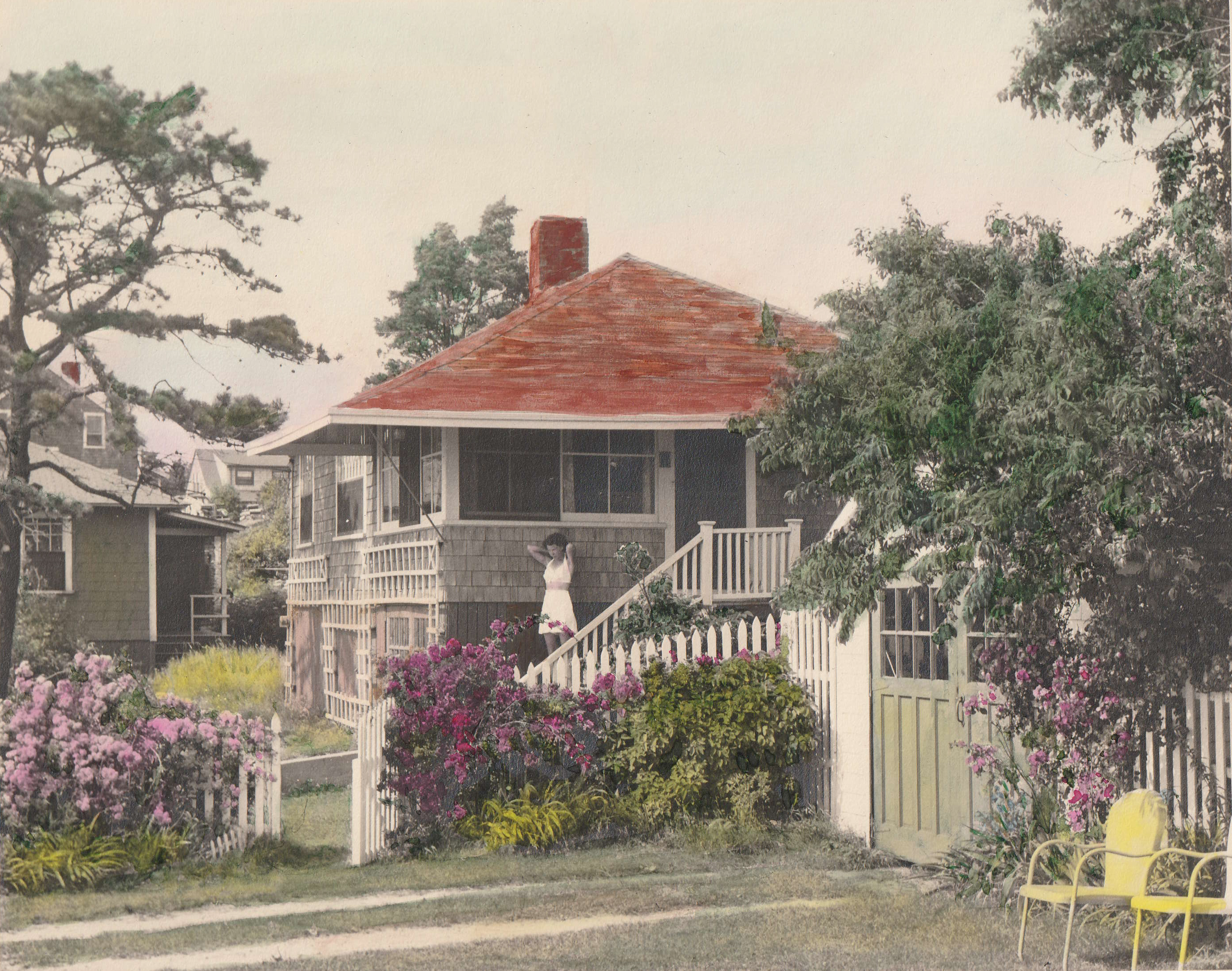
My niece asked me for photos of Pocasset Heights as it was when her father and I were young and our family owned a cluster of houses on Hen Cove. That’s how I found this 1943 picture of my family’s summer house. It was the quintessential Cape Cod cottage of the time, complete with white picket fence overgrown with rambling roses. The model on the steps is my 26-year-old mother. This photo was taken and hand painted with watercolor by my grandmother, Bertha Ewell. I believe Bertha’s father Herbert Dunbar built this cottage in the early 1900s, although I have no proof of that. It is similar to two others that he built nearby, and next door to my grandparents’ house. That’s their garage and fence in the photo.
I described this house in one of my Bourne Musings four years ago. In that column I wrote of the sturdy iron pump next to the kitchen sink that drew water from a shallow well, and of the tiny bathroom in a shed attached to the back wall that drained into a hole in the sand under a hatch in the floor. The shower was outdoors, with water coming from a tank on the roof that was heated by the summer sun. Interior walls were simple partitions made of vertical beaded boards set into two by fours at the top and bottom to keep them in place. Heat, when needed to take off the morning or evening chill, came from a central fireplace.
This cottage was unusual in that it was elevated on cedar posts high enough to avoid being flooded during extreme storms, long before such practice became common. The lower level was largely unexcavated, with a small garage that was primarily used for off-season boat storage. The house held its ground through six hurricanes, while the cottage next door washed off its foundation and the garage in the photo was destroyed. Each of those storms left seaweed in the floor joists but didn’t move the building. The house next door was relocated up the hill after Hurricane Carol in 1954 and still stands today. This house still stands too, but looks very different now. Gone are the picket fence and rambling roses, along with the pine tree and the trellis on the front wall.
Over the years since my parents sold this house, it has been expanded, upgraded, and brought up to current health and building codes by a series of owners. It is no longer the crude summer place of my childhood. A broad deck in the front sits atop a raised septic system, and the shallow well has been replaced by town water. I have not seen the interior but assume the simple board partitions have been replaced with framed walls. It most likely has central heating and air conditioning, and a modern kitchen with granite counters and premium appliances. My folks sold this property for $7500 in 1955, enough at the time to build a new cottage on higher ground. It was recently listed for sale again, but this time the asking price was more than a million dollars.
BRIDGE REPLACEMENT QUESTIONS
(Published on the editorial page of The Bourne Enterprise February 24, 2023)
Engineers with the Massachusetts Department of Transportation (commonly known as MassDOT) have been making progress with their plans to replace the two highway bridges crossing the canal. So far, they have announced the type of bridges they want to build and where they want to build them. But while they did conduct a public survey on bridge design preference, they limited the available options, skewed the design sketches to favor their own preferences, and have been leaving a lot of questions unanswered. I can’t help but feel that the engineers are too focused on individual pieces of the puzzle and not looking at the bigger picture of how all the pieces fit together.
First, will replacing the existing bridges solve the other traffic problems along the canal? More than two-thirds of the traffic crossing the Bourne Bridge flows between Route 25 and the Mid-Cape Highway. That traffic will continue to overwhelm Sandwich Road after the bridges are replaced. The concept of a direct connection between those two highways was dismissed early in the process with no apparent cost/benefit analysis. That concept called for a straight three-mile highway from Route 25 at the Wareham town line to the Mid-Cape where the power lines cross, with a high-level bridge across the canal in Bournedale. Such a connection would take so much traffic off the Bourne Bridge that it could be replaced with a smaller structure than currently proposed, and it would eliminate the need to widen Sandwich Road into a highway.
Second, shouldn’t the redesign of the bridge approaches and highway connections be thoroughly worked out before the bridge designs and crossing locations are firmed up? Preliminary studies done by MassDOT and the Cape Cod Commission suggested multiple ways to reconfigure the roads along the canal and the approaches to the bridges, but neither study recommended a preferred solution. This aspect of the bridge replacement project will involve substantial land taking, and promises to be far more disruptive of traffic flow during construction than the actual bridge construction.
Third, do the Bourne and Sagamore bridges need to be of the same design? While the two existing bridges appear to be identical, they are not. The center spans are the same size and of similar design, but the Bourne Bridge is almost twice as long, and the Sagamore crossing is steeper. Maybe considering building different bridge designs at the two crossings would be less expensive and more efficient. Perhaps a pair of conventional steel spans would be fine for the Sagamore crossing, while using a more dramatic and iconic design at the Bourne crossing.
I don’t question the technical ability of the people involved in the canal bridges project, but I do question their ability to develop creative solutions and not simply fall back on conventional designs because that is all they are comfortable with. I would like to see MassDOT bring in a highly qualified and experienced project manager who sees the big picture, knows how to guide and encourage the engineers and designers, and who understands the importance of including community review and input in every step of the project, in order to generate the public support that they will need throughout the permitting process.
A WOODSY TRIBUTE TO SAINT VALENTINE
(Published on the editorial page of The Bourne Enterprise February 10, 2023)
The mild first half of this winter has extended the season for walking Bourne’s many woodland trails with no need for snowshoes or skis. And with the leaves gone, we often see things we might not have noticed during the growing season. That happened to Paula and me a couple of weeks ago when we were hiking the Bourne Conservation Trust’s Cataumet Greenway trail. We hadn’t gone far when we noticed two trees seeming to grow out of the same root.
It’s common in second-growth forests, of course, to see trees with multiple trunks growing out of one root. But in this case, one is a pitch pine and the other a pin oak. These two trees continue to cling to each other for about twenty feet, where their branches begin to wrap around each other in apparent embrace. I snapped this photo and told Paula I might write a column about it. She responded that I could call it “A Pitch Pine and a Pin Oak Walk into a Bar.”
Pitch pines and pin oaks dominate the upland forests of Bourne and much of Cape Cod. They thrive in well-drained sandy soils and grow quite fast. Some of the largest specimens of both can be found in the town-owned Four Ponds Conservation Area. A careful observer might notice that when you see one of these trees, you will frequently see a specimen of the other that is about the same age within eight to ten feet away. They seem to share some sort of symbiotic relationship; perhaps the pine shades the oak until it can get established, then the oak shields the pine from harsh winds. An on-line search found no confirmation of this idea, however.
I recall years ago reading an environmental impact report related to Camp Edwards that stated these two species of trees play a crucial role in the life cycle of a rare moth that is unique to this area. But once again, I could find no reference to this symbiosis on-line. I do know that both of these tree species played a key role in the early economic development of the upper Cape. The pines provided a source of pine tar for building and maintaining wooden ships, and the oaks were a source of firewood for the glass works and iron foundries of Sandwich, Bournedale and Pocasset. Turpentine was also refined from the pine trees, and there is still a road on the military base named Turpentine Road.
As we approach the Valentine’s Day celebration of the loved ones who share our lives, whether they be family, friends or spouses, we might also note the many interconnections we find in nature. Whether those ties are found in trees, flowering plants, animals, insects, or in the oceans, they appear to be an essential core element of life on earth. So, while we scurry around for gifts and cards, and do our part to support the florists and chocolatiers, let’s not forget the deeper meaning of the legend of Saint Valentine and just have compassion for each other. Like those two trees, we all may be more intertwined than we ever knew.
HISTORIC TREASURE OR JUST AN OLD BUILDING?
(Published on the editorial page of The Bourne Enterprise January 27, 2023)
What is the difference between an old building and a historic treasure? That is a question the Bourne Historical Commission wrestles with at nearly every meeting. The historical commission is a town committee of volunteers appointed by the board of selectmen. It is often confused with the Bourne Historical Society, which is a non-government organization dedicated to preserving, protecting and promoting not just historic properties, but also documents and artifacts related to the town’s past. The two entities frequently work together but occasionally differ on policy.
The answer to my opening question is never clear-cut and often so nuanced that reaching agreement is difficult even among historians. The historical commission is currently considering whether it is appropriate to demolish two high-profile buildings in Bourne: the Keene house on Sandwich Road and the former chamber of commerce information booth on MacArthur Boulevard. One is clearly of historical value but may have deteriorated beyond the point of reasonable reclamation; the other is an old building of nostalgic value but debatable historical importance.
The Keene house is reportedly one of only three houses in Bourne built before 1700. That alone grants it solid historical significance. It is an authentic Cape Cod style house, which also grants it architectural importance. It has been home to several prominent Bourne families, but none of them are historically notable. The house may have physically deteriorated so badly that it would be too expensive and difficult to move or restore. So, the question now becomes whether the Keene house is important enough to the town to invest whatever it will take to preserve it.
The former information booth is one of two identical structures built nearly a century ago to welcome and direct visitors to Cape Cod. One has been preserved by the historical society and repurposed into a gift shop, along with several other historic structures, on the grounds of the Aptucxet trading post that the society maintains. The other one has served for years as a retail shop or office; most recently as a kayak rental place. It appears to be structurally sound, although the original windows recently disappeared. Even if it has little historical value, it would seem to have some remaining use as a back yard shed or writer’s retreat.
Bourne has an impressive collection of historic properties. There are dozens of eighteenth-century homes along the length of County Road, and many more in Bourne Village, Cataumet, and scattered throughout the town. A demolition delay bylaw grants the historical commission authority to delay for up to a year demolition of any structure more than 75 years old in order to enable efforts by others to acquire and relocate the building. That does not mean that every old building is worth saving, but it does give the community an opportunity to decide whether a property has historical value, and time to find alternatives to demolition. And while we may have an emotional or nostalgic desire to hang onto anything that reminds us of our history, there comes a time when it might be best for all concerned to simply let go of relics that no longer have any practical use or value.
POCASSET MOBILE HOME PARK
(Published on the editorial page of The Bourne Enterprise January 13, 2023)
Pocasset Mobile Home Park has been a fixture on Barlows Landing Road for as long as I can remember. For decades it provided affordable housing for retirees, military families and low-income residents. During the last thirty years, however, it has suffered from lack of maintenance and a decline in tenants. The situation become so bad that in 2011 a court-appointed receiver was assigned to manage the property. The park was returned to its owners after the roads were paved and a wastewater treatment facility was installed three years ago, but it still needs replacement of its roads, water lines and utilities.
Crown Communities LLC, an investment firm that buys mobile home parks and renovates them, has agreed to pay $3.8 million for the Pocasset property. Current tenants, working with two non-profit organizations that help mobile home owners buy their parks, tried to exercise a right of first refusal to buy the property, but lacked the resources to close the deal. That is probably a good thing for them.
Regardless of who buys the property, it will need hundreds of thousands of dollars’ worth of work to bring it up to standard, and rent increases to support this investment and the purchase will be measured not in percentages but in multiples of the current rate. It is unlikely that many current tenants will be able to remain under those conditions. If Crown Communities’ promises are fulfilled, the tenants will have at least two years to make other arrangements, which may include selling their units to Crown.
The mid-twentieth century mobile homes that occupy the park have long outlived their useful lives and have little if any market value. Twenty of them have been abandoned, and many of the remaining units could meet the same fate. While mobile homes can theoretically be moved to other locations, the reality is that they rarely are. Most have been sitting so long that their tires have rotted and wheel bearings seized with rust. Building codes and zoning bylaws in most Massachusetts towns restrict mobile homes to established parks, and few of those parks have openings for new tenants.
The pending change in park ownership will be a major disruption to the lives of the current residents. It will also mean a significant loss of low-income housing available in Bourne. In every other regard, though, the expected improvements should be welcome. Rebuilding the park will improve not only its visual appeal, but also the health and safety of its residents. And the improvements alone could add a million dollars to the town’s tax base.
There is also a possibility that new owners might change the use of the property. A site this size with a wastewater treatment plant is a prime candidate for redevelopment as garden apartments or condominiums. It could also become a glamping facility, fitted out with high-end camping trailers, as recently was done to the former Sippewissett Campground in Falmouth. Or this might be an opportunity for town officials to negotiate with the new owners to encourage development of workforce housing that would fill a crucial need for affordable housing for employees of local businesses that are struggling to hire enough people to stay in business.
2023 PREDICTIONS FOR BOURNE
(Published on the editorial page of The Bourne Enterprise December 30, 2022)
My first column in 2022 made some tongue in cheek predictions for the year in Bourne. Some were spot-on, others way off. I correctly foresaw that the contractors working on Belmont Circle would stall the project through another summer season, and that the state highway engineers would hold more public meetings on the canal bridge replacements at which they could not answer any questions because, in their words, “We are not that far along with the project.”
I was off on my prediction that the Calamar apartments would be completed this year, and that Cumberland Farms would buy the motel on Trowbridge Road for better access to the bridge rotary, but still got more right than wrong. I correctly saw that COVID would continue to be a problem but not restrict our lives as much as before, that local businesses would still struggle to find workers, and that remote working would become more normal than anyone ever expected.
So, what do I foresee for 2023? It will be another strong year for local businesses, although they will still struggle to hire workers. COVID will continue to plague the unvaccinated but most of us will pretend it has gone away. Cumberland Farms’ massive gas station at the bridge rotary will open in time for the summer season, shocking visitors with the dramatic change in their once-welcoming view of Cape Cod. The developers of the Calamar apartments have announced that they will be finished in April but didn’t specify a year.
The Belmont Circle renovation will finally be completed, making it much safer for the dozens of pedestrians and cyclists crossing it every year, but dramatically increasing the number of fender-benders and thoroughly aggravating drivers that still have to thread their way around a dangerous and useless traffic circle while dealing with signals that only come on now and then. And Bourne residents heading to Wareham from Buzzards Bay will have to put up with even more disruption on Cranberry Highway, as that project is less than half done.
Engineers working on the bridge project will continue to present excruciatingly slow and boring updates, during which they will be unable to answer questions about schedules, costs, changes to the road system, or any other citizen concerns because, well, you know. As cost estimates climb and traffic gets increasingly worse on Sandwich Road and Scenic Highway, we might wish the state had not been so quick to dismiss the concept of a single high-level bridge in Bournedale, with a direct connection between Route 25 in Wareham and the Mid-Cape Highway in Sandwich – a true “flyover”.
In the meantime, most of us will continue to quietly enjoy the countless benefits of living in Bourne. We will bike, walk and fish along the canal paths, hike the many woodland trails, enjoy our protected harbors and beaches, shop and dine in our newly revitalized downtown, and participate in our town’s many festivals and special events. We will curse the summer traffic and complain about the government and the difficulty finding plumbers, electricians and other tradespeople. But you won’t find many who would want to live anywhere else.
A BIG DEAL OVER A SMALL SEAL
(Published on the editorial page of The Bourne Enterprise December 9, 2022)
There once was a time when a government seal meant something. These symbols first appeared in western Europe in the 12th century for impressing wax seals on official documents. They became popular in the United States in the 1890s more as symbols of identity for towns, cities and states to use on letterheads and monuments than for legal certification. The Massachusetts legislature adopted a law in 1899 requiring that all municipalities in the commonwealth create a seal, four years after Bourne’s was adopted.
Apparently, nobody noticed over the last 127 years that Bourne’s seal not only fails to represent anything significant to the town, but badly represents actual history. That is, until now. Local history buff Jack MacDonald thinks it’s time to change Bourne’s town seal, and I agree. Our seal shows native Americans with tipis from the western plains looking at Mayflower type sailing ships. While Mashpee is a center of Wampanoag culture, and Plymouth owns the Pilgrim story, Bourne is not primarily known for either.
When Bourne’s seal was adopted, our town was a major industrial center, with sprawling factories building railroad cars, casting iron stoves and hardware, and distilling pine tar and turpentine from the abundant pitch pines. Buzzards Bay was a booming railroad hub, with bars and flophouses lining Main Street. The canal had not been built, although it had been envisioned since the country’s founding. A few wealthy people had summer estates in town, but tourists mostly rode through Bourne on trains on their way to somewhere else, much as they do now in cars and recreational vehicles.
So, what should Bourne’s town seal depict? Our town’s most iconic feature is of course the canal and its bridges. But those bridges are destined for replacement, and the canal is not easy to depict without them. What else do we have? The Massachusetts Maritime Academy is a big feature, but not as much a part of Bourne’s identity as it probably should be. Then there is our landfill, the biggest in the state, or the military base, which occupies 40 percent of the town’s land area. No, none of them would be appropriate. The seal should represent a feature that will stand the test of time and remain relevant a century from now.
My suggestion is the new town seal should depict the Bourne Historical Society’s replica of the Aptucxet trading post. In the 1600s the original trading post was an international point of commerce between Europe and much of the northeast. The only issue with this choice is another of Jack MacDonald’s concerns with which I agree. That is that the original trading post was most likely located in the area now called Gray Gables and was probably a cruder building than the replica. It simply makes no sense that ships powered only by the wind would have travelled that far up a shallow river to trade goods. And there is no record of what the original structure looked like. Nevertheless, the current Aptucxet building honors our history, whether accurate or not, is truly unique to Bourne, and would be a most appropriate subject for our town seal.
A BOURNE TRADITION RETURNS
(Published on the editorial page of The Bourne Enterprise November 18, 2022)
Among the things that make a town a true community are the festivals and special events that bring neighbors together for a common celebration. Bourne is a town of at least nine villages, depending on how you count them, full of people with diverse backgrounds, economic status and political positions. Yet we manage to come together for our community events. We have the July fourth parade, Canal Days and, once again, the Bourne Historical Society’s Harvest Dinner.
This mostly annual event returned this year after missing two years to the pandemic shutdown. Dozens of hard-working and dedicated volunteers gave our community a wonderful opportunity to enjoy a delicious dinner, an informative historical presentation, and a chance to meet some neighbors we had not known before. It was a most pleasant way to usher in the holiday season on the first truly cold evening of autumn.
A dozen large roasted turkeys, as many homemade pies and plates of cookies, and all the fixings that go with a traditional thanksgiving dinner were prepared in homes and served up hot at the Weary Travelers’ Club. Planning for this event was meticulous, with much attention to detail, including the table centerpieces crafted of local foliage, the little bags of candy on each plate setting, and the eclectic collection of artifacts on the raffle table.
The after-dinner presentation by historian Kevin Doyle and noted artist Karen Rinaldo told the story of the first thanksgiving, not as we learned it in fourth grade but as it is now understood through diligent research. Both the pilgrims and the native people came together warily out of common need. As Mr. Doyle noted, it would have taken only a nod from Sachem for the Plymouth colony to be wiped out, the fate of several other European settlements of the time.
The night was not without glitches, though. The organizers engaged the venue in the daylight, not realizing that part of the room had no lighting for an evening event. One volunteer ran home and got a camp lantern to illuminate the greeters’ table. Then the sound system failed to work, leaving the presenters having to project their voices and the audience struggling to hear them. But nobody complained. How could we, after watching how hard the volunteers worked to make this a memorable evening.
It was especially encouraging to see Skip Barlow, the longtime leader and emcee of previous harvest dinners, having miraculously advanced in his recovery from a devastating head injury that left him hospitalized for months. Although no longer able to lead the trivia contest, Skip was hard at work in the kitchen and keeping the buffet table stocked.
Most of all, Paula and I enjoyed meeting and talking with the other celebrants at our table. There was no mention of politics, the pandemic or the economy, but each person had an interesting story. One couple had towed their Airstream trailer through all 49 continental states and every province of Canada. A former Air Force mechanic told us of his adventures restoring antique cars and single-handedly building a barn to store them. When it was over, we left feeling well-fed, not just with food, but with a warm sense of belonging to a welcoming community.
DO WE STILL WANT COMMUTER RAIL?
(Published on the editorial page of The Bourne Enterprise November 4, 2022)
Bourne planners have long advocated extension of commuter rail service to Buzzards Bay as a catalyst for new development in our downtown, and the state has wanted it to reduce road use. But as I recently noted in this column, Main Street development has taken off without the added boost from commuter rail. So, do we still want train service to Bourne? Absolutely yes, but for different reasons than to promote development or reduce vehicular traffic.
The latest of several studies recommending extending daily rail service from Lakeville to Bourne is the Cape Rail Study prepared for the Massachusetts Department of Transportation by the planning firm VHB and reported in The Bourne Enterprise last December. Like the earlier studies, this one assumed that any rail service to Buzzards Bay would be primarily for commuters to Boston, with several round trips every work day. None of them foresaw a fundamental change in the way people work that arose during the COVID pandemic shutdown and dramatically affected commuting patterns.
The movement of executives, managers and office personnel from mid-city buildings to remote working from home became widespread during the shutdown. Remote workers suddenly gained hours every workday that they formerly wasted commuting. Their employers often found that remote workers were more productive. They also found in some cases that they did not need as much high-rent office space if their employees were only coming in one or two days a week.
As a result, remote working is a trend that has gained legs and is not likely to revert to the old normal. This trend has affected Bourne, where many formerly seasonal residents have settled year-round to enjoy the benefits of living at the shore while continuing their work in the city without the daily commute. It has also affected the Massachusetts Bay Transportation Authority (MBTA), which has had to cut back its scheduled commuter rail and bus runs and table discussion of service extensions.
While Bourne’s plan is to create a community where residents can live, work, shop and play without having to commute somewhere else every day, we still want a convenient connection to the city for those times that a face-to-face meeting is essential or we need to fly off to a distant destination. Rather than thinking of rail primarily for commuting, though, we should envision it as a more traditional all-purpose service.
The seasonal Cape Flyer has proven highly successful and popular. Maybe the MBTA should make it a year-round service with an early morning trip from Hyannis returning late afternoon once a day. That would serve commuters, shoppers, occasional travelers, and the many older Cape Cod residents who travel to Boston for medical treatments. The MBTA is currently undergoing a major reorganization to recover from decades of poor management and inadequate funding. This would be a good time for Bourne leaders to be actively involved with changes in the way it serves the public.
DANGEROUS INTERSECTIONS
(Published on the editorial page of The Bourne Enterprise October 21, 2022)
It looks like the special town meeting on Monday will not be considering a $1.3 million plan to reconfigure the intersection of Shore Road and Barlows Landing Road in Pocasset to make it safer for pedestrians. The finance committee and capital outlay committee have both asked to postpone this article until the annual town meeting because of the cost. I agree, but for a different reason. There are other intersections in Bourne that are far more dangerous and, in some cases, easier and less expensive to fix. If we are going to spend that much reconfiguring intersections, lets spread it around.
According to the Cape Cod Commission, the worst intersections in Bourne for number and severity of crashes are the Bourne Bridge rotary, Belmont Circle, Meetinghouse Lane at State Road and Nightingale Road at Scenic Highway. These are also four of the six locations in Bourne that have experienced fatal accidents in the last decade. All of these intersections are on state highways, would be difficult and expensive to alter, and are beyond the town’s authority to change. The current work being done at Belmont Circle will improve safety for pedestrians and cyclists but does nothing to resolve traffic problems there.
At least eight dangerous intersections of town roads in Bourne need attention. The worst of these is on County Road where it meets Clay Pond Road and Beach Street in Monument Beach. Short lines of sight, coupled with County Road traffic too often going too fast, has led to many T-bone collisions, often with serious injuries and including at least one fatality. This intersection needs to be a four-way stop with flashing lights and warning signs on the northbound side of County Road.
Five Corners, where County Road intersects Trowbridge Road, Sandwich Road and Shore Road, would be a close second in danger, with its strange three-way stop. This intersection has more accidents than Clay Pond Road but with fewer injuries. It too could be fixed with just one more stop sign. The intersection of Shore Road and Barlows Landing Road would be third in line. This one has fewer collisions, but is especially dangerous for pedestrians.
When a class of graduate planning students from the University of Pennsylvania created a plan for Bourne villages in 2005, one of the students, who was a civil engineer, suggested a simple and less costly solution for the Pocasset intersection. He recommended making it a four-way stop, closing the curb cut closest to the corner, and reducing the radius of all four corners. That would bring the stop lines and crosswalks closer to the crossing where they would be more visible to drivers. Surely, this could be done for less cost than proposed.
Other dangerous intersections that need attention include the end of County Road where it intersects Route 28A in Cataumet, County Road at Barlows Landing Road, which already has a traffic light but still sees a lot of accidents, and Williston Road at Scusset Beach Road in Sagamore Beach. Some of these would be difficult and expensive to fix, but others just need better signage and would not cost a million dollars or more to upgrade.
MEMORIES OF THE SCALLOP FEST
(Published on the editorial page of The Bourne Enterprise September 30, 2022)
The Cape Cod Canal Day celebration this year was a perfect way to close the summer. Hundreds of mostly area residents enjoyed the music of local bands, lunch from a broad array of food trucks, and a large gathering of regional crafters, artists and businesses, all under picture-perfect weather. It was a relaxing, low-keyed Saturday that also brought many new customers to the businesses that have recently opened on Main Street.
As we strolled through the crowds, we heard several people comment that it wasn’t the same as the Scallop Fest, a three-day festival that occupied the same site for many years. I think that is a good thing. While the Scallop Fest was a big money-maker for the Cape Cod Canal Region Chamber of Commerce, it was also an enormous and extremely risky undertaking.
The year that I co-chaired the scallop fest committee was when I realized the enormity of both the logistics and the liability the festival created for the chamber. Renting a huge circus tent at the height of the hurricane season, recruiting as many as 300 volunteers to run the show, having some of them working deep-fat fryers under make-shift conditions, and cramming so many cars and buses into a crowded downtown, offered too many opportunities for disaster.
When the show was over and everything cleaned up and stored away for another year, Rick Gurnon, Mark Tyrell and I were charged by the chamber board of directors with studying the issue and recommending changes to reduce the cost, the risk, and the need for so many volunteers. By that time many of the long-time volunteers had aged out, and it was becoming difficult to recruit younger workers whose lives were too busy to make such a commitment.
We made three major recommendations, beginning with reducing the duration of the festival to two days. The most important change we suggested was bringing in a juried craft show that set up its own tent, had a cadre of skilled crafters, and raised the quality of the goods offered. They were not available Labor Day weekend, though, so we had to move the festival to the third weekend in September. We expected that change to reduce attendance but it did just the opposite. The next year set a new record.
To reduce the need for volunteer cooks and servers, and offer visitors more food options, we recommended inviting local restaurants and food trucks to set up around the now smaller food tent. We even looked into moving the whole show to the county fairgrounds but determined that idea would not work well. A few years later, after the Army Corps of Engineers built the new parking lot, limiting the area available for the scallop fest, the chamber did move the festival to the fairgrounds and found that we were right.
The Scallop Fest was a wonderful community celebration for many years, but it was time for it to end. We all seem to lead much busier and often hectic lives now and have little time to devote to such a big undertaking. Cape Cod Canal Day is much more attuned to the way we live and play today. It still generates money for the chamber’s scholarship program and visitor centers, but without the risks of losing it all if something goes terribly wrong.
BOURNE’S DOWNTOWN HAS COME ALIVE
(Published on the editorial page of The Bourne Enterprise September 9, 2022)
Main Street Buzzards Bay, Bourne’s downtown, is a lively place once again. After two decades of dedicated effort by a small group of volunteers and town officials, the empty storefronts and junk shops are gone, new eateries are buzzing with activity, people are moving in and developers are making serious investments in new projects. When a thrift shop is replaced by a traditional country store, it’s a sure sign our downtown is back in business.
The town’s goal from the start, stated in the first local comprehensive plan, was to create a downtown where residents could live, work, shop and play without having to drive someplace else. That goal is clearly in sight. After nearly twelve million dollars of public investment in streetscape improvements, the town park and the wastewater treatment plant, Main Street has reached a critical mass that is attracting substantial private investment.
Anchored at one end by the railroad station and Massachusetts Maritime Academy, and at the other end by town hall, the community center, and the new Hampton Inn, the rest of Main Street is ripe for redevelopment with little additional public investment needed. Work has finally resumed on the Calamar apartment complex, and an even larger residential project is under review by our town planners.
In the early stages of planning the downtown revival, the town made three crucial moves. First, it changed the zoning to allow higher densities, taller buildings, and more flexible mix of land uses. Second, it convinced the Cape Cod Commission to designate the Main Street area as a growth incentive zone and allow Bourne’s planners more flexibility in permitting new development. And third, it joined the Massachusetts Bay Transportation Authority, with the tacit understanding that commuter rail service would be extended from Lakeville to Buzzards Bay.
At the time, planners felt that commuter rail would encourage residential development around the rail station and bring more people into downtown, much as it had done in Lakeville and Plymouth. That obviously did not happen and, given the dire condition of the MBTA, is not likely to happen any time soon. Further, the role of commuter rail abruptly changed when the pandemic accelerated the move of many executive and office workers to remote locations. That move has proven beneficial for both employers and employees, changing corporate attitudes toward centralized office locations and reducing the need for daily commutes.
With the success of Bourne’s efforts to revitalize its downtown, and the current pace of new development, we may not need the additional stimulus of a commuter rail connection. Main Street businesses already have access to high-speed fiber-optic internet connections, and downtown residents working remotely might soon have it too. It turns out that what at first seemed like major setbacks have actually moved us closer to our goal of a neighborhood that allows people to live without needing to travel every day.
Imagine being able to work from home, stepping out for a break at your favorite coffee shop or convenience store, eating at your favorite restaurant, or taking a walk or bike ride along the canal, all within a short walking distance. That dream is already reality for some people; soon it will be available to many more.
POCASSET SHORE WATCHDOGS
(Published on the editorial page of The Bourne Enterprise August 26, 2022)
By a fortunate coincidence, my column on the woes of Hen Cove appeared the day before the annual meeting of the Pocasset Water Quality Coalition. I did not know of their meeting when I submitted my column. I was aware of this organization, but thought their mission was only to oppose the concept of disposing treated wastewater into the canal. It turns out they are much more than that.
The coalition is a 501(c)(3) non-profit charitable organization incorporated in November 2019 whose mission “is to restore the water quality of Hen Cove, Barlow’s Landing harbor, and the inlet of Wings Neck to healthy environment levels.” Many of its members live or have seasonal homes around Hen Cove and are distraught over the environmental degradation that I wrote about earlier this month. The coalition has an impressive website that can be found at www.pocassetwaterquality.org.
The coalition’s annual meeting was attended by about 60 people, including several town officials. Speaking were Senator Susan Moran, the Chair and the Vice President of the Conservation Law Foundation, Selectperson Mary Jane Mastrangelo, and Wastewater Advisory Committee Chair Kathy Fox Alfano. Senator Moran spoke of state and federal efforts to improve water quality throughout the region, including the issue of dumping radioactive water from the Pilgrim power plant into Cape Cod Bay. All of the speakers applauded Bourne’s ongoing effort to create a Water Quality Management Plan.
Coalition board member Chris Bade announced that they now have more than 250 members, and spoke of their participation in the annual Bassett’s Island cleanup, their encouragement of tree and beach grass planting, and their effort to get a dam removed. That dam, installed by a private landowner in the 1950s as a place to moor his boat, caused the initial blockage of tidal flow between Hen Cove and Barlow’s Creek a few years before the town created the new beach. Vice-president Bob Dwyer noted that the dam now belongs to the Bourne Conservation Trust, which is in favor of removing it. The town would still have to install a substantial culvert under Circuit Avenue.
A promotional flyer distributed at the annual meeting states “Through spirited grass-roots efforts, building connections across the Commonwealth, and supporting good science, the coalition hopes to drive infrastructure changes in Pocasset to improve marine water quality so that bathing is pleasant, and starfish, scallop, and horseshoe crabs may return to the delight of current and future generations.”
After the meeting I was approached by several of my contemporaries who confirmed my memories of clear water, thick eelgrass, and a vibrant ecosystem in Hen Cove in the 1940s and 1950s. One remembered swimming with oysters at Patuisset. With the help of the coalition, working in cooperation with other environmental groups and relevant government agencies, Hen Cove might once again become the popular place depicted in this postcard from a century ago that I found in a box of old family photos.
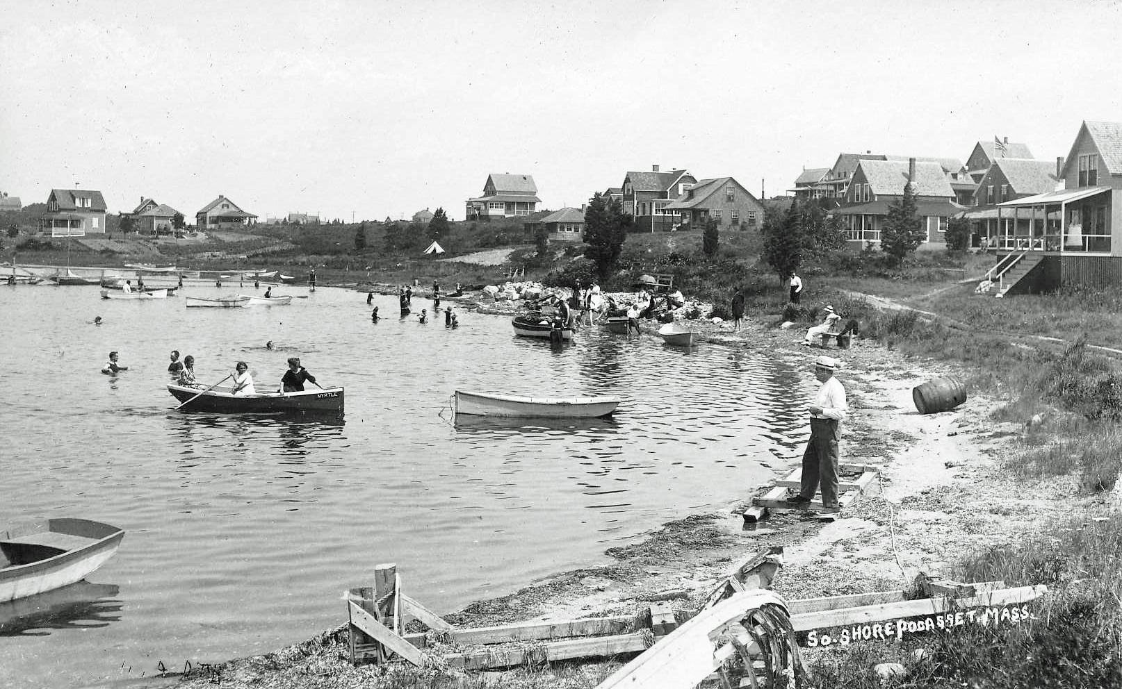
HEN COVE IS DYING – LONG LIVE HEN COVE
(Published on the editorial page of The Bourne Enterprise August 12, 2022)
My brother Ken and I were walking around Hen Cove last year and were astonished at what we saw. The tide was unusually low, exposing large areas of the cove bottom, which was nothing but bare sand, gravel and algae. It wasn’t like that when we were youngsters, fishing off the town pier and sailing the cove in our grandfather’s old catboat or the sailboard Ken made from plans in Boys Life magazine.
Back then, the bottom was lushly covered in eelgrass. From the end of the pier, we could watch schools of eels and young fish swimming through clear water. The intertidal zone was rife with minnows, horseshoe crabs, fiddlers, and thousands of periwinkles. Quahogs were plentiful and we often dug enough in a few minutes for our mother to make a tasty chowder.
Conditions are very different today. A confluence of environmental disasters has zeroed in on Hen Cove to create the barren bottom we see now. First the town closed a natural waterway to the saltmarsh behind Barlows Landing and removed a small island protecting that inlet in order to create the new town beach. At about the same time, the Air Force was dumping fuel and toxic chemicals into the ground at Otis Air Force Base. The plume from that dumping has now reached the shoreline, along with another plume of chemicals from a massive fuel spill at the Otis Rotary a few years back.
More recently, many of the once seasonal cottages around Hen Cove have been converted to year-round second or retirement homes, with heavily fertilized lawns and septic systems that leach excess nitrogen into the groundwater that drains into the cove. Increased demand for boat moorings and deeper water required dredging to replace the natural channel that disappeared when the new beach was created.
The situation is certainly dire, but not hopeless. Environmentalists and government agencies at all levels now recognize the problem and are initiating actions and programs to correct the effects of decades of bad decisions and innocent errors. It will take many more decades to bring Hen Cove back to life, but at least the damage has been identified and quantified. The challenge now is to come up with solutions and find ways to fund the work.
The federal government is responsible for the toxic plumes, and they will be the most time consuming and expensive problems to clean up. The town needs to reopen the tidal flow between Hen Cove and the salt marsh on the other side of Circuit Avenue. That effort will be relatively less expensive, but will need cooperation between the local, county, state and federal governments. The same level of coordination between governments will be needed to rectify the nitrogen pollution from fertilizers and septic systems.
I don’t expect to see eelgrass and quahogs return to Hen Cove in my lifetime, but my great-grandchildren might. For their sake, I’m pleased to see the powers that be are finally paying attention to the little cove that is so dear to my heart and so full of fond memories.
FIREWORKS – LOVE THEM OR HATE THEM
(Published on the editorial page of The Bourne Enterprise July 8, 2022
Is there anything in life more viscerally thrilling than watching a live firework show? The first one I saw was rather modest. I had gathered with my parents and cousins on the ball field behind the Jonathan Bourne library for the show. The rockets didn’t go very high, there were no big booms, and a makeshift trellis holding colored flares representing the stars and stripes was mostly blurred by smoke. But it was still thrilling.
Most Independence Days of my youth were spent on Hen Cove when Pocasset Heights was mostly populated by middle-class families with young children. Our next-door neighbor was a travelling salesman who worked all week while his family enjoyed the beach. On Friday night before July fourth, we would eagerly await the arrival of his Pontiac with its trunk full of fireworks from New Hampshire.
There were boxes of firecrackers and sparklers, a few Roman candles, and worms. Remember them? Little tablets that when ignited grew into ugly fat gray worms. I never did understand the appeal of those things. My favorites were the firecrackers. We would ignite them under empty soup cans and see who could send theirs highest. By some miracle we all survived with a full complement of fingers and eyes.
Later in life, my wife and I would take our daughters to see the fireworks shows and carry them back to the car half asleep when the shows ended. Even later, when I was working in Back Bay, we would crowd onto the banks of the Charles with half a million others to watch the Boston extravaganza. When you add live cannon fire to The Boston Pops playing the 1812 Overture during the grand finale, you take visceral thrills to a whole new level.
Now we don’t have to leave home to see fireworks, as we have neighbors nearby who like to shoot off rockets long before and for weeks after July fourth. They wake babies and terrify pets for miles around. They also threaten the tinder-dry woodlands around us that could be set afire by hot remnants of their noisy toys. Their actions are illegal, but the law is not enforced and the penalties are lighter than a parking ticket.
The dangers of live fireworks, the cost of extravagant shows, and the pollution of all that smoke may soon make these displays less common. In some places they are already being replaced by choreographed dances of lighted drones. Those shows are certainly impressive but lack the thrills and the noise of the pyrotechnics.
I no longer have the stamina to walk a mile or more to see a show, stand for an hour, and walk back to the car, but I don’t have to. I now live high on a hill where I can sit on a bench and see the rockets’ red glare from a dozen shows across the western horizon. It’s not very thrilling, but it is a wonderful reminder of a uniquely American form of celebrating our independence and the freedom for which many of us risked our lives.
LET’S GIVE THE BYPASS A NAME
(Published on the editorial page of The Bourne Enterprise on June 10, 2022)
The Buzzards Bay bypass may be the most vilified and, at the same time, the most useful road in Bourne. Built in 1951 to ease congestion on Main Street, it was soon blamed for causing the demise of our downtown shopping area. It didn’t, but nevertheless, the myth became widely accepted as fact and is often cited to this day.
Before the bypass, nearly all traffic between the cape and points west had to drive through Main Street. With the dramatic increase in automobile use in the late 1940s, Main Street became so clogged with traffic on summer weekends that it was nearly impossible to get downtown to shop. The bypass enabled through traffic to get around the shopping district, and local residents to get to Main Street stores.
When community leaders began the campaign to revitalize Main Street twenty years ago, some advocated eliminating the bypass altogether. The president of the maritime academy suggested converting it to a parking lot for cadets. To address the issue, the neighborhood association hired me to create a comprehensive transportation plan for Buzzards Bay. As part of that effort, I brought in traffic engineers from Rhode Island to evaluate the bypass and its actual effect on Main Street.
The engineers found that the bypass carried half of the traffic between Memorial Circle and Belmont Circle. They also found that eliminating the bypass would increase traffic volumes on Main Street to the point that it would be considered a failed road at peak traffic times year-round. That study effectively ended talk of eliminating the bypass.
At about the same time, a class of graduate students in city planning at the University of Pennsylvania chose to create a village centers plan for Bourne as a class project. The group included students from such diverse places as Taiwan, South Korea and Texas. Some of them were architects and planners with professional experience. Their advisor and head of the planning department was a summer resident of Cataumet.
The Penn students came up with a creative solution for the bypass that would reconnect the residential area to the north with the commercial area to the south, and dramatically improve the visual impact of the road. They found that the bypass right of way is unusually wide, as much as 140 feet in places, so they suggested rebuilding the road as a parkway, with a landscaped divider between lanes and a separate bike path alongside. Their solution is as valid today as it was seventeen years ago.
With the opening of the new police station on the bypass, the road has now become accepted as an essential element of our traffic system. It has actually helped the revitalization of Main Street by making the downtown shops, eateries, and other attractions more accessible. Maybe the time has finally come to fully embrace this road and give it a proper name. The Penn students called it Buzzards Bay Boulevard. Who knows what it might become in the future? If sea levels rise as high as some people are predicting, it might become the new Main Street.
WHAT SHOULD WE DO WITH TOWN MEETING?
(Published on the editorial page of The Bourne Enterprise May 6, 2022)
Town meetings are a lot like the rest of life: long periods of boring routine punctuated by moments of serious reflection, disappointment, rancor, elation and laughter. They are relics of a time past that remain active only in New England towns. As a form of government, they are the purest practice of democracy that exists because they assure that everyone has an opportunity to weigh in on every question. Although some towns, like Falmouth, elect representatives to vote at their town meetings, sort of a very large city council.
Bourne’s town meeting is open to every registered voter. As a result, attendance varies from a minimum quorum to an overflow crowd when a controversial issue appears on the warrant. Only about 150 voters showed up for this year’s annual meeting. That was enough to qualify as a quorum, but disappointed some voters who lamented the seeming lack of interest in town affairs. As a percentage of the population, though, the ratio of 150 voters for 20,452 residents is almost exactly the same as Falmouth’s 244 elected representatives for 32,517 residents.
Despite seeming to be slow and messy, our town meetings actually work quite well. Rarely are decisions questioned because they result from extensive discussion and hearing from all angles. They also provide a useful forum for questioning and directing policies and actions of elected town officials and boards. Most of all, they are impossible to corrupt. Even misleading statements are quickly exposed and dismissed.
Every town meeting seems to have at least one member who serves as a sort of court jester, frequently asking innocent questions or making statements that prompt laughter. My favorite story of such a person occurred many years ago when I was the town planner in the town of Dartmouth. I had presented an article proposing that the town spend a million dollars to buy a farm in an undeveloped area to preserve the land for a future school site. Our resident jester, whom I’ll call Joe, stood up and said “A million dollars is a lot of money. If you tried to count to a million, it would take you a lifetime.” Later, during a recess, Joe came over, patted me on the shoulder, and said “Good work, young man.” I said “Joe, if you count at a reasonable pace eight hours a day, it would take only a month to reach one million.” Joe laughed and said “Oh, no; you try it, sooner or later, you’re gonna lose count.” Dartmouth voters appropriated the million dollars, bought the farm, and years later built a new high school on the site, which is now surrounded by suburban development.
So, what should we do with town meeting? Nothing. Keep it like it is. Keep it open, keep it messy, and keep it as our legislative branch of government. Bourne, with its limited land area, is not likely to ever get so big that it needs to switch to a city council form of government as Barnstable did. And, if you are not a regular at our town meetings, give it a try next time. You will be participating in a 400-year-old tradition that you might find not only informative, but also entertaining.
DUST OFF YOUR HIKING BOOTS
(Published on the editorial page of The Bourne Enterprise April 15, 2022)
Now that the days are getting warmer and the winter winds are winding down, it’s time to dust off your hiking boots, grab your walking stick, and take advantage of the many miles of public hiking trails in Bourne. I’ve written before of the beautifully maintained trails on Bourne Conservation Trust land. You can download trail maps of their many sites from http://www.bourneconservationtrust.org. But the biggest hiking area belongs to the town.
The crown jewel of Bourne’s hiking areas, the Four Ponds Conservation Area, is conveniently located in the middle of Pocasset. This 133-acre parcel, the headwaters of the Pocasset River, was a source of bog iron for the Pocasset Iron Works in the 19th century. In the early 20th century, it was occupied by a fish and game club that enlarged and improved the ponds. During the building boom of the 1970’s it was purchased by a developer who planned to build a large condominium project. Public resistance to that idea, along with serious development challenges, led to it being sold to the town for conservation. It is maintained primarily by volunteers working with the conservation commission.
Trails around four ponds are well-marked and easy to follow. A hike around the whole property is about two miles, but there are plenty of shorter routes. A warning, though: some of the trails are very steep, with elevations ranging from 24 feet to over 100 feet. The main access point is from a parking lot on Barlow’s Landing Road across from Pocasset Mobile Home Park. There is another access point next to the pond on County Road, but there is no parking at that location.
Abutting the four ponds area are more than 350 acres of accessible land in the town forest and the Bourne Water District reserve. Access roads in this area are open for hiking but are not as scenic or interesting as the four ponds trails. Parking is available off County Road just north of the water district facilities on the unpaved section of Valley Bars Road. You can also enter this area from the other end of Valley Bars Road by the Weary Travelers Club. If you live in Pocasset Woods, or know somebody who does and will let you park in their driveway, there is a pedestrian access at the low point on Spinnaker Lane. This is a private road, though, and there is no street parking.
In addition to sturdy footwear and a hiking stick, first-time users of these trails should take a compass or have a good GPS phone app. It is easy to get disoriented or totally lost in such a large area of woods. And don’t forget to take precautions to avoid tick bites. If you are walking a dog, be sure to have it on a leash, as there are many distractions to draw dogs off the trail. If you were less than active this winter and want to start with a shorter hike, you might try the Leary Property at the S-curve on County Road. An easy quarter-mile walk will reward you with expansive views of the Back River estuary.
MACARTHUR BOULEVARD MAKEOVER
(Published on the editorial page of The Bourne Enterprise on March 11, 2022
Is MacArthur Boulevard a street or a road? A non-profit organization called Strong Towns would call it a “stroad,” a combination of through street and local road. Strong Towns is encouraging transportation planners to separate through travel from local traffic along heavily-developed business strips like MacArthur Boulevard, in an effort to increase safety and improve traffic flow for both local and through traffic.
MacArthur Boulevard wasn’t always a commercial strip. When Route 28 was first made into a divided highway to improve access to the military base, there were few businesses along the road. In the 1950s there was the string of little shops near the bridge rotary that is about to be replaced by a Cumberland Farms, the town dump, now buried under the Brookside golf course, Wing’s package store at the corner of Barlow’s Landing Road, and a small motel and the diner near the base rotary. The rest was just pine forest like the northbound side.
Our main highway has now become Bourne’s auto mile, along with dozens of other businesses that cater primarily to a regional market or to through traffic heading to Falmouth and Martha’s Vineyard. This commercial strip has bolstered Bourne’s tax base, and most of the businesses are locally owned, which keeps money circulating in the area and boosting our economy. But these advantages are often offset by dangerous conflicts between local and through traffic.
Bourne considered fixing this issue more than forty years ago. The highway right-of-way was widened to 400 feet to enable construction of new northbound lanes east of the current roadway. The existing northbound lanes would then be made southbound, and the old southbound lanes would become a two-way local access road serving the many businesses that sprung up in the 1970s. This plan remains an aspirational element of Bourne’s Local Comprehensive Plan today.
While it is unlikely that this plan will ever be built, a section of it may be constructed north of the Atlantic Car Wash when the new Bourne bridge is built and the bridge rotary is replaced with a more conventional highway interchange. The most likely reconfiguration of the bridge approach originated with the selectmen’s Transportation Advisory Committee. That plan, with some regrettable modifications, is shown in this screen shot from a presentation the state highway engineers made in 2019. Sharp-eyed readers will see some major flaws in this layout, but the basic concept of a high-speed interchange between the bridge, the boulevard and Sandwich Road is likely to remain.
This plan would accomplish the Strong Towns goal of separating local from through traffic. It would make it much safer and easier for local traffic to get into and out of the businesses along the highway. But it would also somewhat isolate those same businesses, including the proposed Cumberland Farms gas station and convenience store, from much of their customer base. Opening of the new bridges and related road changes is still at least a dozen years away, though, so there is time to work out the bugs in the design. By then, we all might be driving electric cars that we buy on-line, so gas stations and auto dealers might not even be around.
HERE COMES CUMBERLAND FARMS
(Published on the editorial page of The Bourne Enterprise February 4, 2022)
The Bourne Planning Board has granted a special permit allowing Cumberland Farms to build a turnpike-style truck stop at the Bourne Bridge rotary. The board had little choice, as the latest plan meets all of the zoning and environmental requirements of the town. An earlier plan, submitted five years ago, proposed using the dangerous curb cut at the entrance to MacArthur Boulevard as the primary entry and exit to the development. The planning board rejected that plan because previous studies had shown that curb cut to be the site of many collisions and recommended that it be eliminated.
Cumberland Farms sued the town in Land Court to overturn the planning board’s earlier decision. That suit has not yet been decided, but apparently corporate leaders determined either that they would likely lose the case, or maybe they were eager to get the project underway. The corporation has now agreed to close the dangerous curb cut after purchasing the Atlantic Lobster Mart site to gain access to its almost as dangerous curb cut.
The new development will dramatically alter the scene that has greeted visitors to Cape Cod for generations. The faux lighthouse will be demolished, along with the cluster of quaint little shops between the existing gas station and the funeral home. In their place we will get a bank of ten gas pumps and a big new flat-roofed box of a building reminiscent in design of our old police station. Within the building will be a convenience store, coffee shop and at least one fast-food franchise with a drive-up window.
The wooded slope behind the old buildings will be clear-cut and leveled, with a concrete retaining wall and fence installed only 15 feet from the rear property lines of the residences on Sandy Lane. Fortunately, most of those homes have retained enough trees in their back yards to at least partially buffer the lights, sights and sounds of the drive-up lanes and loading area behind the proposed building. The steeper slope behind the motel on Trowbridge Road will get a retaining wall with stone rip-rap on the upper slope.
There is probably nothing that can be done now to alter this plan. Cumberland Farms has a long history of insensitivity to community concerns and environmental regulations. This should be a wake-up call to the town, however, to amend our zoning bylaw and institute design review for the MacArthur Boulevard business district, much as it has done for downtown Buzzards Bay.
It still seems odd, though, that Cumberland Farms would install such a massive development at this location, in light of the new traffic patterns that will accompany replacement of the Bourne Bridge. While plans for the new bridge are far from final, it will most likely be built east of the existing bridge, and the rotary will be replaced by a new road pattern that allows continuous traffic flow between the bridge, the boulevard and Sandwich Road. MacArthur Boulevard north of the car wash will probably be shifted east to align with the new bridge. The existing southbound lane will then become a local access road, bypassed by the through traffic that this proposal is designed to serve. Maybe Cumberland Farms should reconsider this whole idea.
2022 PREDICTIONS FOR BOURNE
(Published on the editorial page of The Bourne Enterprise January 14, 2022)
Looking into the crystal ball that I recently got from my neighbors’ store in Pocasset, I see another economically strong year for Bourne. The shortage of workers will still plague local businesses, as will the actual plague of COVID19 in all its variants. We will all be less fearful and more hopeful, however, as the pandemic eases and daily life becomes more normal.
With the opening (finally!) of the Calomar apartments across Main Street from the community center, Buzzards Bay will have about 150 new residents walking the neighborhood, eating at the newly opened restaurants, and shopping downtown. New business development along Main Street has taken off; now we are beginning to see new residential development catch up.
The contractors building the sidewalks to nowhere around Belmont Circle have successfully stalled that project into winter, after a fall of digging up newly laid paving to fix whatever they messed up earlier. Now that the asphalt plants have closed until spring, we can foresee this boondoggle continuing long enough to aggravate travelers passing through Bourne for another season.
And speaking of Massachusetts Department of Transportation projects, we can confidently predict that their engineers and others representing the Army Corps of Engineers will hold yet another public information session in which they will be unable to answer a single question about the proposed canal bridge replacement project because, in their words, “we are not that far along with the project.”
While we are less confident about this next prediction, we do foresee the colorful little bags of dog poop piled up along the canal service roads becoming effective barriers to keep bikes and skaters from falling onto the rocks. It is not likely that they will ever get high enough to block the view, though.
It looks like Cumberland Farms has finally realized that the town has a solid case for closing that ultra-dangerous curb cut into the Bourne bridge rotary and given up their legal battle to keep it. Now they want a development that looks more like a turnpike rest area than a gas station, with parking for 175 cars and recreational vehicles. Watch for them to buy the adjacent motel, so they can gain access to the rotary via Trowbridge Road. They already bought the lighthouse, which means one more iconic Bourne roadside attraction will soon disappear.
Finally, the movement of Boston executives, consultants and office workers into working from home during the pandemic has proven so successful for both employees and employers that it will become the new normal. Companies are saving a lot of money on office rent, while workers are saving hours of commuting time, expense, and aggravation. This trend has already had a big impact on Bourne’s economy, as many seasonal residents have stayed in their second homes far more than they ever could before and spending more money in local businesses.
Yes, 2022 will be a good year for Bourne. Of course, compared to the last two years, the bar to success has been lowered nearly to ground level. Here’s to you, ’22!
HELP WANTED!
(Published on the editorial page of The Bourne Enterprise December 10, 2021)
This has been a strong year for Bourne businesses. Visitor traffic broke records, downtown Main Street saw several new eateries and shops open, and both the national and local economies have been booming. Despite the economic boom, local businesses still struggled, not for lack of customers, but for lack of help. And it wasn’t only restaurants and stores that have been hurting.
Automobile repair shops and appliance service companies have been consistently booked weeks ahead for lack of technicians, many of whom were out sick during the pandemic. Restaurants closed for a day or more each week when they could not schedule enough kitchen or wait staff to stay open full-time. Other businesses, from donut shops to pharmacies, frequently opened with only one or two workers. Help wanted signs can be seen at nearly every business in Bourne.
While news reports blamed the low minimum wage, federal stimulus payments, or extended unemployment insurance for the shortage of help, the reality on the ground told a different story. One Bourne landscaping service could not fill ten openings for seasonal labor at three times the minimum wage. A local contractor interviewed fifty applicants before he found one he wanted to hire who actually showed up to work. The pizza shop offering $30 per hour for drivers put up this sign in September, after the busy season and as the expanded unemployment benefits were ending.
At the root of the problem, of course, is the viral pandemic. Foreign students and seasonal workers from Ireland, Brazil, and other countries that have come to Cape Cod on H-2B visas for decades could no longer travel here. Many mothers of young children had to leave the workforce when day-care centers closed, or they were reluctant to expose elderly relatives who had been caring for their children to the virus.
This shortage of workers is not going away soon. As the virus continues to mutate and to sideline even vaccinated workers, vacancies related to the illness will also continue. And until the virus is controlled globally, travel restrictions will continue. Beyond those obvious reasons lies a strange phenomenon that has not yet been fully explored. A trend appears to be emerging across the country that during the pandemic shut-down many workers have reevaluated their life priorities and decided to drop out of the work force or to start their own businesses.
Whatever the reasons, it is clear that every business owner needs to look for new and creative ways to attract and retain employees. The chamber of commerce or other business groups might explore ways to offer free worker transportation from off-Cape cities, to develop guest housing programs for seasonal workers, or to provide incentives for high school and college students to work. Falmouth is aggressively pursuing workforce housing options; maybe Bourne could follow its lead. In the meantime, those of us who support and frequent our local businesses just need to be more patient and understanding. And we need to keep in mind that the worker shortage is not the result of a failure but a problem that arose out of economic success.
WAITING TOO FOR NEW CANAL BRIDGES
(Published on the editorial page of The Bourne Enterprise on November 5, 2021)
You might call this the final installment of my “Wait, Wait” trilogy: waiting for new bridges crossing the canal. While we are in no rush to see the big hurricane I wrote about in August, and we soon would like to pedal the Shining Sea Bike Trail extension I wrote about last month, we are also eager to see better highway connections between the mainland and cape sides of Bourne.
The most common questions we hear about the new bridges are when will they be ready to use and what will they look like. Let’s start with the easier question first: the new bridges will almost certainly be a form of cable-stayed design like the Zakim/Bunker Hill bridge connecting Boston with Charlestown and the new Tappan Zee bridge crossing the Hudson River.
Cable-stayed bridges are about 30 percent less expensive to build than other design types, and construction time is considerably faster. Nearly all bridges spanning 300 to 3000 feet built in the last 50 years have been of this basic type. Some have single pylons holding the cables, but most have two and some have multiple pylons over much longer total lengths. Roadways can run through the pylons, be cantilevered on either or both sides, or a combination of these, as on the Zakim bridge.
So, when will the new bridges be done? As someone who has co-managed construction projects with both the Army Corps of Engineers and the Massachusetts Department of Transportation, I had to chuckle at news reports predicting the bridges would open in five years. That might be how long it takes to build the bridges, but there is a lot of work to be done before construction can begin. This project also includes replacement of the Bourne Bridge rotary with a conventional interchange, and other improvements to access roads at both bridges. The Corps will manage construction of the bridges, while the state will manage the roadway improvements.
Once agreement is reached on the basic bridge design and road improvements, detailed design, engineering, and permitting can begin. At the same time, land acquisition will begin, some of which is likely to involve eminent domain takings. Each bridge, and each segment of highway work, will require full environment impact statements and detailed economic impact studies. And getting funds appropriated for development and construction from both state and federal sources will be a continuing and challenging effort.
If this project is given highest priority, quickly funded, and fast-tracked by both the Corps and the state, construction could begin within ten years, and the bridges could be open by 2034, exactly 100 years after the current bridges opened to traffic. Related road work might take longer. Given the track record of these agencies, however, a more realistic date might be 2040 or later. Remember Boston’s “Big Dig”?
Virtual public meetings explaining the current state of program design and progress have been scheduled for November 16 and 18 by the Massachusetts Department of Transportation. For links to these meetings as well as earlier reports, log onto http://www.capecodcommission.org/our-work/cape-cod-canal-study-resources/. There you will also be able to sign up for continuing notification of program updates and meetings. What else can you do? Just wait and see.
WAITING, WAITING FOR THE NEW RAIL TRAIL
(Published on the editorial page of The Bourne Enterprise October 8, 2021)
My neighbor Maria asked me recently when the Shining Sea Bike Trail will be extended to the canal service road. She was not happy with my response, as she was hoping to pedal it next summer. I explained that it took nearly 50 years to get the trail from Woods Hole to North Falmouth and it could take 20 years or more to connect it to the canal.
I told her that the initial design work has been done on the first leg of the trail that would extend from the canal to Gray Gables. I said that funding was on track for 2024 for this first leg, and it could be ready to use in five years. When she calmed down a bit, I told Maria that projects like this are far more complex than they seem. This one is especially difficult because the railroad remains in place.
While Bourne is working to bring the trail south from the canal, Falmouth has begun work on extending it north to the Cataumet station. It then could continue north to Pocasset without too much difficulty, as the right-of way is broad through that area and there are few road crossings. The section between Pocasset and Gray Gables will be a challenge, though.
Most of the right of way through Monument Beach is only 40 feet wide. While this area once had two tracks, over the years the remaining single track has gradually been moved and curves straightened so that now much of it will have to be relocated to make room for the new trail. A 1,000-foot-long trestle will have to be built across the Pocasset River, and another long trestle will be needed across and north of Back River.
An alternative to keeping the trail within the railroad right of way through this section might be to build it alongside Shore Road or across other land, and to use lightly travelled existing streets for some sections where it simply won’t fit with the tracks in place. There is also the possibility that the tracks might someday be removed. The military has not used them in decades, and has torn up almost all of the rails on the base. They now serve only the trash train and an occasional dinner train.
Every leg of the new trail will require detailed design and engineering, followed by extensive environmental review at both state and local levels. If federal funding is involved, additional review could add years to the process. Throughout the design and permitting, the railroad will strenuously protect its interest in the track and right of way, which are owned by the state. It recently convinced the state to invest more than three million dollars to upgrade the track.
Despite the obstacles, the trail will be built. Thirty years ago, when I was negotiating a lease with the state for the Steamship Authority to expand its Palmer Avenue parking lot, state officials insisted we leave the rails in place. They are now gone. Maria is much younger than I am, and will likely live long enough to see the bike trail finished. While she didn’t like my answer to her question, I’m just glad she didn’t ask me when the new canal bridges will be finished.
WAITING FOR THE BIG ONE
(Published on the editorial page of The Bourne Enterprise September 3, 2021)
Well, Henri was certainly a washout, quite literally for southwestern New England and parts of New York, but figuratively for Cape Cod. All of the frenzied preparations were not in vain, though. They were a dress rehearsal for the BIG ONE that is certain to hit us someday.
Nearly half of Bourne residents have never experienced a hurricane. Only a few are old enough to remember the 1938 storm. That hurricane washed away most of the houses on Taylor’s Point and many from Gray Gables. It flooded much of Main Street, five feet deep at the railroad station and the fire station.
The 1938 hurricane took the Cape by surprise. In the days before satellite images and computer models, meteorologists could only speculate on the potential path of such storms, and local officials had little warning or time to prepare. Many residents did not even know a storm was coming. Even today, the experts could not say with certainty where Henri would go, and were surprised when it suddenly turned west after making landfall, then made an abrupt U-turn.
Hurricanes like Ida that have hit southern states in recent years have been notably larger in area, slower-moving, and more devastating than any we have seen on the Cape. Warming of the ocean along the Atlantic coast, however, has increased the possibility of stronger storms coming this far north. The worst hurricane ever recorded to hit Cape Cod blew through on August 25, 1635. Historians have estimated it was a Category 4 storm that had sustained winds of 130 miles per hour, and a tsunami-like storm surge.
The worst case for Bourne would be a direct hit from a Category 4 or 5 storm. One computer model estimated that even a Category 3 storm, travelling northward at 60 miles per hour, could push a tidal surge into Buzzards Bay as high as 29 feet. That would pretty much wipe out our downtown between the canal and the bypass. For comparison, the surge in 1938 was 14 feet.
So, what can we do to avoid such devastation? Probably not much. While we can build levees and raise streets to adjust to rising sea levels, no amount of planning or mitigation can counter Mother Nature at her worst. The best action we can take in the face of such a disaster is to get out of the way. Then, after the wind dies down and the water recedes, rebuild on higher ground. The Buzzards Bay bypass might someday become the new Main Street.
In the meantime, we will do what we have always done. We will recognize that natural disasters are an aspect of our lives over which we have no control. We will focus instead on the years or decades between the storms, when we enjoy the benefits of living in such a wonderful place. We will bask on the beaches, bike along the canal, and participate in all the community events. But we will still closely monitor the weather, in case we have to quickly get out of the way.
THE EVOLUTION OF A NEIGHBORHOOD
(Published on the editorial page of The Bourne Enterprise August 13, 2021)
At the beginning of the 20th century, my grandfather, Bert Ewell, bought a plot of land overlooking Hen Cove. Bert was a young bank clerk in Brockton who loved to get his toes in the mud and dig quahogs. Back then, low-lying waterfront property was plentiful and cheap. The wealthy folk preferred to build on higher bluffs with better views.
Bert would come down on the train every weekend from early spring until late fall. He cobbled together a crude lean-to with an outhouse from discarded building materials that washed up on the beach or that he salvaged from scrap yards. From his perch at the corner of Circuit Avenue and Saco, he could see huge seasonal mansions on Cedar Point and Scraggy Neck, but he had few other neighbors.
Over the years, Bert’s lean-to grew into a shack, then evolved into a cottage. Eventually, it got running water and a cesspool, then he added an enormous fireplace so he could use it year-round. He and Grandma Bertha (Dunbar) sold their Brockton house and retired to the cottage in 1942. Bert spent the next 26 summers reclining on a chaise on his sunporch, smoking his pipe, and watching the weather and everything else on Hen Cove.
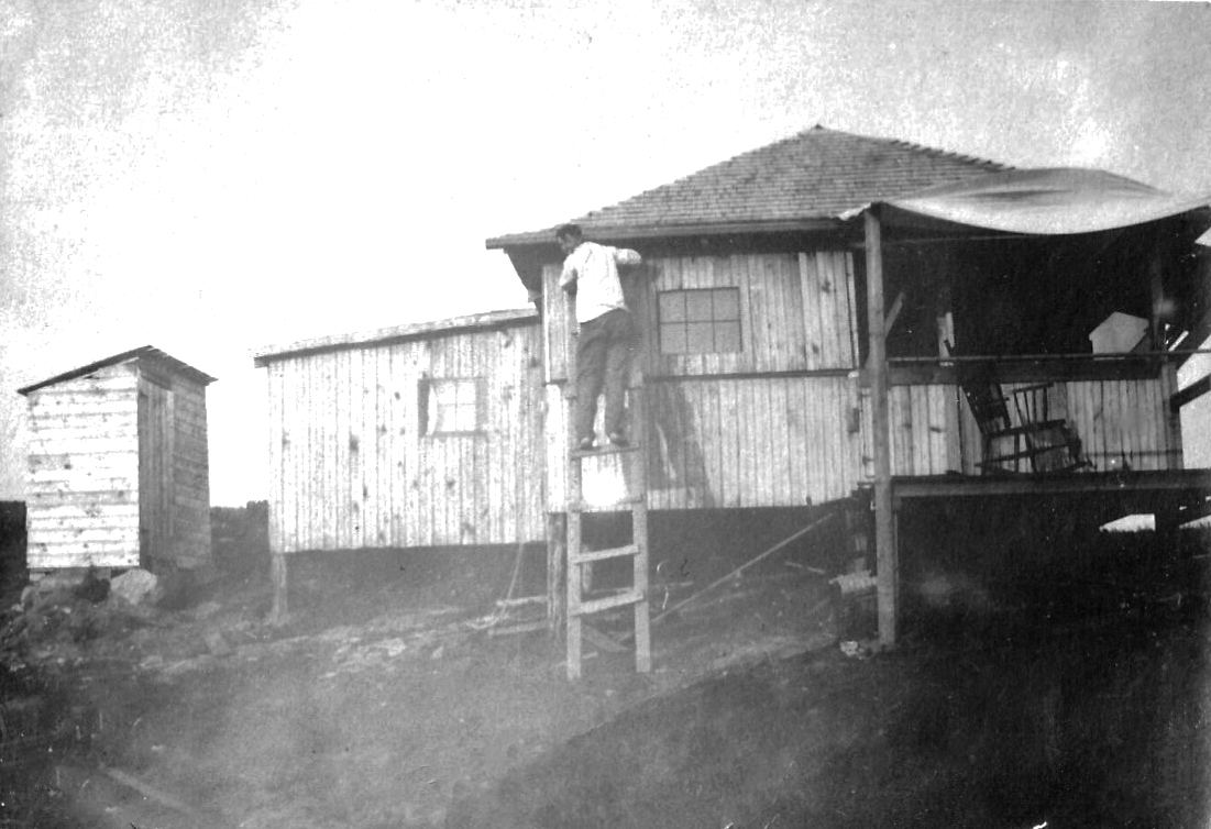
By that time the neighborhood was completely built up with modest seasonal cottages that were kept in families for generations. There was a handful that were occupied year-round, but most were used only in the summer by middle-income families with young children. A neighborhood association owned most of the beach, but the town had a small area with a swimming float, as well as the pier that has been rebuilt many times.
Those days evoke wonderful memories for my brother and me, along with our cousins and friends that we grew up with from summer to summer. Our family had four houses clustered together with shared yards as if they were all one. Only one of those houses remains now, and it has been winterized and expanded beyond recognition. It recently sold for more than $600,000.
During the Cape-wide building boom of the 1970s, many of the cottages around Hen Cove were winterized and became retirement homes for my parent’s generation. Others were sold out of the families, as those of my generation became too busy with careers to be able to spend extensive time at a summer house. My mother sold our little cottage and bought a condominium at Lily Pond with the proceeds of the sale.
In recent years nearly all of the small seasonal cottages have been enlarged or replaced by much bigger structures. The middle-income families have been displaced by a new generation of more affluent owners who can afford the often seven-figure prices of even the smallest houses. The neighborhood is much quieter now, but the neighborhood association is still active.
Bert’s little house was torn down a century after it was first started. The new owners replaced it with a year-round retirement home, built to modern standards, that retained the basic floor plan and many of the quirky design elements of the old place. Our family considers it to be a fitting tribute to Grandpa Bert’s creativity and his love of this beautiful location.
CRUISING INTO BUZZARDS BAY
(Published on the editorial page of The Bourne Enterprise on July 9, 2021)
I was surprised to see a coastal cruise ship docked at the Massachusetts Maritime Academy last month. At first, I thought it might have encountered a problem and made an emergency stop. It turns out it was a planned stop to give passengers a tour of the campus and a chance to visit our newly revitalized downtown. What a great idea! Why haven’t we been doing this for years? How could we have overlooked such an easy opportunity to show off the wonderful assets Bourne has to offer?
According to Elizabeth Simmons, Vice-President of External Affairs at the academy, American Cruise Lines suggested the visit, and school administrators liked the idea. The cruise line employs academy graduates and hoped to recruit more with this stop. Unfortunately, most of the cadets were away on their annual sea term. This may be the first time a cruise ship has visited Buzzards Bay, but not the first time someone has suggested tapping the canal traffic for visitors.
Back in 2004, when Tom Moccia was leading the Buzzards Bay Revitalization Association, he invited architects and planners from around the world to submit ideas for redesign of the town park. As is typical for such a competition, the submissions were far more grandiose and expensive than the bandstand and splash pad we ended up with.
My favorite submission did more than create a fancy park. It connected the canal with a yacht basin for visiting pleasure vessels. Setting aside practical issues, such as nearly impossible permitting and outrageous costs, I liked the concept of inviting boaters using the canal to stop by and visit our downtown. I included the drawing from the competition into the transportation study that I prepared for Tom’s group in 2007.
Inviting small coastal cruise ships to visit Buzzards Bay accomplishes the same purpose without a major capital investment. The academy reaps a public relations benefit, local businesses see a regular influx of visitors without adding vehicular traffic, and the ship passengers gain another point of interest. During last month’s stay, the cruise line offered excursions to Plymouth and Hyannis, as well as Main Street and the academy.
The Cape Cod Canal Region Chamber of Commerce helped to coordinate this visit, providing brochures of local sites and businesses. They might consider scheduling special events such as Canal Day, a strawberry or scallop festival, craft fair, or art show at times that the ships visit. The Corps of Engineers could include tours of their facilities, including the train bridge, as they once did during the annual scallop festival. Main Street shops could coordinate sidewalk sales.
This visit was apparently a one-time event, but it shouldn’t take much arm-twisting to convince all those involved that making it a regularly scheduled stop would benefit everyone. Unlike the ocean-going cruise ships that can overwhelm small ports when they unload 6000 passengers, the coastal ships are much smaller. This one carried only 175 passengers. They might even enjoy a concert at the bandstand or a romp on the splash pad.
MACHINE GUNS AND CAPE COD DON’T MIX
(Published on the obituary page of The Bourne Enterprise June 4, 2021)
On a sunny summer afternoon 30 years ago, I was sitting on my deck at Sea Watch with my friends Bill and Rita, who were visiting the Cape from their home in the Pacific Northwest. In the middle of a sentence, Bill suddenly stopped and said “If I didn’t know better, I’d swear I just heard machine gun fire.” I assured him he wasn’t hearing things, and that those of us who lived here were used to the noise of machine guns and artillery.
Not long after that, the gun range was shut down because of the heavy metal pollution of the ground and the aquifer beneath it from the ammunition. The National Guard appears to have been doing fine without the benefit of the gun range for decades, but now seems determined to return to their old ways. Why do they need to bring the noise and pollution back to the Cape?
Despite their many disingenuous public hearings where they faced near-unanimous opposition, and leaning on a bogus environmental study that said only what they wanted to hear, it is clearly obvious the Guard is determined to reopen the range. Maybe it’s time for our state legislators to step in and stop this folly.
Bourne has changed significantly over the last 30 years, maturing from a mostly vacation and retirement place into a year-round community with a strong economic base that is less dependent than it had been on the military presence. The Coast Guard air station and housing are totally appropriate for this location, as is the Air Force cyber-security facility, but artillery and machine gun ranges don’t fit here anymore.
(Now, for those who are about to send me hate mail, I should mention that I am a Coast Guard veteran and hold a Class A Large Capacity license to carry. My father and grandfather were both expert marksmen. For me, this is a community planning issue, not a gun debate.)
It’s not common knowledge, but most of Joint Base Cape Cod belongs to the state and is leased to the federal government. Much of it was a state park before the military took over, and it will revert to parkland under a recent agreement when the military no longer needs it. This might be a good time for the state to take part of the base back. It would be well-used for hiking, camping, and most importantly, protection of the Cape’s sole-source aquifer.
An added benefit, and another thing that is not commonly known, is that the highest natural elevation on Cape Cod lies within the base about three-quarters of a mile from MacArthur Boulevard. The next time you are stuck in traffic coming on-Cape across the Bourne Bridge, look straight ahead at the horizon. You will see a little bump in the tree line that is Sand Hill, elevation 306 feet. If a 50-foot tower were erected on this spot, a person standing on top on a clear day could see nearly all of Cape Cod, Martha’s Vineyard, and the Elizabeth Islands. And it would be a lot quieter than a machine gun range.
THE GREAT HIGHWAY CONSPIRACY
(Published on the editorial page of The Bourne Enterprise May 9, 2021)
Are the Army Corps of Engineers and the Massachusetts Department of Transportation (MassDOT) conspiring to keep us from driving? Probably not, but it sure seems like it. We finally got a breather after the Corps finished repairing the lights on the Sagamore Bridge, when they announced that they would immediately begin work on the Bourne Bridge. The Bourne Bridge is 1,000 feet longer than the Sagamore, and has almost twice as many lights, so it might be closed longer. With either bridge reduced to one lane in each direction, traffic seems to multiply on both Scenic Highway and Sandwich Road, increasing drive times even for drivers not crossing the bridges.
If you want to head south to Falmouth, you will find both overpasses at Brick Kiln Road reduced to one lane, as those bridges undergo major repairs. If you tried to avoid that bottleneck in April by using Route 28A, you might have run into another single-lane closure while National Grid installed a new gas line. Fortunately, that work is now done. To further aggravate the situation, Main Street in Falmouth was finally getting repaved after a winter of utility improvements.
Trying to get into and out of downtown Buzzards Bay remains a problem, as MassDOT continues building sidewalks to nowhere around Belmont Circle. Worse yet, this three-million-dollar boondoggle will do absolutely nothing to fix the very serious traffic issues around this rotary and the Route 25 interchange. For the same money, MassDOT could have widened the access ramps to two lanes and run traffic straight to Main Street and Scenic Highway. Now it will be many more years that nearly half the traffic heading south from Route 25 will have to go around the rotary to get to the Mid-Cape Highway.
For anyone living or working in Buzzards Bay, the situation is about to get a lot worse. MassDOT has already begun a five-year project completely reconstructing Cranberry Highway (Routes 6 and 28) between the Wareham town line at Cohasset Narrows and the traffic lights at Home Depot. Portions of this road will be completely closed in both direction for extended periods as this project proceeds. That will force traffic to use Route 25 for what might have been a local trip. At times it will significantly increase traffic on Head of the Bay Road.
Looking further ahead, at about the time that the Cranberry Highway project is done, the Army Corps and MassDOT will begin a genuine conspiracy, the BIG ONE: replacement of the canal bridges and reconfiguring the access roads around both. That work will make today’s delays seem like minor annoyances.
The good news, of course, is that when all this work is done, Bourne residents will have better roads and bridges, making it safer and mostly easier to get around. Belmont Circle will still be a bear, but that will primarily affect the traffic passing through town on its way to someplace else. We are also pretty resilient when it comes to traffic. We know better than to go anywhere on summer weekends, and we know how to get around the Cape without making any left turns.
BOURNE: A RAILROAD TOWN?
(Published on the editorial page of The Bourne Enterprise April 9, 2021)
For most of our residents and visitors, Bourne is defined by the canal, the military base, and the seasonal traffic passing through on its way to someplace else. Few would consider the railroad of importance, as all it serves now is a trash train, a seasonal weekend commuter service, and an occasional dinner train. There was a time, though, when Bourne was defined by the railroad.
The first trains rolled into the area that would later become Bourne in 1848. Crossing Cohasset Narrows where the tracks remain today, the rails ran along the Monument and Manomet Rivers to the Sandwich Glass Works. The railroad was promoted and partially financed by a group of Sandwich business owners to connect the town with the main line railroad in Middleborough.
Downtown Buzzards Bay did not exist until the railroad arrived. Before then, there was the state pier and a small cluster of houses on Head of the Bay Road, but not much else. The village grew around the railroad terminal and engine servicing facilities located where the town park is now. At that time, Bournedale was a significant manufacturing center that might have become the town center if construction of the canal hadn’t separated the village from its rail station.
Village centers in Pocasset and Cataumet also developed around the railroad stations on the Woods Hole branch. There was another station on Depot Road between Pocasset and Cataumet known as South Pocasset, but it did not last long. Pocasset center had been located on County Road near the intersection with Barlows Landing Road before the railroad came through and caused it to move a half-mile west.
The railroad breathed new life into the Keith Car Company just as demand for their Conestoga wagons was winding down. Keith soon became one of the country’s largest railroad car builders, extending for nearly a mile along the Manomet River in Sagamore. Much of the plant was demolished when the canal was built, but the company still managed to build thousands of freight cars that were shipped to France during the first world war.
The railroad was essential to military operations in Bourne during the first half of the twentieth century. Thousands of troops deploying for Europe arrived by train from all over the country. Camp Edwards became a major training center for National Guard units throughout the northeast. After Otis Air Base was built, and large transport planes developed, the railroad became less important. Rails still extend into Joint Base Cape Cod, but they are rarely used.
Bourne was also once served by a trolley line that connected it to New Bedford and Fall River. The tracks generally followed today’s Route 6 into Buzzards Bay, crossing the Monument River on Old Bridge Road, and continuing alongside Sandwich Road to County Road.
And finally, here is an obscure fact for the trivia buffs: The railroad bridge across the canal is the second longest vertical lift bridge in the country. A similar bridge in Staten Island, New York, is seven feet longer. While interstate trains may never return to Cape Cod, we might someday see daily commuter trains crossing our bridge once again.
BOURNE’S SECRET BIKE PATH
(Published on the editorial page of The Bourne Enterprise April 2, 2021)
We all love walking or biking along the canal service roads, and we champion the enthusiasts who are working to extend the Shining Sea Trail from North Falmouth to the canal. Only a few mountain bikers, however, seem to know that Bourne has another recreational path, better known as Valley Bars Road.
Valley Bars is a strange road. It seems to pop up in several places, heading to Monk’s Cove off Shore Road, serving a handful of houses off County Road, and going in two directions from different points on Clay Pond Road. Those disparate segments are actually connected, though, by unpaved paths through the woods.
Although it does not appear on old road maps, evidence on the ground indicates that Valley Bars Road may be an ancient way that once extended from the shore to a point well into what is now Brookside Village and possibly beyond. Where it meets the end of Shaker Drive, it apparently connected with another ancient way shown on some maps as Meganset Trail. These trails may have existed for hundreds of years, long predating the use of wheeled vehicles.
While the origin of Valley Bars Road is intriguing, its future might be more interesting. Most of the unimproved sections are on town property, except for a short piece at the northern end that crosses a wooded area belonging to Harbor Hill Condominiums. It would take relatively little money or effort to upgrade those sections into paved recreational trails that could serve walkers and other cyclists, as they do now for mountain bikers.
At the western end is Monk’s Park and Little Bay Trails, created in 1993 when the town bought an undeveloped subdivision overlooking Monk’s Cove, and the Bourne Conservation Trust acquired a large portion of the former Briarwood campground. This area has become a popular year-round spot for hikers and boaters. It is an especially good place from which to paddle or sail the protected water between Wing’s Neck, Pocasset River, Back River and Mashnee Island.
Once the Shining Sea Trail is extended from the canal, access from north and south by bicycle will be safe and easy. Getting there by bike from the east will not be as easy and certainly not safe. Biking on Barlows Landing Road, Clay Pond Road, Shore Road and County Road is not safe for casual riders. Improving Valley Bars Road as a bike trail would solve that problem.
Hundreds of residents in the neighborhoods off Clay Pond Road, along with hundreds more in Brookside and Harbor Hill, would then have safe and easy bike access to the shore. One or two short side trails across the town forest would open up similar access to residents of the neighborhoods off Barlows Landing Road.
When presented with this concept a couple of years ago, the town’s Bicycle/Pedestrian Advisory Committee found the idea interesting, but emphasized that their primary mission remains extending the rail trail. With the recent announcement of funding available for improving safety for cyclists and walkers under the state’s Complete Streets initiative, this project might be the perfect candidate for consideration.
DOWNTOWN’S HIDDEN GEM
(Published on the editorial page of The Bourne Enterprise February 19, 2021)
In the midst of Bourne’s downtown is a hidden gem: The National Marine Life Center. From rather humble beginnings in an abandoned lumber yard, the center has emerged as an important player in the effort to rescue and rehabilitate stranded sea turtles, seals, dolphins, and other marine life. Our town owes a debt of thanks to two strong women who were instrumental in creating the center and guiding its growth into a nationally respected institution.
The center was originally conceived by Sallie Riggs while she was working at the Woods Hole Oceanographic Institution. After two earlier unsuccessful attempts to establish a marine hospital on Cape Cod, Sallie brought together veterinarian Joseph Geraci of Tufts University, retired investment banker Townsend Horner, and others, who incorporated the National Marine Life Center in 1995 as an independent, non-profit corporation.
Sallie immediately became deeply involved with the local business community and town government to build support for the new center. That involvement soon grew into a passion for revitalizing all of Main Street as Bourne’s downtown. Once she got the center established, Sallie turned over the leadership to others so that she could devote her time and effort to Main Street.
For several years after Sallie stepped down, the marine life center struggled to develop plans and programs, while focusing on fund-raising. In 2005, Kathy Zagzebski was brought in as the president and executive director. Kathy arrived with stellar academic credentials and broad experience in marine rescue operations in California, Hawaii, Georgia, and North Carolina.
Under Kathy’s leadership, the center has evolved into a nationally known and respected marine education, research and rescue operation. She assembled a strong support staff of experienced professionals, supplemented with ardent volunteers and enthusiastic student interns during the summer season. The center partners with related organizations all over the country to advance the science and coordinate rescue and release of stranded or injured marine animals.
While most of us have been hunkered down at home, the center staff have been busy. So far this winter season, the center has received and processed more than 216 cold-stunned sea turtles, seven times the typical number. They are also treating three seals, including Montauk, a harbor seal that has recently been deemed non-releasable after being rescued three times.
Like Sallie, Kathy also became quickly involved in the process of putting Buzzards Bay back on the map as a vital town center. She served on the boards of the Bourne Financial Development Corporation, the Main Street Steering Committee and the Selectmen’s Wastewater Advisory Committee. She also served on several regional non-profit boards, including the advisory committee of the Environmental Technology Program at Upper Cape Cod Regional Technical High School.
After 16 years, Kathy has decided to move on. With luck and care, the center’s board of directors will find a new executive director who will bring to Buzzards Bay the best skills for the next stage of the center’s growth. It will not be an easy task to find somebody with the same quiet competence, technical knowledge, and extraordinary people skills as Kathy Zagzebski. We will miss her.
WHAT! ANOTHER CANAL OUTFALL?
(Published on the editorial page of The Bourne Enterprise January 8, 2021)
Recent posts on social media about a proposed wastewater outfall into the canal evoke images of huge volumes of brown sludge pouring into pristine waters. That is unfortunate, because the reality is that the proposed plan would benefit the entire Buzzards Bay watershed while greatly reducing pollution in many of its bays and inlets.
In brief, this proposal would create a regional wastewater district that includes Bourne, Marion, Wareham, Plymouth and the Maritime Academy. It is being driven by the region’s primary environmental organization, the Buzzards Bay Coalition. This is an unusual combination of players that has attracted support from both state and federal environmental protection agencies.
Bourne has a neighborhood of 850 houses on tiny lots with cesspools and septic systems that drain into Buttermilk Bay. Plymouth has a neighborhood of 450 houses on tiny lots south of Route 25 that also drains into Buttermilk Bay and is isolated from the town treatment plants. Wareham wants to expand sewer service to three mobile home parks and other neighborhoods. Marion and the academy have obsolete treatment facilities that need to be replaced soon.
Wareham’s wastewater treatment plant has been cited as the best-run in the state. It consistently produces an effluent that measures well below state limits for total nitrogen, the primary pollutant of salt water embayments. There is room on its site to double or triple the size of the Wareham facility but it cannot even operate at current capacity because it discharges into the Agawam River, which is little more than a creek at the discharge point.
If the Wareham plant could discharge into the canal, as the academy does now, there would be almost no limit on its expansion capacity. It could then treat the wastewater from Marion, the academy, and the currently unsewered neighborhoods in Wareham, Plymouth and Buzzards Bay. It will be an expensive project, but far less expensive than if each town and the academy had to build its own treatment plant.
This plan has been underway for seven years now. The coalition has received several substantial grants from the federal government to evaluate potential routes of an outfall pipe, and determine what effect an expanded outfall would have on water quality in the canal. It had to monitor existing conditions at the outfall location for two years before it could begin the permit process.
An evaluation of the proposed outfall conducted by a team of scientists from the Woods Hole Oceanographic Institution and UMass Dartmouth calculated that the canal flushes between 56 billion and 80 billion gallons of water a day. Then, through a series of computer model scenarios, the team concluded that even if the volume of effluent from the Wareham plant were quintupled to 10,000 gallons per day, it would have a negligible effect on water quality in the canal.
The primary advantage of a canal outfall is the high volume of water and its rapid movement that results in quick dilution and dispersion of the already highly treated effluent. With the proposed plan being initiated and managed by the Buzzards Bay Coalition, we can be confident that all potential environmental threats of the outfall will be thoroughly addressed. This is literally a win/win solution to a serious problem for all involved.
2020 RANTS AND RAVES
(Published on the editorial page of The Bourne Enterprise December 11, 2020)
This has certainly been an interesting year. It wasn’t all bad, though. Bourne got a new police station, and the adjacent downtown wastewater treatment facility is finally under construction. Looking back, we should give credit to a few people in Bourne who met the challenges of this year head-on and succeeded. We also should mention a few blunders that deserve a loud rant.
The biggest rave goes to the doctors, nurses, and attendants working under incredible stress and personal risk during the viral pandemic. That includes our first responders, who risk their lives every day to keep Bourne residents safe and secure. Special recognition goes to the EMTs who have to share an ambulance with Coronavirus patients.
A corresponding rant goes to the mostly young folk who continue to party on and gather without masks or social distancing, endangering their elderly relatives and neighbors. They don’t seem to understand that this is not a matter of personal freedom or inconvenience, but a serious public health crisis that is killing more people every day in this country than died in the 9/11 attack.
The biggest rant goes to the state Department of Transportation (MassDOT). It is about to spend more than $3 million building sidewalks to nowhere around Belmont Circle without solving any of the traffic problems that plague that area. As a result, we can expect it will be many more years before we see efficient connections between Route 25, Scenic Highway, and Main Street.
There was some good news at the other end of Main Street, though. Here is a rave for Vincent and Noreen Michienzi, who have invested heavily in improvements to their properties facing the newly upgraded town park. And here’s a shoutout to Tom Cahir, Administrator of the Cape Cod Regional Transit Authority, who continues to expand bus service to his home town.
A big rave goes to Town Clerk Barry Johnson and his dedicated assistants who successfully managed three elections that were safe, efficient, and convenient. We might also congratulate two other town officials, Town Administrator Anthony Schiavi and Superintendent of Schools Kerri Anne Quinlan-Zhou. Both stepped into new positions and were quickly hit with what must be the greatest challenge of their careers.
MassDOT gets another rant, along with the Army Corps of Engineers, for failing to choose the most obvious solution to the canal bridge issue. A straight connection along the route of the power lines between Route 25 and the Mid-Cape Highway, with a high-level bridge across the canal, would take half the traffic off of the old bridges, Sandwich Road, and Scenic Highway. That would allow us to keep our iconic iron bridges and topiary Cape Cod welcome sign.
Finally, here’s a toast to a new year that promises to be a lot less interesting, but certainly more enjoyable. It looks like the virus will soon be contained, allowing us to return to a more normal life. Schools should be able to reopen, and the theaters and restaurants that survive the winter should be back for the summer season. We might even be able to hike or bike the canal paths without wearing masks, and once again enjoy a real Fourth of July parade.
MOVING AROUND BOURNE
(Published on the editorial page of The Bourne Enterprise November 13, 2020)
Seeing photos of St. Peter’s church sitting on a barge in the canal evoked memories of my grandfather Bert Ewell being excited about watching it being trundled over to its new home on Main Street. The sanctuary was moved by barge from Hull 74 years ago. While this move by water was unusual, Bourne has a long history of having its buildings moved about.
The school department’s office building in Bourne village started out as Monument Academy, built in 1840 at Monument Hill on County Road. It was moved to Sandwich Road in 1866, where the library is now, then to its current location when the library was built in 1925. The first-floor was for middle grades, while high school students used the second-floor.
The neighboring 1888 Alonzo Booth blacksmith shop sat at the edge of Shore Road at the corner of Olde Forge Lane. It was moved to its current location and restored in 1998. The Bourne Post Office was originally part of the Blackington house, located near the wooden bridge that spanned the Monument River. It was relocated when the canal was built in 1913.
The commercial building at 2 Shore Road was also moved when it was displaced by the canal construction. According to the Bourne Historical Society, this building once housed the George Douglas grocery store, and continued to conduct business as it was being moved, pulled on skids by horses and oxen.
The windmill at the Aptucxet Museum came from actor Joseph Jefferson’s estate, Crow’s Nest, overlooking Buttermilk Bay. It was never a real windmill, but was built as Jefferson’s art studio. It continues in that role, now used by artist Lance Shinkle, who created the pedal-powered carousel that is displayed in the lower level and open to the public during the summer months.
Bourne has another historic windmill, on Shore Road in Cataumet, that may hold a record for the longest move. It was originally built in Chatham, moved to Orleans, and in 1900 moved to Cataumet, where it is now a dwelling. President Grover Cleveland’s private railroad station was recently relocated and restored after sitting near the Aptucxet trading post for decades. It was originally situated at the intersection of Thorne and Monument Neck Roads in Gray Gables.
In Pocasset, the soon to be replaced fire station displaced a smaller station that still exists. The old station was moved to the back of the ball field and has served ever since as a welding shop. The cabinet shop across the street was moved from County Road, where it was a school. The nearby Baptist Church had a very short move back from the road onto a new foundation.
The strangest move of all, though, has to be the Bourne Water District office on Barlow’s Landing Road. It still sits on its original site, where it was a Methodist church. It was cut in half laterally, with the top half set on a new foundation in front of the bottom half, which had a new roof added. That explains the stained-glass window on the front. The gilded faucet above the window is a story for another day.
WHAT’S TO BECOME OF OUR POST OFFICES?
(Published on the editorial page of The Bourne Enterprise October 23, 2020)
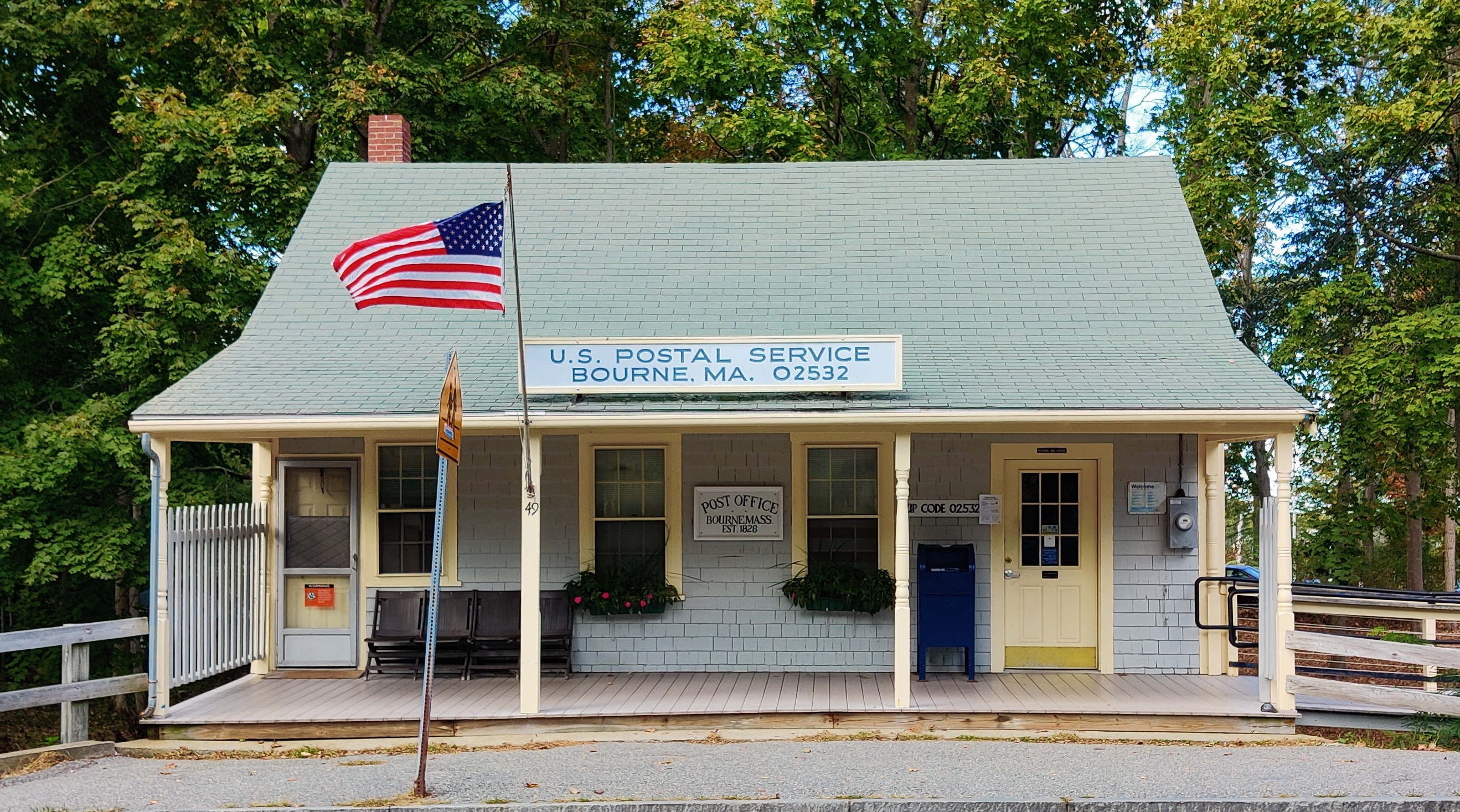
Bourne is a town rich in post offices. We have eight of them if you include the military base. But that might change soon. The Postal Service won’t be shut down; that would take a constitutional amendment, and the service is too well-liked by everyone for that to happen. Its operations could be contracted to a private company, however, and probably will be restructured to adapt to changes in the way we communicate.
Those of us of a certain age can remember when a sharply uniformed mailman came to our door twice a day, carrying a huge leather bag full of letters, postcards, bills, catalogs and magazines. There were lots of magazines, many of them weeklies. There was Time, Life, and The Saturday Evening Post. Dad got Popular Science and National Geographic; Mom got the Ladies Home Journal, Better Homes & Gardens, and Good Housekeeping.
Things are different now. We get our news and magazines electronically. We shop on-line. We get our bills by email and pay them electronically. We send greetings, congratulations and invitations on social media platforms. Much of what we get in the mail now is advertising and packages. Most of the letters are from charities and organizations looking for donations.
When was the last time you had to wait in line at the post office? How often have you had to ring a bell to get served at the counter? The need for some basic restructuring is apparent; the bigger question is how it should be done. The challenge is to make the operation more cost-effective and efficient without losing the convenience of an important public service.
For an idea of how a privatized post office might operate, we only have to look at the competing private delivery services, UPS, DHL and FEDEX. They have central depots serving multiple towns or larger regions. Franchised storefronts offer packing and shipping options. Some even have post office boxes for document mail. Nearly all customer services are conducted on-line, with delivery drivers picking up outgoing parcels and letters. The postal service does that too, but few people know about that service.
Changes of this magnitude would have a profound effect on Bourne. We might retain a central office in Buzzards Bay, and the base facility would certainly remain, but the others would likely close. The result would hurt Bourne’s retired population the most. Many of our older residents are not computer savvy or able to get to a post office in another part of town. They still pay their bills by mail and like to buy their stamps in person. Some prefer having post office boxes.
More importantly, Bourne’s post offices anchor our villages. They are where we run into friends and neighbors for impromptu chats. They draw us to village centers where we are more likely to shop at neighborhood stores. They give each of our villages a focal point and individual identity. They keep us connected in a way that may no longer be essential, but remains important to every one of us. Like so many other aspects of our lives, though, we will adapt to the inevitable changes we see coming.
A SUMMER CELEBRATION
(Published on the editorial page of The Bourne Enterprise September 18, 2020)
After a summer of solitary sports and family activities, Bourne finally came out for a safe and most enjoyable community celebration. That was the day the Mayflower replica sailed through the canal on its way back to Plymouth. Thousands of Bourne residents and visitors gathered along the service roads and in neighboring yards and balconies on a gloriously sunny day.
We couldn’t have a Fourth of July parade this year, the county fair was cancelled, and the scallop fest is long gone. Traditional neighborhood picnics and ball games could not be held lest they turn into virus super-spreaders. The crowd watching the Mayflower, though, showed a remarkable level of compliance with safety standards. Nearly everyone sported masks and kept a reasonable distance from each other.
The rest of the summer was not bad either. Traffic was high, but more spread out. Because so many people were laid off, furloughed, or working remotely, seasonal residents and visitors arrived earlier, stayed longer, and left later, resulting in less congestion at the bridges at peak times. Surprisingly, our beaches were not over-crowded, but the marinas and boat ramps were extremely busy. Bourne’s paddle shops quickly sold out of kayaks and paddleboards.
The canal service roads and the Cape’s bike paths saw much higher than normal use all summer. Bicycle sales nearly doubled worldwide during the pandemic shut-down, leaving retailers and wholesalers without inventory even before the summer began. Other retailers have struggled to make up for lost revenue during the shut-down; a reminder that we need to make an extra effort to support our local business owners as the season winds down.
Most of Bourne’s restaurants managed to stay open, while six out of ten nationwide permanently closed. Whether they can survive a continued limitation on occupancy only time will tell. The experts are saying it could be another six months to a year or more before the virus is contained and it becomes safe for bars to open and restaurants to reach full capacity.
So, what are the takeaways from this very different summer? First, that it wasn’t so different after all. Cape Cod had the potential to be a viral disaster, with so many visitors coming here from New York, New Jersey, Florida, and other hot spots. Second, that we may never return to the old normal. And third, that maybe the new normal will in some ways be better than before.
Many businesses have found that trusted employees are more productive working from home. And those employees now have more free time and money that was once wasted on a daily commute. That means more seasonal residents working remotely will choose to live in Bourne full-time. Similarly, more colleges will be offering on-line courses at reduced prices from traditional on-campus experiences. We don’t know yet how elementary and high-schools will change, but will soon find out.
This is the time of year when many columnists speculate on what the fall and winter will bring. Let’s see, we have hurricane season, a global pandemic, economic uncertainty, a changing climate, and a contentious election. My crystal ball just melted.
PADDLING BOURNE
(Published on the editorial page of The Bourne Enterprise August 4, 2020)
During this time of social distancing and solitary pursuits, paddling a canoe or kayak offers a chance for both exercise and quiet meditation. Gliding silently up to a flock of egrets in Back River, watching blue crabs scurry on the bottom of Eel Pond, or poking into areas where bigger boats cannot go, are all wonderfully enjoyable experiences.
There are few places anywhere that can beat Bourne for kayaking. The Buzzards Bay coast from Buttermilk Bay to Squeeteague Harbor offers paddlers a dozen gorgeous and protected bays, coves, rivers, and estuaries. The only place to avoid is the canal. It’s illegal and dangerous to paddle in or close to there.
The best access to Buttermilk Bay is the end of Electric Avenue. There are other access points but parking is limited. Launching is officially banned from all town beaches, but you can usually get away with it at off-peak times if you stay on the edges and away from swimmers.
For the area between Mashnee Island and Wings Neck, launch from the little beach next to the boat ramp at Monument Beach marina. From there you can paddle up into Back River, stop for a swim on the Mashnee dike beach, or duck under the Emmons Road bridge into Little Bay. There is a great spot for a picnic lunch on Tobey’s Island, then paddle over to the Pocasset River.
You will need a Bourne parking permit to park and launch at any town landing. If you don’t have a permit, you can launch at Monk’s Cove. Non-permit parking is available along the road east of the railroad overpass. Monk’s is also a good place to launch when the Monument Beach lot is full. The ramp there is not paved, and the water is shallow, so it is rarely used for larger boats and there is usually ample parking.
Between Wings Neck and Scraggy Neck are the cloverleaf harbors of Barlows Landing, Hen Cove, and Redbrook Harbor. In the middle is Bassett’s Island, which makes a great stop for a picnic and a swim. Most of the island is privately owned, but the sandy southern leg is town-owned and open to the public. Launch from Barlows Landing or Hen Cove.
Throughout all these areas you will find rock hazards. The glacier that formed Cape Cod left many boulders along the coast, and too many of them lurk near the surface. There are even some in the middle of bays where you would least expect them. Before you paddle, look over the area at low tide to get an idea where the rocks are.
And please remember that kayaks are not toys; they are vessels subject to the same marine rules as bigger boats. Be especially cautious in busy channels and harbors. Not only do other boats have the right of way, sailors and motor boaters often don’t see you down there between the waves. Most importantly, always wear a flotation vest that fits your size and weight.
One last caution: the narrow channels leading into Buttermilk Bay at Cohasset Narrows, Back River, Eel Pond, and the upper portion of the Pocasset River flow fast between tides. Try to hit those areas at slack tides. But don’t let these warnings deter you; kayaking is a wonderful, low-impact sport that provides excellent cardio-vascular exercise, can be enjoyed at any age, and keeps you a safe distance from everyone else.
A DIFFERENT TRAFFIC JAM
(Published on the Editorial Page of The Bourne Enterprise July 10, 2020)
Monk’s Cove as seen from the railroad and someday bike trail

On a sunny Saturday in mid-June traffic was gridlocked, not at the bridge but on the bike trail in Falmouth. The parking lots were full, all the benches along the way were occupied, and traffic was so heavy in spots that it stopped. With many other outdoor activities closed by the pandemic, walking and biking trails across the country have seen a doubling or tripling of traffic.
The Shining Sea Trail in Falmouth is one of the most scenic recreational trails in the country. It has been featured in national magazines and is a major tourist attraction. Trail users generate an estimated four to five million dollars a year in economic activity in Falmouth, based upon surveys of similar trails by the national non-profit Rails to Trails Conservancy.
The rail corridor through Bourne is even more scenic and inviting than the Falmouth trail, and someday it too will be a recreational trail generating similar economic activity for our town. The Friends of the Bourne Rail Trail has been enthusiastically promoting extension of the Shining Sea Trail through Bourne to the Canal, working with town officials to make it happen.
With seed money appropriated by Town Meeting, and federal and state grants, as well as a grant from the Conservancy, the town has contracted with engineers to design the first section of the trail extension. That plan is for a paved trail alongside the tracks from the canal to Gray Gables. The second section is in early planning stages to extend the trail into Monument Beach. Falmouth is working to bring its trail up to Cataumet.
The plan is to keep the tracks in place and build the trail alongside the rails. That will quadruple the cost over removing the rails to build the trail, and result in a far less inviting trail experience. It will allow the plan to proceed, however. The state is currently spending $3 million to upgrade the tracks, which now serve only a private trash hauler and an occasional dinner train.
There are substantial roadblocks to removing the rails, despite their light use. The military wants to keep the rails in place to serve Joint Base Cape Cod, although they rarely use the railroad. The Town of Falmouth wants to extend commuter rail service to North Falmouth. The Massachusetts Department of Transportation has conflicting mandates to preserve and expand rail service while also promoting expansion of recreational trails.
The Cape Cod Commission’s Regional Policy Plan envisions a trail system covering the Cape from Woods Hole to Provincetown, including the connection between Falmouth and the canal. Bourne’s Local Comprehensive Plan states that extending the Shining Sea Trail “…would open some of the most scenic portions of the town’s coastline to public access without the need for expanded parking areas or roads.”
Whether we have a rail trail or a trail with rail, connecting the Shining Sea Trail to the canal will benefit Bourne enormously, not only generating economic activity and raising abutting property values, but also providing pedestrian and bicycle connections among all of Bourne’s villages, increasing public safety by offering a safe alternative to biking on County and Shore Roads, and closing a major gap in the regional trail system. Some of us can’t wait to see it happen.
HOW WE WISH IT HAD BEEN
(Published on the Editorial Page of The Bourne Enterprise June 5, 2020)
One spring day in 2001 I was walking down Water Street in Woods Hole with a local builder named Tom. As we approached the drawbridge, Tom stopped and pointed to the quaint little restaurant overlooking the canal connecting the pond to the channel. He told me he had rebuilt that structure to its current configuration.
He said the owner had asked him to make it look like it had been 50 years earlier. Tom then pulled a picture postcard out of his pocket that showed what that building looked like in 1950. Its first floor was completely clad in porcelain-glazed steel panels advertising Coca-Cola.
Tom said when he showed the owner that photo, she was appalled. He assured her, however, that he knew what she wanted. So, he told me, he refinished her building to be “how she wished it had looked 50 years ago.”
I love that phrase, and have often used it in my work as a community planner. Even today, as our world is turning topsy-turvy, there are many people in Bourne who desperately want to return to the way they wish our town had been 50—or even 100—years ago.
They want Buzzards Bay to be a quaint little Cape Cod village, although it never was. For a brief period between the end of the second World War and construction of the by-pass, Buzzards Bay was somewhat of a normal downtown, even though it was hopelessly clogged with traffic passing through to somewhere else during the summer season.
Buzzards Bay village didn’t exist at all until the railroad arrived in the mid-1800s. The bars and flophouses that served the railroaders later evolved to serve soldiers on liberty until after the war, when hundreds of little houses were built around its center for military retirees and young families moving out of the cities.
Now, after two decades of hard work by a dedicated cadre of community volunteers, Buzzards Bay is emerging as a true downtown. The momentum is there for the village to be not what we wish it had been 50 years ago, but what we want it to be now: an active town center where residents live, work, shop, and play without having to go somewhere else.
The viral pandemic, and the looming economic recession resulting from it, may delay our march toward this goal. We need to be careful, though, not to further cripple progress by undermining or turning back key elements of our plan. The movement to withdraw Bourne from membership in the MBTA, for example, seems extremely short-sighted.
Town meeting changed Main Street zoning to allow mid-rise multi-use buildings. Voters appropriated funds to expand wastewater capacity that will enable new development downtown. And they chose to join the MBTA as a key future connection to the Boston metropolitan area.
We must persist in our effort to bring commuter rail to Bourne so that future generations can enjoy the sort of vibrant community that we envision. If we don’t, our grandchildren might still be struggling to make something of Buzzards Bay and wanting it to be what they wish it had been 50 years earlier.
THE SUMMER OF 2020
(Published on the editorial page of the Bourne Enterprise May 22, 2020)
What will the summer of 2020 be like in Bourne? Life has taken so many strange twists and turns this year, any prediction is only speculation, but here is mine. I think that Bourne will have a very good season, with more people, more traffic, and many local businesses doing well.
It won’t be a typical summer, though, as our favorite group activities won’t happen. There will be no county fair, no scallop fest, no Fourth of July parade, no Cape Baseball League, and no summer theater.
There will be family gatherings, backyard barbeques, boating, fishing, bicycling, and golf for those who are willing to walk the course. Expect beaches and marinas to remain open, but with strict enforcement of social distancing and safety measures, including limited access.
Bourne’s population usually doubles in July and August. And while we traditionally refer to the summer visitors as tourists, the vast majority of our summer residents are second home owners or renters. We don’t see as many day-trippers and weekenders as some other Cape towns, except for friends and family members.
With the schools closed and more people working remotely or not at all, the summer folk are already arriving earlier and likely to stay longer. There will be less commuting between the Cape house and the city, but still plenty of summer traffic. If we need to isolate, what better place to do it than Bourne?
We are likely to see some easing of restrictions on small retail and service businesses, with a new emphasis on curb-side service and continued limits on the number of customers allowed inside at any time. Expect to see strange mask-like tan lines on a lot of people this year.
Restaurants that can accommodate drive-through pick-up will be busy, but those that rely on bar patronage will continue to suffer. The pandemic has fundamentally changed the food service industry, and this will be a summer of adjustment for everyone in the business.
Traditional gatherings for church services, weddings, and funerals will most likely continue to be limited at least through the summer. Some will be conducted remotely, but many will be postponed by as much as a year.
Those of us old enough to remember summers in Bourne in the middle of the last century might see familiar patterns. Families staying close to home, enjoying the sunshine and cooking out on the deck, sailing out to Bassett’s for a picnic on the beach, or walking along the canal in the evening. Of course, back then we didn’t have the internet, Netflix, or Hulu. The kids will remain glued to their devices no matter where they are staying.
For a very important group of Bourne residents not much will change. Those working in health care, police, fire protection, emergency services, and grocery stores will continue to be stressed beyond reason. This pandemic has given all of us a new appreciation of the wonderfully dedicated people who provide our essential services and will have no vacation this year. Give them a break, help them when you can, and be generous with your smiles and tips.
BOURNE’S INDUSTRIAL PAST
(Published on the editorial page of the Bourne Enterprise on May 8, 2020)
Our little town is usually seen as a quiet seaside community that a lot of people drive through going someplace else. It wasn’t always like that, however. For more than a century, beginning in the 1820s, the area that is now Bourne and Sandwich was a major industrial center shipping manufactured goods all over the world.
It started in 1821 when the Bournedale Iron Works began business. A year later the Pocasset Iron Company was established at the head of the Pocasset River on County Road. In 1825 the Boston and Sandwich Glass Company began making decorative glass products, and in 1826 the Keith and Ryder wagon company began building farm wagons and prairie schooners for sale to pioneering families that were moving west to open new frontiers.
This 1850 photograph from the Bourne Historical Archives shows the Tahanto Iron Company looking northwest from County Road a short distance north of Barlows Landing Road.

With the arrival of the railroad in 1847, the area’s industrial development turned serious. The Pocasset Iron Company became the Tahanto Iron Company and expanded into a large factory that dominated the local landscape. The last structure of that complex washed away in the 1938 hurricane, but you can still see remnants of the bog iron quarries and water works that supplied this industrial center throughout the Four Ponds Conservation Area off Barlows Landing Road.
Keith and Ryder moved from South Sandwich to Sagamore and began building railroad cars under the name of Keith Car and Manufacturing Company. By the turn of the twentieth century, Keith had become a major manufacturer of railroad freight cars, its factory complex extending two miles along the Scusset River. Hundreds of Keith cars were shipped to Europe to support allied efforts during World War I. The Bournedale Iron Works grew too, as the primary supplier of iron fittings for the Keith cars.
This photo of the Keith factory looking northeast was taken near the current location of Atlantic Engineering. All the buildings on the left were displaced when the canal was enlarged in the 1930s.
The Sandwich glass works was located on the Cape for the abundant forests that would fuel its furnaces and refractories. By the time Bourne split from Sandwich in 1884, however, the upper Cape and Plymouth area had been stripped of most of its trees. Turpentine Road, which is now located within Joint Base Cape Cod, was named for a factory that produced turpentine and pine tar products for shipbuilding. This company began operations in 1850 but disappeared along with the trees by 1900.
Local officials welcomed construction of the Cape Cod Canal in 1914 as a catalyst for new industrial development. While opening of the canal was undoubtedly the most significant event in Bourne’s history, it turned out to be a very different asset to the town than its promoters envisioned. The canal not only failed to bring new industry to Bourne, but it also cut through the middle of the Keith factory complex.
Bourne’s industrial age ended with the Great Depression in the 1930s. Recent years, though, have seen the emergence of a different kind of industry: development and manufacture of deep-water submersible vehicles by Hydroid and specialized electronic devices by Onset Computer. As other high-tech firms split off from the research institutions in Woods Hole and set up shop in Bourne’s industrial parks, our town’s industries are once again shipping goods all over the world.
A WALK IN THE WOODS
(Published on the editorial page of the Bourne Enterprise on April 24, 2020)
Walking in the woods is still allowed under social distancing, and Bourne offers lots of choices of where to do it. Between town-owned conservation areas and lands of the Bourne Conservation Trust, we have many miles of well-marked and maintained trails.
Aside from the canal service roads, the most popular walk in Bourne is probably the town-owned Four Ponds Conservation Area. This extensive tract borders the town forest and provides several miles of trails. Access is off Barlow’s Landing Road opposite the mobile home park. Take a compass with you if you’re not familiar with the trails.
One of my favorites is the Bourne Sisters Woodland and Perry Woods. This area offers more than a mile and a half of scenic trails across both town and Trust lands. Its only public entry is easy to miss, located on the S-curve at 221 County Road. Park just off the road and follow the trail signs. There is also a private bridge connecting this parcel with Brookside.
The flooded cranberry bog at Bourne Sisters. That’s Brookside on the opposite shore.
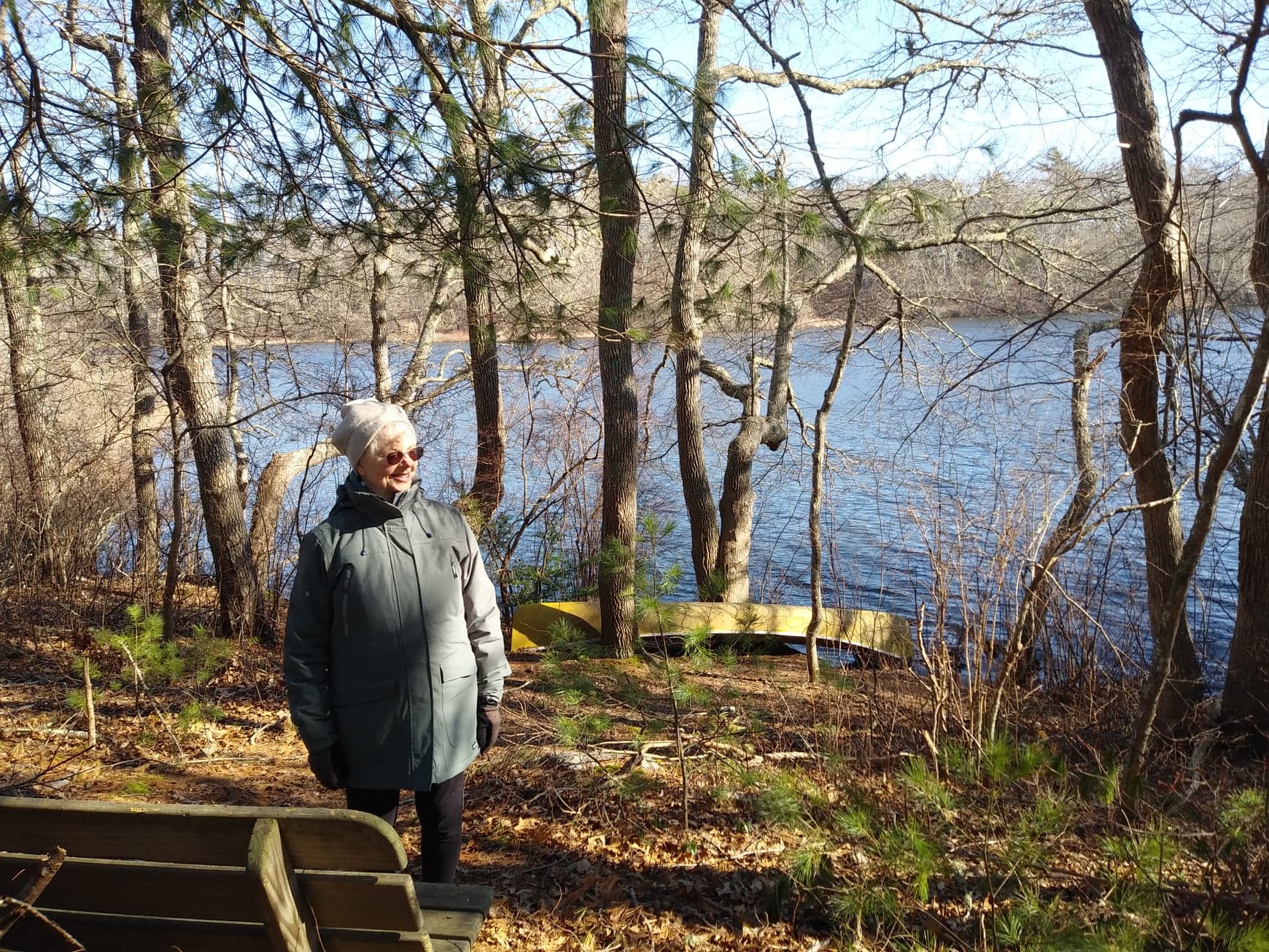
If you want a shorter but even more scenic walk, the Leary property is immediately across the street from the Bourne Sisters entrance. This town-owned promontory offers panoramic views of the upper reaches of Back River not publicly visible from anywhere else. The trail is only about a quarter mile long, not including several small side trails, and there is a loop driveway for parking at the entrance.
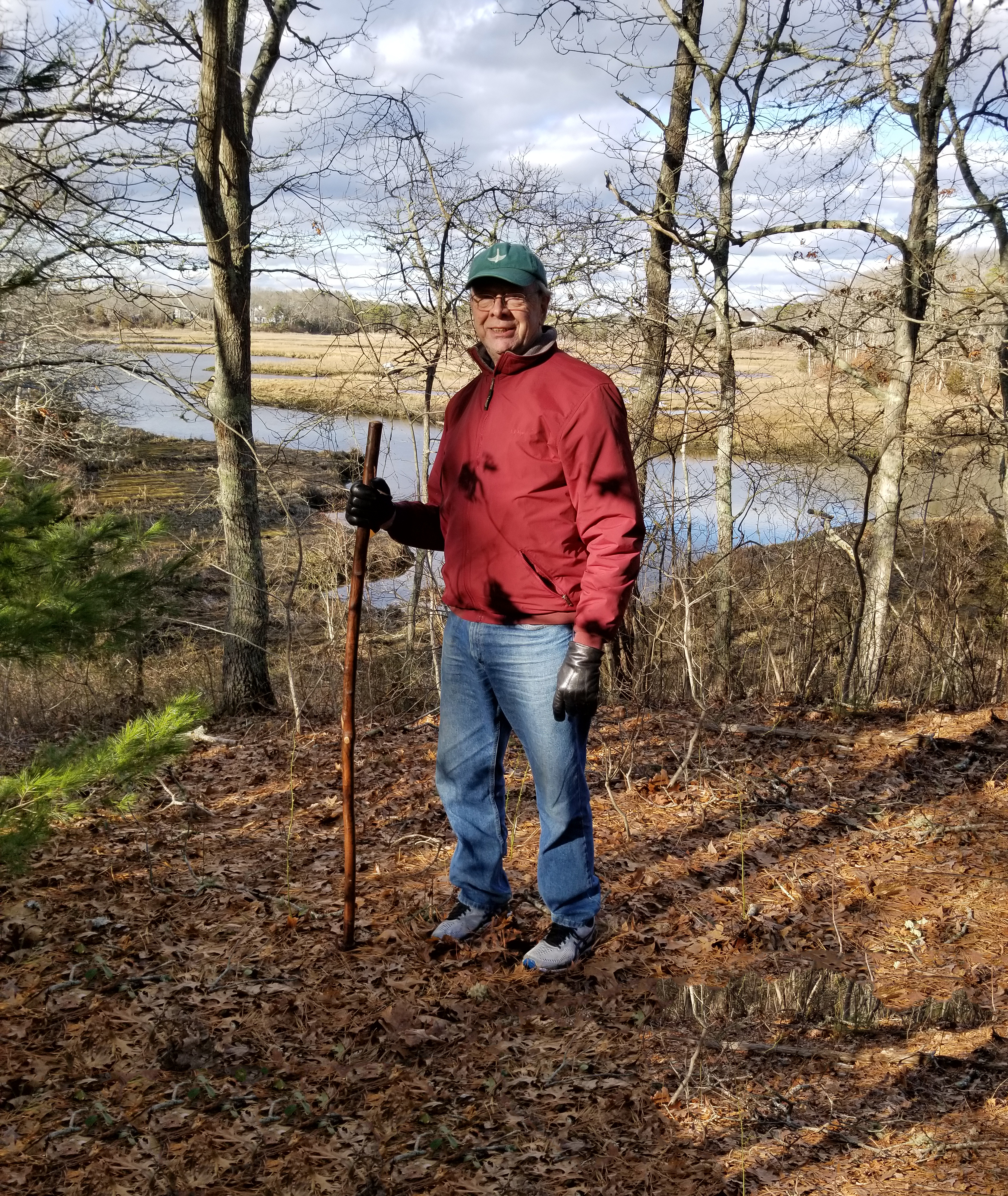
Another popular hiking spot over both town and Trust lands can be found at Monk’s Park off Shore Road in Monument Beach. Park next to the railroad bridge on Valley Bars Road, or at the east entrance to the Little Bay Trails on Shore Road. Plan to rest your feet at the benches and chairs overlooking Little Bay and Monk’s Cove.
All of these trails have portions that are quite steep. For those of us of a certain age, a sturdy walking stick is a big help, not just for support but mostly for balance. It’s also handy for brushing aside leaves and pine needles that can prove slippery on slopes.
The Trust owns another large tract with trails in the Cataumet area. The Cataumet Greenway trails cover much of the land between Depot Street and Redbrook Harbor Road. Although there are several access points, the easiest are from the Cataumet Post Office parking lot and the Dimmick Waterfront Park on Redbrook Harbor Road.
Just north of Redbrook Pond, at the top of the hill on Shore Road, you will find the Redbrook Pond trails, another Trust property. Park at the entrance to Thaxter Road. The main loop is about a mile, but there are intermediate trails to shorten the walk. As with all Trust properties, the trails are well marked and maintained. This one offers grand views of Redbrook Pond and several cranberry bogs.
You can view and download maps of all of the Bourne Conservation Trust properties and trails at its website, http://www.bourneconservationtrust.org. Wherever you choose to walk, please keep your dogs on leashes, pick up their poop and any trash you see on the trails, and enjoy the freedom of a safe outdoor experience close to home.
THE EVER-WINDING COUNTY ROAD
(Published on the editorial page of the Bourne Enterprise on February 7, 2020)
Have you ever driven County Road and wondered why it turns and winds around so much? It has been realigned and relocated in places over the years, but remains one of the crookedest roads in Bourne. Not far from its southern end in Cataumet, County Road makes an unexpected turn so sharp that it has probably seen more single-car accidents than any other spot in town.
It then meanders past the old Cataumet school house and several 18th century homes, and through farms and cranberry bogs, before hitting a rare straight stretch near the county complex. It wasn’t always this straight here, but once ducked down to touch the shore of the old Flax Pond, now called Picture Lake. Maybe the road got its name from the county facilities, as it is not actually a county road, but is maintained by the town.
Just past the lights at Barlows Landing Road, County Road dips down between two of the four ponds in the town conservation area, then abruptly climbs again. The crest of this climb was once much sharper than it is now. Driving from the north in his 1947 Plymouth, my father would often speed up over this crest, thrilling my brother and me with the feeling that we had gone airborne.
Two hundred years ago, this was the center of Pocasset, with a school and a church, all within walking distance of the Pocasset Iron Company, a major factory that shipped cast iron pots, stoves, and utensils all over the world. The school building still exists, but was moved to a spot across the street from the Pocasset fire station. The church also exists today, cut in half with its top half moved in front of the rear and now housing the Bourne Water District offices. There is nothing left of the iron works, except for the ponds and dams that were essential to its operations.
Continuing north, County Road winds between and among some of the oldest houses in Bourne, before reaching its northern end at its intersection with Shore Road and Sandwich Road. So, how did County Road get to be so winding? Clearly it was not planned or laid out by a surveyor or civil engineer. More likely, it simply followed a path of least resistance by people travelling on foot with cattle and other livestock.
The origins of County Road predate any written historical records. It appears on a 1626 map of the area, along with Sandwich Road and Turpentine Road, which is now located entirely within the military base. Most likely County Road was originally a trail used by the indigenous people of the area to travel between their inland winter hunting grounds and their coastal summer fishing encampments.
County Road may have existed for thousands of years before my ancestors invaded the region in the early 1600s, and long before there was any need for travel fast enough to require a straighter and more level thoroughfare. Today it remains an important route connecting four of Bourne’s villages. It might also be considered an historic trail, evoking images of our town’s changing demographics and character over the last four centuries.
A VERY GOOD YEAR FOR BOURNE
(Published on the editorial page of the Bourne Enterprise January 10, 2020)
If we can turn our attention away from the turmoil in our nation’s capital for a moment and look at what has been happening in our town, we will see that 2019 was a very good year for Bourne. Main Street in Buzzards Bay has finally reemerged as a thriving downtown, new locally-owned businesses have opened, we have a new town administrator, and town finances are strong.
Our downtown district still has a way to go to fulfill its potential, but it has turned the corner and is not likely to slide back now. A 20-year effort by town officials, property owners, and a dedicated corps of volunteers is finally beginning to show positive results. Most of the rundown buildings have been demolished and others rebuilt to host new shops and restaurants.
Opening of the new Hampton Inn is a key element of the downtown renewal. The town park has been repaired and continues to be a popular venue for community events and family recreation. Construction of the long-awaited wastewater treatment plant appears imminent, and the new police station will strengthen the town center image of Buzzards Bay.
All of these actions were envisioned in Bourne’s 2007 Local Comprehensive Plan. That plan has now been revised and updated, and was certified by the Cape Cod Commission in December. It continues to lay out a solid vision for Bourne as a town of village centers with an economy based largely on education, ocean-related businesses, and recreation.
So, what might 2020 bring to Bourne? Certainly, replacement of the canal bridges will be a major topic of discussion and planning. The Army Corps of Engineers is wrapping up a five-year feasibility study and is expected to publish its final report soon. The Massachusetts Department of Transportation (MassDOT) is finalizing a 12-year study of canal region traffic that will need to be coordinated with the Corps’ plans.
There have been statements reported that we might see new bridges within five years. As someone who has managed major projects jointly with both MassDOT and the Corps, I can assure you that it will take much longer. Within that five-year time frame, we should expect to see a program that sets design parameters for the bridges and the roads leading to them. Funding sources will be identified, and initial design and permitting appropriations will be made.
The following five to ten years will include land takings and resulting legal proceedings. During that time economic feasibility studies and environmental impact reports will be prepared for each element of the project. Each element will also go through multiple federal, state, and local permitting processes. After final engineering design, financing, and contract bidding, construction is likely to take at least five years.
In short, most of us who are past retirement age are not likely to see the new bridges completed in our lifetimes. In the meantime, watch for more new businesses to open in Buzzards Bay, as well as continued improvements in rail and bus service in Bourne, eventually including daily commuter trains. And be sure to frequent our burgeoning downtown to patronize both the new and the long-established businesses along Main Street.
TO “T” OR NOT TO “T”
(Published on the editorial page of the Bourne Enterprise December 13, 2019)
Recent discussions about whether Bourne should remain a member of the Massachusetts Bay Transportation Authority, better known as the MBTA or just the “T”, seem to be missing the big picture. As the former chairman of the town’s Transportation Advisory Committee at the time when Bourne voted to join the T, I would like to offer another way to look at the issue.
First, it’s not about the cost. Some confusing and misinterpreted numbers have been thrown around, but the actual annual net cost to the town of T membership has been about $40,000. And the Cape Cod Regional Transit Authority is using that money to expand bus service in Buzzards Bay. In short, we are getting good value for our public transit assessment.
Second, it’s not entirely about the need to provide more convenient train service for current commuters to Boston. For those of us who have been working diligently to revitalize Bourne’s downtown, extending service to Buzzards Bay is all about bringing new life to Main Street. Take a look at what happened in Lakeville. Within a quarter mile of the station the neighborhood is built out with apartments, condominiums, offices, banks, restaurants, and other services.
That housing is occupied predominantly by young single or coupled urban workers who cannot afford to live in the metropolitan area but prefer the ease and reliability of the train to the nightmare of driving to Boston. This demographic spends much of their money locally, but imposes few demands on municipal services.
Bourne’s Main Street has turned the corner and is now a busy place once again. Anchored by the Maritime Academy at one end and the town hall and community center at the other, our downtown will continue to thrive with or without the T. Bringing in commuter rail, however, will transform the village.
When Bourne voted to join the T, we were reliably promised that service would begin within a year. At the same time the Authority began a major reorganization and capital program to repair decades of deferred maintenance and poor management. It kept its commitment to extend the Green Line to Medford, and elected to upgrade the old Fall River branch to bring commuter rail to the South Coast. The extension to Buzzards Bay got deferred.
Perhaps it’s a blessing that the T has temporarily set aside its expansion plan. While Bourne has made great strides revitalizing its downtown, changing the zoning to encourage smart growth and investing in streetscape improvements, the utility infrastructure is not yet ready to service the kind of growth that the T would bring. We need a few more years to fix that situation.
There is no reason to bail out now, though. The Baker/Polito administration strongly supports commuter rail and has been very supportive of our efforts to create a vibrant community in Buzzards Bay. We will eventually get commuter rail service if we hang in there; we will not get it if we leave now. It’s not just about the train service; it’s about an investment in the future of our downtown.
THANKFUL FOR LIVING IN BOURNE
(Published on the editorial page of the Bourne Enterprise November 8, 2019)
During this month of Thanksgiving we might reflect on why we are thankful to live in Bourne. Sometimes it seems we are so focused on summer traffic and limited employment opportunities that we forget how blessed we are to live year-round in a place where others spend thousands of dollars to visit for a week or two.
As summers have become hotter, our best weather now comes in the spring and fall when many of the visitors are not here. That is the time we most enjoy our gardens, our parks, and our many festivals. The water is still warm enough for swimming in the fall when the beaches are empty.
There are very few towns on the New England coast that have such perfect protected coves and estuaries for kayaking, canoeing, sailing and fishing. Nowhere else can match the fishing on the canal or walking and cycling on its service roads. And we can enjoy those activities well into the fall, as winter weather tends to arrive later here than it does inland.
Our usual complaints about summer traffic, shortage of well-paying jobs, and high cost of living don’t stand up to comparisons with living in the Boston metropolitan area. Traffic here in July is no worse than it is every day year-round for most of the area within the Route 495 belt. We sit within reasonable commuting distance to both Providence and Boston, and the average cost of housing in Bourne is about thirty percent less than comparable homes in the suburbs.
One big benefit we share with the other Cape towns is that our municipal services, public safety agencies, medical facilities, utilities, and service businesses are set up to serve peak seasonal populations, so they tend to be larger and better equipped than they would be in similar-sized inland communities. Our taxes are lower too because more than half of Bourne’s real estate taxes come from seasonal properties.
A unique benefit of living anywhere on Cape Cod is the broad variety and high quality of live entertainment available year-round. From the Symphony to the many theaters, coffee houses, clubs, and other venues, we never have to travel far or pay too much for a night out. Except in the quietest months of winter we also have many weekend festivals nearby.
Bourne enjoys a diverse population of retired summer visitors and military people who came here from all parts of the country and chose to return when their working days were over. That retired population includes many highly experienced professionals who volunteer to serve on the town’s fifty boards and committees, as well as for many non-governmental civic and cultural organizations.
Perhaps the biggest benefit to living in Bourne, though, is the strong sense of community that we share. We know who our neighbors are; we share their triumphs and tragedies; we support them when they need help and they watch out for us when we need them. We would rather patronize local businesses than drive out of town to save a few dollars. Most of us love our town and do what we can to make it a wonderful place to live.
LOTS AND LOTS OF PARKING LOTS
(Published on the editorial page of the Bourne Enterprise October 4, 2019)
This was going to be a gentle essay on how the Massachusetts Maritime Academy has made Bourne a college town and helped to restore Main Street Buzzards Bay as a vibrant downtown. That draft was written a few weeks ago, reviewed by the Academy President for accuracy, and was ready for publication.
That original draft pointed out that ours is the only Cape Cod town with a fully accredited four-year college offering Bachelor and Master of Science degrees, as well as continuing professional development programs. It noted that the Academy is not only the largest state maritime academy in the country, but is widely considered to be among the best.
It recounted the positive effects the Academy’s presence has had on revitalization of Bourne’s downtown. How the cadets and their families, as well as the many mariners coming to Bourne for continuing education and license recertification, patronize Main Street restaurants and businesses. And how the new Hampton Inn could not have been built in Buzzards Bay without the expectation of visitors from the Academy.
But then two things happened that changed the narrative. First, the Academy announced it was about to buy one of the most valuable developable parcels in Buzzards Bay to use as a parking lot. If this lot were developed as a mixed-use office/retail/residential center, in accordance with current zoning, it could potentially produce a quarter of a million dollars a year in tax revenue. Under state ownership it will pay no taxes.
Second, a drive around the village revealed that every available lot appeared to be a vehicle impoundment area wrapped in ugly rented chain-link fence. These lots not only do not benefit the town or its residents, they severely detract from the community and hurt us all.
This is simply not acceptable. Those of us who have been striving diligently for more than twenty years to create an inviting and thriving downtown never envisioned it becoming dead storage for hundreds of student vehicles. Just as we had turned the corner and finally seen our work coming to fruition, the institution that contributed so much to the revitalization is now inadvertently sabotaging it.
If this parking is essential, then the state needs to build a garage to accommodate it. If it is not essential, then the school needs to limit student parking just as every other non-commuter college does. If the Academy still wants to provide parking for its cadets, it needs to find a location outside of our downtown. The Steamship Authority’s Cataumet lot holds 1,000 cars and lies vacant from Labor Day to Memorial Day. Maybe an agreement could be struck to share that facility.
The town has little control over what the Maritime Academy does or where it does it. We can only raise our voices and loudly shout “NO!” when we dislike what it is doing to our downtown. If the Academy is to remain a good neighbor, it needs to make a drastic change of plans. Whatever is done, the current situation is simply intolerable and cannot be allowed to continue or expand.
ROUND AND ROUND THE ROUNDABOUT
(Published on the editorial page of the Bourne Enterprise September 13, 2019)
What were they thinking? That was my first reaction upon seeing the Massachusetts Department of Transportation’s proposal to revamp Belmont Circle and the ramps connecting it to Route 25 at the entrance to downtown Buzzards Bay. Belmont Circle, sometimes called the east rotary, is neither a circle nor a rotary. It is more of a square; a confusing detour for thousands of visitors trying to get down-Cape.
A large portion of the traffic on Route 25 uses this exit, but both the off- ramp and the on-ramp are only one lane wide. The off-ramp then forces all traffic to go around the circle. Motorists suffer the effects of two major design flaws that compound each other every day year-round.
After twelve years of study, the state’s consulting engineers came up with a plan that does three things right and one thing so wrong that it boggles the mind. They recommend widening both the off-ramp and the on-ramp to two lanes, connecting all lanes directly with Scenic Highway, and adding a traffic signal for local traffic heading to or from Main Street and the bypass road. Those are all essential improvements that would correct the past design errors.
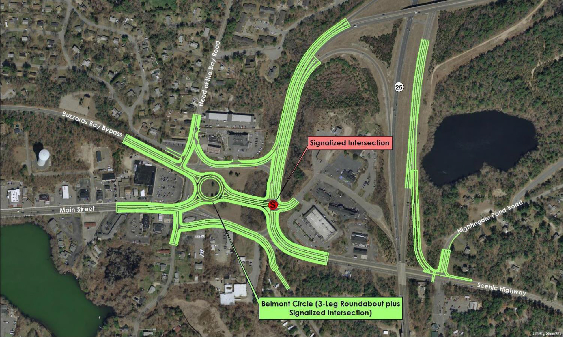
Those changes would encourage more traffic heading to the Mid-Cape Highway to exit here and take Scenic Highway to the Sagamore Bridge instead of crossing the Bourne Bridge, clogging the bridge rotary and Sandwich Road, and backing up MacArthur Boulevard. On Saturday mornings in the summer, 59 percent of the traffic heading east on Route 25 to the Mid-Cape now uses the Bourne Bridge and Sandwich Road to get there.
But the engineers went totally off the rails when they proposed replacing the big square circle with a tiny roundabout that would consolidate all traffic using Main Street, Head of the Bay Road, and the bypass. This inane plan would choke off our burgeoning downtown and make it difficult for tractor trailers to get to local businesses.
The state proposal limits access to CVS, the Mobil station, and other businesses now located around Belmont Circle. It also proposes a redundant access ramp from Scenic Highway to Route 25 branching off at the already dangerous intersection with Nightingale Pond Road.
As a professional planner with more than half a century of experience in transportation studies, I consider roundabouts to be an abomination. They have all the disadvantages of rotaries but on a tighter scale. Even their proponents admit that they don’t work well where traffic volumes exceed 4,000 vehicles per day, which is less than one third of the traffic at this location.
Roundabouts have been promoted under the concept of “traffic calming” by the same people who want everyone to ditch their cars and travel only by bicycle, bus, or train. While that may be an admirable goal, it is highly myopic and won’t happen by making driving more aggravating.
Highway departments across the country have been replacing signalized intersections with roundabouts because they are less expensive to maintain. The state plan to put one in Buzzards Bay needs to be deep-sixed before it gets any further along in the development process. We already have a bad situation resulting from earlier road design errors; let’s not make it worse.
THE LEGEND OF HEN COVE
(Published on the editorial page of the Bourne Enterprise August 16, 2019)
It’s Hen Cove; not Hen’s Cove. At least that’s the legend I learned from my grandmother many years ago. When this postcard photo was made more than a century ago it was apparently called Pocasset Bay. Hen Cove is the middle leaf of the three-leaf clover shape of Pocasset’s harbors, the others being Barlow’s Landing and Redbrook Harbor, which is actually in Cataumet. Hen Cove is the shallowest of the three harbors. My brother Ken and I both learned to sail there. Our family used to joke that if we ever got into trouble, we could just get out and walk home. Ken once flipped his home-made sailfish and the mast simply stuck in the mud.
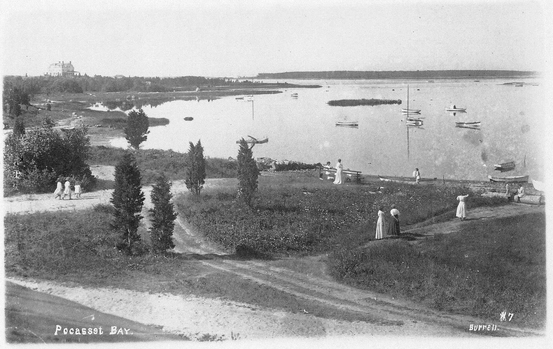
Our grandfather had an old hard-chine gaff-rigged cedar catboat named “Old Squaw”. Grandpa’s old cat was not named for an elderly indigenous woman, but for a sea bird, now commonly called a long-tailed duck. The Old Squaw wasn’t technically a catboat, although it was half as wide as it was long, with a big barn door rudder and an even bigger centerboard. Hard-chine cats are notoriously difficult to turn in light air, so grandpa added an oak bowsprit and a small jib that helped coax it around. That boat was heavy, slow, and a very safe vessel for us in our pre-teen years to use exploring the area between Scraggy and Wings Necks.
Our favorite trip was to sail out to Bassett’s Island at low tide, run the Old Squaw up onto the sand bar, and go digging for quahogs. In those days you could still find some very big ones. When we had enough, we would take a swim until the incoming tide refloated our boat. Then we would raise the heavy canvas sail, haul the anchor, and coast home on a following sea. Those big clams were pretty tough, but our mom would steam them open, grind them up in a hand-cranked cast-iron grinder, and cook them into a glorious chowder. We would save the shells, clean them up and bake them in the sun, then paint water-color scenes on them and give them away as ash trays.
There may have in fact been some dude named Hen who dubbed this cove, but I really doubt it. The story that my grandmother told was that it was named after the little rocky islet in the center of this photo. That island is mostly gone now, washed away by many tides and winter storms. It reportedly once had a large rock on the northern edge, followed by a pile of rocks that were covered at high tide. Grandma called it Hen and Chickens Island. The legend is that when viewed on a foggy morning, the big rock looked a lot like a chicken, and the smaller rocks behind it like a brood of chicks. Hence the name of the island, and by extension the reason that this scenic inlet is now known as Hen Cove.
BOURNE ON THE FOURTH OF JULY – 1949
(Published on the editorial page of the Bourne Enterprise July 5, 2019)
Watching the delight of the children at Bourne’s Fourth of July parade takes me back to a smaller parade when I was their age. In those days as now the best Independence Day celebrations happened in the neighborhoods. Our neighborhood was Pocasset Heights.
My grandfather, Bert Ewell, built a camp shack with an outhouse at the corner of Circuit and Saco Avenues in 1904. Over the years he expanded it into a comfortable year-round home that he and my grandmother retired to forty years later.
We had a cottage next door that my father bought from his uncle. Back then summer houses seldom sold to strangers. They usually stayed in the family for generations. Like most of the other cottages in the neighborhood, ours was pretty rustic.
It did have indoor plumbing of a sort. There was a flushable toilet and sink in a little room off the back entryway, but the only source of water was a shallow well with a massive iron pump next to the kitchen sink. To wash the dishes or flush the toilet we would prime the pump with water from a nearby bucket, then fill the bucket and carry it out to the wash room.
The kitchen had a wooden ice box that drained through a hole in the floor. Once a week an old man with a mule-drawn wagon laden with 50-pound blocks of ice would come by and restock our crude fridge. His visit was also a real treat for the neighborhood kids. Although he didn’t speak our language, he knew what we wanted. With a warm smile he would chip off a sliver of ice for each of us to cool our throats on a hot July day.
The highlight of the summer, though, was the annual neighborhood association clam bake. Early in the morning a crew would show up and build a sort of fortress on the beach near the big rock that remains to this day. They would start with a ring of rocks surrounding a bonfire that soon enough became a bed of hot embers.
They would then add layers of fresh seaweed, clams, potatoes, corn, and lobsters that steamed all afternoon. The wonderful aroma of that meal cooking made it seem like the longest day of the summer until we could finally dig in early that evening.
And then there was the parade, which was also a competition of sorts. Called the “horrible parade” it invited all the neighborhood children to dress up and make up as the most horrible creatures we could imagine. I won first prize one year as a bedraggled hobo but had to settle for second prize, which was a box of pencils. It seems the girl who came in second was only two and could not write yet.
Our old neighborhood is quite different today. The neighborhood association is still active and holding memorable events. But the young families that once filled the streets with laughing kids can no longer spare the time to live at the beach all summer. Nearly all of the old cottages have been replaced or rebuilt into year-round homes for those who can afford them.
Even the little beach at the end of Saco Ave is mostly gone, flooded twice a day by rising sea levels. I still like to wander down to the pier, though, and remember fondly those carefree days that now seem so long ago.
RAIL TRAIL BENEFITS
(Published on the editorial page of the Bourne Enterprise June 14, 2019)
As the winter winds die down and the summer sun returns, many of us are dusting off our bikes, skates, and walking shoes and dreaming once again of the day when the Shining Sea Trail extends along Bourne’s Buzzards Bay shoreline between North Falmouth and the canal service road. The Bourne segment would certainly be the most scenic and probably the most heavily used portion of the of entire Cape Cod rail trail system.
This project would benefit Bourne in more ways than any other single action the town might take. It would provide safe bicycle and pedestrian connections among all of Bourne’s villages and off the streets. It would increase public safety by giving cyclists an alternative to pedaling on Shore and County Roads. And it would open some of the most scenic portions of the town’s coastline to view without need for expanded parking areas or roads.
Building this trail would also provide a significant boost to Bourne’s economy. The national non-profit organization Rails to Trails Conservancy has documented substantial financial benefits to local businesses and to public health where trails have been built. One in-depth survey cited by the Conservancy found average direct spending by trail users of $31 per person. Most of that money goes to locally-owned small businesses, such as lunch stops, bike shops, restaurants, and lodgings.
The Massachusetts Department of Transportation estimates that Cape Cod rail trails are used by an average of 1,000 people per day during the summer season from Memorial Day through Labor Day. The Falmouth Bikeways Committee has counted an average of twice that many riders each Saturday, Sunday, and holiday during the summer on the Shining Sea Trail. The Army Corps of Engineers says 300,000 people use the canal service roads each year.
If only 100,000 people use the trail extension through Bourne each year, that would pump more than three million dollars into the town’s economy. It is not unreasonable to expect actual usage of the trail to double that number. It is also not unreasonable to expect that average spending per trail user would be higher than the Conservancy estimate because The Shining Sea Trail is a destination, drawing people from a wider area who are likely to stay for more than a day.
The Conservancy has also shown that property abutting a recreational trail increases in value compared to similar properties elsewhere, which could add a considerable amount to Bourne’s property tax base. Their researchers are studying this trail benefit to better document actual numbers, but currently estimate that properties directly abutting a trail sell for five to fifteen percent more than comparable properties that do not abut trails.
That means that current abutters would reap a windfall benefit when selling their properties, and the town would reap a windfall benefit when the higher selling prices prompt increases in the tax assessment. Over a period of time, this would add millions to Bourne’s tax base. In summary, extension of the Shining Sea Trail would be a wonderful recreational amenity that would tie Bourne’s many villages together while improving public safety and public health and boosting our economy. What more could we ever want?
BUILDING BRIDGES
(Published on the editorial page of the Bourne Enterprise May 17, 2019)
Is there anything that says “Cape Cod” more than our canal bridges? Not lighthouses; not beaches; not even sand dunes. Every coastal state has those, and theirs are often better than ours. But few tourist areas have anything as uniquely iconic as our graceful antique highway bridges. Do we really need to replace them?
The Army Corps of Engineers is currently engaged in a three-year study to determine whether it is more feasible to replace the two highway bridges with generic six-lane interstate structures, or to perform a major overhaul of the existing bridges. That was last done in 1982 and needs to be done about every 50 years.
Those of us who have endured hour-long backups at the Bourne Bridge this spring, and similar delays at the Sagamore last year, might welcome an efficient but ugly structure that gets us to work or home faster. But the loss to our image and cultural heritage would be unfortunate.
Here is an interesting fact about our bridges that a lot of people don’t realize: the Bourne Bridge is almost twice as long as the Sagamore. The central spans are identical, but the approach spans on the Bourne are about 1,000 feet longer than on the Sagamore. That would also nearly double the cost of replacing the Bourne Bridge.
The Massachusetts Department of Transportation reports that on a summer Saturday 59 percent of the vehicles crossing the Bourne Bridge from the west travel around the rotary and along Sandwich Road to the Mid-Cape Highway. Those vehicles not only have to navigate three-quarters of the way around the rotary, but they also interfere with traffic coming north on MacArthur Boulevard. If that piece of the traffic could be removed, there would be few backups at the Bourne Bridge any time.
Instead of replacing the existing bridges, the Corps of Engineers and state highway engineers should consider a direct connection between Route 25 and the Mid-Cape. This would be a nearly straight highway, three miles long, generally following the route of the power lines between the Bourne/Plymouth town line on Route 25 and the Mid-Cape just east of Exit 1.
Picture a four-lane divided highway crossing a high-level concrete arch bridge near Bournedale. It would span the canal at a point where the land is 150 to 180 feet high on both sides. Connections at both ends would be east/west only, with no need for full interchanges or traffic lights. Such a connector would reduce the travel distance from seven miles to three.
The cost of this concept should be no more than the cost of replacing both existing bridges. It would remove more than half the traffic from the Bourne Bridge, and nearly half from the Sagamore Bridge, Scenic Highway, and Sandwich Road. That would mean far less wear and tear on the old bridges, as well as longer life spans with fewer disruptions for maintenance and repair.
Most importantly, future generations of Cape residents and visitors alike would still feel that wonderful sense of ease and of coming home that we get every time we cross onto the Cape over one of those beautiful old bridges.
VALUABLE VOLUNTEERS
(Published on the editorial page of the Bourne Enterprise April 12, 2019)
Volunteering and town meetings are two old New England traditions. Both are alive and well in Bourne. The town meeting form of government may be the purest form of democracy ever conceived and is nearly impossible to corrupt. Every voter has a chance to speak and gets an equal vote, along with the opportunity to step up and make a difference.
Our local government is actually run mostly by volunteers. We have department heads who are qualified professionals, with staffs of dedicated and experienced people handling the day-to-day business. But the most important policies, budgets, and programs are created and managed by unpaid volunteers serving on 48 boards and committees. With rare exceptions, even our elected officials get no pay or only token salaries.
These folks bring expertise to the table that the town could never afford. They offer lifetimes of knowledge and experience as business owners, executives, lawyers, accountants, teachers, and technicians. Most of their work goes unnoticed and seldom rewarded.
Three of those volunteers deserve special notice. Bob Parady, Sallie Riggs, and Mary Jane (MJ) Mastrangelo have each made volunteer contributions to Bourne that have made a real difference. For 18 years Bob Parady has led our town meetings with fairness, patience, and gentle restraint. As Town Moderator he appoints members to the Finance and Charter Compliance Committees. Bob was also a Selectman/Assessor/Sewer Commissioner for 18 years, on the Planning Board for three years, and served on many other volunteer committees.
Sallie Riggs lives in Falmouth, but has been the driving force behind the revitalization of Main Street Buzzards Bay as Bourne’s Downtown. Sallie created the National Marine Life Center, established the Bourne Financial Development Corporation, and for more than a decade led the Main Street Steering Committee. She also played leading roles on the Transportation Advisory Committee and the Wastewater Advisory Committee.
Because of Sallie’s vision and dogged determination, we now have Keystone Place, and will soon have the Hampton Inn, Calamar Apartments, and a wastewater treatment facility that will enable additional new development and redevelopment downtown. In every case Sallie worked with the developers to convince them that it would be worthwhile to invest in Bourne and to guide them through the approval process. Someday we may see even more economic benefit from her vision for a technology park on the Ingersoll land in Bournedale.
And then there is MJ. Mary Jane Mastrangelo may be the hardest working volunteer that the town has ever seen. She has for years chaired the Finance Committee and the Capital Outlay Committee, and regularly participates in the meetings of many other committees. When a perfect storm of events drove the cost of the new wastewater treatment facility well past the budget, MJ stepped in and showed town officials how to make it work.
Serving on a town committee can be exasperating at times, but also wonderfully satisfying. There is always more work to do than there are hands to do it. Our town is blessed to have so many who are willing to step up and do the work, but we could always use a few more volunteers.
